Category:Ysbyty Ifan (surrounding area)
Jump to navigation
Jump to search

Media in category "Ysbyty Ifan (surrounding area)"
The following 67 files are in this category, out of 67 total.
-
 A Moorland River - geograph.org.uk - 948409.jpg 640 × 480; 91 KB
-
 Afon Caletwr - geograph.org.uk - 108841.jpg 640 × 480; 89 KB
-
 Afon Caletwr, near Yspyty Ifan - geograph.org.uk - 118376.jpg 640 × 480; 154 KB
-
 Afon Rhydyrhalen - geograph.org.uk - 1170715.jpg 480 × 640; 131 KB
-
 B4409 to Ysbyty Ifan - geograph.org.uk - 61328.jpg 640 × 480; 79 KB
-
 Bryniau Duon - geograph.org.uk - 1173550.jpg 640 × 480; 68 KB
-
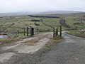 Cattle grid above Hafod Ifan - geograph.org.uk - 1170561.jpg 640 × 480; 71 KB
-
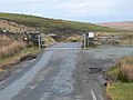 Cattle grid on the Ffestiniog road - geograph.org.uk - 1173542.jpg 640 × 480; 70 KB
-

-
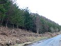 Coed Blaen-y-Coed - geograph.org.uk - 1173748.jpg 640 × 480; 89 KB
-
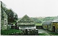
 Derelict buildings near Yspyty Ifan - geograph.org.uk - 118375.jpg 640 × 480; 105 KB
-
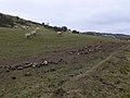
 Extra winter feeding for sheep - geograph.org.uk - 1173545.jpg 640 × 480; 74 KB
-
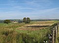
 Farmland at the foot of the Migneint - geograph.org.uk - 1173752.jpg 640 × 480; 68 KB
-
 Farmland near Pen-y-Bryn - geograph.org.uk - 1054709.jpg 640 × 480; 71 KB
-
 Farmland near Ysbyty Ifan - geograph.org.uk - 1056177.jpg 640 × 480; 58 KB
-
 Farmland near Yspyty Ifan - geograph.org.uk - 118377.jpg 640 × 480; 81 KB
-
 Flooded Quarry and Slate Tips - geograph.org.uk - 928.jpg 480 × 640; 53 KB
-
 Foel Ddu. - geograph.org.uk - 417583.jpg 640 × 480; 120 KB
-
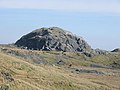
 Foel Gopyn - geograph.org.uk - 1170562.jpg 640 × 480; 70 KB
-
 Foel Gopyn - geograph.org.uk - 1170563.jpg 640 × 480; 92 KB
-
 Gate and Stile near Bryn Llech - geograph.org.uk - 221623.jpg 640 × 427; 101 KB
-
 Hafod Ifan - geograph.org.uk - 1170472.jpg 640 × 480; 76 KB
-
 Hafod Ifan Farm, near Ysbyty Ifan - geograph.org.uk - 131766.jpg 640 × 480; 82 KB
-
 Hafod Las - geograph.org.uk - 1173762.jpg 640 × 480; 46 KB
-
 High farmland west of Ysbyty Ifan - geograph.org.uk - 1170583.jpg 640 × 480; 68 KB
-
 Llyn Cottage near Llyn Conwy - geograph.org.uk - 12242.jpg 640 × 480; 71 KB
-
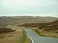
 Lonely road - geograph.org.uk - 1173508.jpg 640 × 480; 85 KB
-
 Looking towards Arennig Fach - geograph.org.uk - 1056172.jpg 640 × 480; 62 KB
-

-
 Nant y Brwyn - geograph.org.uk - 1173507.jpg 480 × 640; 109 KB
-
 North Wales - panoramio.jpg 1,200 × 800; 552 KB
-

-
 Pandy Uchaf - geograph.org.uk - 1173766.jpg 640 × 480; 77 KB
-
 Pen-y-Bryn - geograph.org.uk - 1170581.jpg 640 × 480; 72 KB
-
 Pont Ar Gonwy - geograph.org.uk - 244827.jpg 640 × 480; 162 KB
-
 Pont Blaen Eidda - geograph.org.uk - 1170709.jpg 640 × 480; 120 KB
-
 Pont Caletwyr - geograph.org.uk - 964364.jpg 640 × 480; 103 KB
-
 Pont-ar-Gonwy - geograph.org.uk - 1173444.jpg 640 × 480; 97 KB
-
 River Cliff on Afon Conwy - geograph.org.uk - 770925.jpg 640 × 480; 103 KB
-
 River Conwy - geograph.org.uk - 1173512.jpg 640 × 480; 91 KB
-
 River Conwy south west of Ysbyty Ifan - geograph.org.uk - 1173758.jpg 640 × 480; 115 KB
-
 Sheep on Foel Gopyn - geograph.org.uk - 1170584.jpg 640 × 480; 74 KB
-
 Silage field - geograph.org.uk - 964375.jpg 640 × 468; 73 KB
-
 The Migneint - geograph.org.uk - 172576.jpg 640 × 480; 77 KB
-
 The Migneint - geograph.org.uk - 172578.jpg 640 × 480; 77 KB
-
 The Migneint - geograph.org.uk - 61315.jpg 640 × 480; 87 KB
-
 The Migneint - geograph.org.uk - 61321.jpg 640 × 480; 92 KB
-
 The river Conwy and the Migneint - geograph.org.uk - 1173540.jpg 640 × 480; 77 KB
-
 The road to Blaen Eidda Isaf - geograph.org.uk - 1170712.jpg 640 × 480; 84 KB
-
 Tributary of Afon Ddu - geograph.org.uk - 172585.jpg 640 × 480; 105 KB
-
 Tributary of the River Conwy - geograph.org.uk - 11018.jpg 640 × 480; 97 KB
-
 Ty Cipar - geograph.org.uk - 1173442.jpg 640 × 480; 62 KB
-

-
 Waterfall on the river Conwy - geograph.org.uk - 1173505.jpg 640 × 480; 91 KB
-
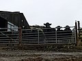 Welsh black cattle at Hafod Ifan - geograph.org.uk - 1170570.jpg 640 × 480; 62 KB
-
 Y Gamallt summit view - geograph.org.uk - 211184.jpg 640 × 381; 275 KB
-
 Ysbyty Ifan, Afon Conwy - geograph.org.uk - 55282.jpg 640 × 427; 71 KB
-
 Ysbyty Ifan, the road from Bala - geograph.org.uk - 55284.jpg 640 × 427; 118 KB
-
 Ysbyty Ifan, watermill - geograph.org.uk - 55285.jpg 640 × 427; 153 KB
-
 Carreg y Foel-gron - geograph.org.uk - 377181.jpg 640 × 480; 77 KB
-
 Foel-Gopyn. - geograph.org.uk - 296340.jpg 640 × 408; 75 KB
-
 Gwernouau Farm. - geograph.org.uk - 295470.jpg 640 × 402; 61 KB
-
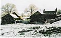 Gwernouau Farm. - geograph.org.uk - 295473.jpg 640 × 402; 89 KB
-
 Gwernouau Farm. - geograph.org.uk - 295475.jpg 640 × 410; 58 KB
-
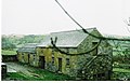
 Gwernouau Farmhouse. - geograph.org.uk - 295467.jpg 640 × 410; 77 KB
-
 Sheep Tracks in the Snow. - geograph.org.uk - 296338.jpg 590 × 480; 52 KB
-
 View from Foel-Gopyn. - geograph.org.uk - 296342.jpg 640 × 391; 80 KB


