Category:Westelijke havendam (Hindeloopen)
Jump to navigation
Jump to search
| Object location | | View all coordinates using: OpenStreetMap |
|---|
 | |||||
| Upload media | |||||
| Instance of | |||||
|---|---|---|---|---|---|
| Location | Hindeloopen, Hindeloopen | ||||
| Heritage designation |
| ||||
 | |||||
Nederlands: Loopsteiger en lichtopstand westelijke havendam, Hindeloopen, gem. Súdwest-Fryslân, Friesland
|
This is a category about rijksmonument number 22196
|
| Address |
|
Media in category "Westelijke havendam (Hindeloopen)"
The following 11 files are in this category, out of 11 total.
-
 Baak aan de Haven - Hindeloopen - 20113604 - RCE.jpg 1,200 × 1,200; 211 KB
-
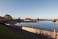 De haven van Hindeloopen.jpg 2,449 × 1,633; 1.36 MB
-
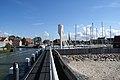 Hindeloopen Haveningang.JPG 3,872 × 2,592; 3.08 MB
-
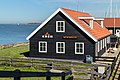
 Hindeloopen. Spits schuur. 30-03-2021. (d.j.b) 01.jpg 4,630 × 3,287; 10.43 MB
-
 Hindeloopen. Spits schuur. 30-03-2021. (d.j.b) 02.jpg 4,888 × 3,259; 10.27 MB
-
 Ingang van haven in Hindeloopen. 30-03-2021. (actm) 01.jpg 4,328 × 3,046; 9.68 MB
-
 Ingang van haven in Hindeloopen. 30-03-2021. (actm) 02.jpg 4,645 × 2,903; 10.91 MB
-
 Ingang van haven in Hindeloopen. 30-03-2021. (actm) 03.jpg 4,980 × 3,091; 11.39 MB
-
 Ingang van haven in Hindeloopen. 30-03-2021. (actm) 04.jpg 5,059 × 3,162; 11.96 MB
-
 Ingang van haven in Hindeloopen. 30-03-2021. (actm) 05.jpg 5,054 × 3,159; 10.87 MB
-
 Westelijke havendam.jpg 2,449 × 1,633; 1.5 MB


_01.jpg)
_02.jpg)
_01.jpg)
_02.jpg)
_03.jpg)
_04.jpg)
_05.jpg)
