Category:Water transport in the London Borough of Tower Hamlets
Jump to navigation
Jump to search

Subcategories
This category has the following 27 subcategories, out of 27 total.
C
- Cruising Association (1 F)
D
- Dead Man's Hole (10 F)
G
- Great Eastern Slipway (24 F)
H
- HMS President Pier (11 F)
L
M
- Masthouse Terrace Pier (7 F)
O
- Old Ford Lock (22 F)
R
- Reuters Pier (5 F)
S
- St. Katharine's Pier (19 F)
T
- Tower Millennium Pier (79 F)
- Tower Wharf (32 F)
- Traitors' Gate (73 F)
- Trinity Buoy Wharf Pier (2 F)
W
- Wapping Old Stairs, London (12 F)
- Wapping Pier (12 F)
- West India Pier (2 F)
Media in category "Water transport in the London Borough of Tower Hamlets"
The following 39 files are in this category, out of 39 total.
-
 Blackwall Basin - geograph.org.uk - 1839280.jpg 640 × 480; 64 KB
-
 Bow Lock, Lee and Stort Navigation - geograph.org.uk - 3398806.jpg 3,648 × 2,432; 2.78 MB
-
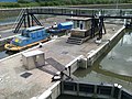
 Bow Locks - geograph.org.uk - 3489068.jpg 640 × 480; 77 KB
-
 Bow Locks - geograph.org.uk - 3586826.jpg 640 × 482; 98 KB
-
 Bow Locks in fog.jpg 2,272 × 1,704; 1.24 MB
-
 Bow Locks3.jpg 2,021 × 1,501; 878 KB
-
 Bow Locks4.jpg 2,048 × 1,536; 1.27 MB
-
 Dolphin at West India Dock Pier - geograph.org.uk - 2129705.jpg 480 × 640; 60 KB
-
 Hackney, London - panoramio.jpg 2,448 × 2,448; 2.8 MB
-
 Hemy (1841-1917).jpg 734 × 480; 74 KB
-
 Isle of Dogs, slipway on the Thames - geograph.org.uk - 1498418.jpg 640 × 480; 57 KB
-
 Landons close from poplar marina.jpg 640 × 427; 469 KB
-

-

-
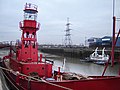 Leamouth lightship 1.jpg 640 × 480; 164 KB
-
 Lee Navigation - geograph.org.uk - 968826.jpg 640 × 427; 67 KB
-
 Lee Navigation, below Old Ford Locks - geograph.org.uk - 968878.jpg 640 × 427; 76 KB
-
 Lee Navigation, Bow Bridge - geograph.org.uk - 968808.jpg 640 × 427; 49 KB
-

-
 Lee Navigation, minor railway bridge - geograph.org.uk - 968846.jpg 640 × 427; 58 KB
-
 Lee Navigation, minor railway bridge - geograph.org.uk - 968856.jpg 640 × 427; 52 KB
-

-
 London - panoramio (201).jpg 3,872 × 2,592; 3.55 MB
-

-
 Marina near Billingsgate - geograph.org.uk - 385339.jpg 640 × 446; 57 KB
-
 Masts Shard (7373911518).jpg 2,872 × 4,312; 2.76 MB
-
 New Crane Stairs, Wapping, London E1 - geograph.org.uk - 1448494.jpg 480 × 640; 119 KB
-
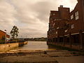
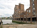
 North Wharf, London.jpg 2,592 × 3,456; 3.98 MB
-
 Old Tower Pier, London - geograph.org.uk - 712769.jpg 429 × 640; 70 KB
-

-
 Poplar Rowing Club - geograph.org.uk - 1221418.jpg 640 × 480; 99 KB
-

-
 River Lee Navigation at Hackney Wick - geograph.org.uk - 3500613.jpg 640 × 480; 67 KB
-
 River Lee near Stratford - geograph.org.uk - 3487377.jpg 640 × 480; 80 KB
-
 Slipway at Cubitt Town - geograph.org.uk - 1987492.jpg 640 × 480; 113 KB
-
 Thames Barrier Control Zone - geograph.org.uk - 1217034.jpg 640 × 480; 104 KB
-
 Thomas Rowlandson - Wapping Old Stairs - Google Art Project.jpg 6,145 × 3,931; 7.9 MB
-
 Wapping Dock Stairs - geograph.org.uk - 898690.jpg 480 × 640; 88 KB
-
 Wharf at East India Dock Basin - geograph.org.uk - 1497147.jpg 640 × 480; 76 KB


.jpg)


_-_geograph.org.uk_-_969285.jpg)


.jpg)


.jpg)


