Category:United States Senate election maps of Ohio (set)
Jump to navigation
Jump to search
States of the United States: Alabama · Alaska · Arizona · Arkansas · California · Colorado · Connecticut · Delaware · Florida · Hawaii · Idaho · Illinois · Indiana · Iowa · Kansas · Kentucky · Louisiana · Maine · Maryland · Massachusetts · Michigan · Minnesota · Mississippi · Missouri · Montana · Nebraska · Nevada · New Hampshire · New Jersey · New Mexico · New York · North Carolina · North Dakota · Ohio · Oklahoma · Oregon · Pennsylvania · Rhode Island · South Carolina · South Dakota · Tennessee · Texas · Utah · Vermont · Virginia · Washington · West Virginia · Wisconsin · Wyoming
This category is an image set. It should contain only images that have the same style, and should have a parent category that is purely topical.
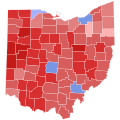
Media in category "United States Senate election maps of Ohio (set)"
The following 29 files are in this category, out of 29 total.
-
 1914 United States Senate election in Ohio results map by county.svg 810 × 810; 40 KB
-
 1916 Ohio senate election.svg 800 × 870; 1.38 MB
-
-
 1938 United States Senate election in Ohio results by county map.svg 744 × 744; 213 KB
-
 1944 United States Senate election in Ohio results by county map.svg 744 × 744; 213 KB
-
-
 1956 United States Senate election in Ohio results map by county.svg 744 × 744; 213 KB
-
 1958 United States Senate election in Ohio results map by county.svg 810 × 810; 40 KB
-
 1962 United States Senate election in Ohio results map by county.svg 810 × 810; 27 KB
-
 1964 United States Senate election in Ohio results map by county.svg 810 × 810; 27 KB
-
 Senate election in Ohio 1968.svg 744 × 744; 206 KB
-
 1970 United States Senate election in Ohio results map by county.svg 810 × 810; 39 KB
-
 1974 United States Senate election in Ohio results map by county.svg 810 × 810; 39 KB
-
 1976 United States Senate election in Ohio results map by county.svg 810 × 810; 39 KB
-
 1980 United States Senate election in Ohio results map by county.svg 810 × 810; 39 KB
-
 1982 United States Senate election in Ohio results map by county.svg 810 × 810; 39 KB
-
 1986 United States Senate election in Ohio results map by county.svg 810 × 810; 39 KB
-
 1988 United States Senate election in Ohio results map by county.svg 810 × 810; 39 KB
-
 1992 United States Senate election in Ohio results map by county.svg 810 × 810; 39 KB
-
 1994 United States Senate election in Ohio results map by county.svg 810 × 810; 39 KB
-
 1998 United States Senate election in Ohio results map by county.svg 810 × 810; 39 KB
-
 2000 United States Senate election in Ohio results map by county.svg 810 × 810; 39 KB
-
 2004 United States Senate election in Ohio results map by county.svg 810 × 810; 39 KB
-
 2006 United States Senate election in Ohio results map by county.svg 810 × 810; 39 KB
-
 2010 United States Senate election in Ohio results map by county.svg 810 × 810; 39 KB
-
 2012 United States Senate election in Ohio results map by county.svg 810 × 810; 39 KB
-
 2016 United States Senate election in Ohio results map by county.svg 810 × 810; 39 KB
-
 2018 United States Senate election in Ohio results map by county.svg 810 × 810; 39 KB
-
 2022 United States Senate election in Ohio results map by county.svg 810 × 810; 39 KB


