Category:Tranchot Maps
Jump to navigation
Jump to search
Deutsch:
Kartenaufnahme der Rheinlande durch Tranchot und von Müffling (1803-1820).
Kartenaufnahme der Rheinlande durch Tranchot und von Müffling (1803-1820).
Français :
Cartographie de la Rhénanie commencée sur ordre du Ministre français de la Guerre pour le Dépôt de la Guerre sous le commandement du colonel Tranchot, reprise et poursuivie par les Prussiens, sous la direction du Général von Müffling.
Cartographie de la Rhénanie commencée sur ordre du Ministre français de la Guerre pour le Dépôt de la Guerre sous le commandement du colonel Tranchot, reprise et poursuivie par les Prussiens, sous la direction du Général von Müffling.
Nederlands:
Deze categorie bevat kaarten van de Topografische opname van't Rijnland door Tranchot en von Müffling.
Naast groote delen van de hedendaagse duitse deelstaten Noordrijn-Westfalen, Rijnland-Palts en Saarland toont het werk ook gebieden en plaatsen van delen van de nederlandse provincies Limburg en Gelderland en ook van de belgische provincies Limburg en Luik.
| Upload media | |||||
| |||||
Pages in category "Tranchot Maps"
This category contains only the following page.
Media in category "Tranchot Maps"
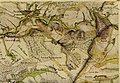
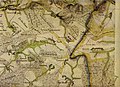
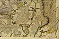
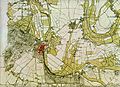
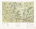
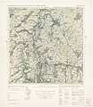
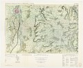
The following 99 files are in this category, out of 99 total.
-
 Antoniuskapelle Deurne Trancot 1803.jpg 486 × 384; 216 KB
-
 Ausschnitt Tranchot 1801 Broichen.png 798 × 499; 1.02 MB
-
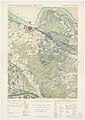
 Geilenkirchen Tranchot.png 1,276 × 731; 1.92 MB
-
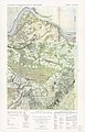
 Geilenkirchen und Umgebung um 1800.png 747 × 495; 791 KB
-
 Gelleshof Topograhische Aufnahme.png 555 × 453; 553 KB
-
 Herzogenrath Karte 1803.jpg 1,368 × 1,649; 491 KB
-
 Hurpesch op Tranchotkaart.PNG 1,040 × 489; 1.17 MB
-
 Köln - Tranchotkarte3 (Nippes-Mauenheim).jpg 1,668 × 1,108; 812 KB
-
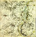
 Overview Tranchot Map Rhine 1801-1815.gif 241 × 326; 15 KB
-

-
 Schwammenauel.jpg 1,316 × 846; 788 KB
-
 Tranchot 046.jpg 2,542 × 2,950; 945 KB
-
 Tranchot Map 67 Linnich.jpg 1,851 × 1,915; 2.05 MB
-
 Tranchot uebersicht.jpg 500 × 797; 50 KB
-
 Tranchot uebersicht.png 500 × 797; 60 KB
-
 Tranchot uebersicht.svg 590 × 940; 102 KB
-
 Tranchotkaart Eys.jpg 800 × 566; 89 KB
-
 TrK01 Nijmegen Nord - 3 Nijmegen Süd.jpg 2,300 × 3,259; 1.19 MB
-
 TrK02 Millingen - 4 Kranenburg.jpg 2,197 × 3,412; 1.19 MB
-
 TrK07 Cuijck.jpg 2,538 × 2,954; 1.11 MB
-
 TrK08 Gennep.jpg 2,541 × 2,951; 1.19 MB
-
 TrK1-3-Nijmegen A1.jpg 4,612 × 3,007; 9.7 MB
-
 TrK1-3-Nijmegen A2.jpg 4,577 × 2,951; 10.08 MB
-
 TrK1-3-Nijmegen B1.jpg 4,649 × 3,381; 13.76 MB
-
 TrK1-3-Nijmegen B2.jpg 4,613 × 3,381; 14.41 MB
-
 TrK1-3-Nijmegen C1.jpg 4,586 × 3,207; 13.67 MB
-
 TrK1-3-Nijmegen C2.jpg 4,632 × 3,376; 14.27 MB
-
 TrK111-Ahrweiler A1.jpg 4,417 × 3,213; 11.67 MB
-
 TrK111-Ahrweiler A2.jpg 4,532 × 3,069; 11.76 MB
-
 TrK111-Ahrweiler B1.jpg 4,373 × 3,394; 12.28 MB
-
 TrK111-Ahrweiler B2.jpg 4,357 × 3,394; 12.01 MB
-
 TrK111-Ahrweiler C1.jpg 4,454 × 3,106; 11 MB
-
 TrK111-Ahrweiler C2.jpg 4,464 × 3,219; 11.95 MB
-
 TrK111-Ahrweiler.jpg 3,771 × 4,020; 14.11 MB
-
 TrK112-Remagen.jpg 3,796 × 3,374; 12.89 MB
-
 TrK12 St. Anthonis.jpg 2,543 × 2,948; 1.04 MB
-
 TrK13 Boxmeer.jpg 2,541 × 2,951; 1.09 MB
-
 TrK14 Weeze.jpg 2,536 × 2,957; 1.13 MB
-
 TrK18 Weverslo.jpg 2,544 × 2,947; 971 KB
-
 TrK19 Venraij.jpg 2,545 × 2,946; 1.11 MB
-
 TrK20 Meerlo.jpg 2,546 × 2,945; 1.24 MB
-
 TrK24 Deurne.jpg 2,546 × 2,945; 891 KB
-
 TrK25 Horst.jpg 2,543 × 2,948; 1.04 MB
-
 TrK26 Velden.jpg 2,546 × 2,945; 1.14 MB
-
 TrK31 Meijel.jpg 2,548 × 2,942; 953 KB
-
 TrK32 Helden.jpg 2,553 × 2,937; 1.26 MB
-
 TrK33 Venlo.jpg 2,541 × 2,951; 1.21 MB
-
 TrK37 Uerdingen.jpg 2,546 × 2,945; 585 KB
-
 TrK39 Swalmen.jpg 2,543 × 2,949; 1.13 MB
-
 TrK40 Brüggen.jpg 2,544 × 2,948; 1.23 MB
-
 TrK44-Neuss-Detail.jpg 2,273 × 2,322; 6.11 MB
-
 TrK45 Stevensweert.jpg 2,549 × 2,942; 1,024 KB
-
 TrK46 Roermond.jpg 2,542 × 2,950; 939 KB
-
 TrK47 Herkenbosch.jpg 2,545 × 2,946; 1.07 MB
-
 Trk49(rrh)-Altenkirchen A1.jpg 4,517 × 3,120; 14.19 MB
-
 Trk49(rrh)-Altenkirchen A2.jpg 4,513 × 3,107; 13.98 MB
-
 Trk49(rrh)-Altenkirchen B1.jpg 4,517 × 3,394; 15.48 MB
-
 Trk49(rrh)-Altenkirchen B2.jpg 4,679 × 3,400; 15.46 MB
-
 Trk49(rrh)-Altenkirchen C1.jpg 4,539 × 2,594; 11.66 MB
-
 Trk49(rrh)-Altenkirchen C2.jpg 4,679 × 3,113; 14.34 MB
-
 Trk5-Kleve A1.jpg 4,305 × 2,894; 10.05 MB
-
 Trk5-Kleve A2.jpg 4,553 × 2,905; 9.82 MB
-
 Trk5-Kleve B1.jpg 4,661 × 3,381; 13.72 MB
-
 Trk5-Kleve B2.jpg 4,636 × 3,325; 12.71 MB
-
 Trk5-Kleve C1.jpg 4,644 × 2,019; 8.19 MB
-
 Trk5-Kleve C2, crop1, Hasselt, Rosenthal, Moyland, Schneppenbaum.jpg 3,702 × 2,460; 7.09 MB
-
 Trk5-Kleve C2.jpg 4,628 × 3,075; 12.41 MB
-
 TrK50-Glehn.jpg 3,242 × 3,300; 10.75 MB
-
 TrK52-Zons.jpg 3,853 × 3,971; 12.83 MB
-
 TrK53 Neeroeteren - 54 Maaseik.jpg 3,096 × 2,421; 1.17 MB
-
 TrK55 Waldfeucht.jpg 2,541 × 2,951; 1,019 KB
-
 TrK56 Heinsberg.jpg 2,540 × 2,951; 1.03 MB
-
 TrK59-Grevenbroich.jpg 3,264 × 3,280; 10.11 MB
-
 TrK60-Rommerskirchen.jpg 3,936 × 3,936; 14.02 MB
-
 TrK63 Eisden - 64 Sittard.jpg 3,074 × 2,439; 962 KB
-
 TrK65 Gangelt.jpg 2,539 × 2,953; 991 KB
-
 TrK69-Bedburg.jpg 4,034 × 3,966; 15.57 MB
-
 TrK7-Cuijk A1.jpg 4,616 × 3,145; 12.7 MB
-
 TrK7-Cuijk A2.jpg 4,589 × 3,171; 13.01 MB
-
 TrK7-Cuijk B1.jpg 4,624 × 3,381; 14.08 MB
-
 TrK7-Cuijk B2.jpg 4,632 × 3,369; 13.56 MB
-
 TrK7-Cuijk C1.jpg 4,624 × 2,838; 11.85 MB
-
 TrK7-Cuijk C2.jpg 4,621 × 2,546; 10.6 MB
-
 TrK70-Bergheim A1.jpg 4,598 × 3,195; 10.63 MB
-
 TrK70-Bergheim A2.jpg 4,494 × 3,078; 8.36 MB
-
 TrK70-Bergheim B1.jpg 4,604 × 3,382; 12.63 MB
-
 TrK70-Bergheim B2.jpg 4,476 × 3,332; 11.34 MB
-
 TrK70-Bergheim C1.jpg 4,492 × 3,178; 11.96 MB
-
 TrK70-Bergheim C2.jpg 4,501 × 2,719; 10.01 MB
-
 TrK73 Rekem - 74 West Valkenburg.jpg 3,055 × 2,454; 1.01 MB
-
 TrK74 Ost Valkenburg - 75 Heerlen (Imstenrade).jpg 355 × 177; 12 KB
-
 TrK74 Ost Valkenburg - 75 Heerlen.jpg 2,542 × 2,949; 1.1 MB
-
 TrK76 Herzogenrath.jpg 2,548 × 2,943; 1.08 MB
-
 Trk78-Juelich.djvu 2,500 × 2,566; 1.01 MB
-
 TrK83 Maastricht - 84 Margraten (cropped).jpg 2,413 × 889; 426 KB
-
 TrK83 Maastricht - 84 Margraten (Scharn).jpg 1,200 × 690; 233 KB
-
 TrK83 Maastricht - 84 Margraten.jpg 3,026 × 2,478; 1.05 MB
-
 TrK85 Vaals.jpg 2,444 × 3,068; 1.07 MB
-
 Wassermühlen am Wehebach.png 2,952 × 1,771; 3.44 MB


.jpg)


-Altenkirchen_A1.jpg)
-Altenkirchen_A2.jpg)
-Altenkirchen_B1.jpg)
-Altenkirchen_B2.jpg)
-Altenkirchen_C1.jpg)
-Altenkirchen_C2.jpg)


.jpg)


.jpg)


.jpg)