Category:Theatrum Orbis Terrarum (1606 Folger)
Jump to navigation
Jump to search
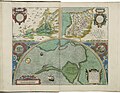
copy of the first English Language edition of Ortelius's Atlas in the Folger Shakespeare Library  Map of Asia from the Folger copy of Theatrum Orbis Terranum | |||||
| Upload media | |||||
| Instance of |
| ||||
|---|---|---|---|---|---|
| Location | Folger Shakespeare Library, Washington, D.C., District of Columbia | ||||
| Collection | |||||
| Inventory number |
| ||||
| |||||
This category contains scans of the 1606 edition of the Theatrum Orbis Terrarum housed at the Folger Shakespeare Library.
Media in category "Theatrum Orbis Terrarum (1606 Folger)"
The following 164 files are in this category, out of 164 total.
-
 Image of Daphne by Abraham Ortelius.jpeg 3,031 × 2,352; 2.43 MB
-
 Image of Tempe in Thessaly by Abraham Ortelius.jpeg 3,023 × 2,344; 2.29 MB
-
 Image of the Monasterio de el Escorial by Abraham Ortelius.jpeg 3,057 × 2,354; 2.3 MB
-
 Inset map of Carthage by Abraham Ortelius (cropped).jpeg 391 × 416; 76 KB
-
 Map and images of the peregrination of Abraham the Patriarch by Abraham Ortelius.jpeg 3,029 × 2,348; 2.33 MB
-
 Map and images of the peregrination of Saint Paul by Abraham Ortelius.jpeg 3,035 × 2,338; 2.28 MB
-
 Map of Abruzzo by Abraham Ortelius.jpeg 1,590 × 1,183; 516 KB
-
 Map of Africa by Abraham Ortelius.jpeg 3,051 × 2,337; 2.62 MB
-
 Map of ancient Egypt and inset map of the area around Alexandria by Abraham Ortelius.jpeg 3,070 × 2,370; 2.36 MB
-
 Map of ancient geography by Abraham Ortelius.jpeg 3,060 × 2,363; 1.98 MB
-
 Map of ancient Italy by Abraham Ortelius (Liguria).jpg 636 × 349; 161 KB
-
 Map of ancient Italy by Abraham Ortelius.jpeg 3,068 × 2,354; 2.36 MB
-

-
 Map of ancient Thrace by Abraham Ortelius.jpeg 3,058 × 2,359; 2.33 MB
-
 Map of ancient Tuscia by Abraham Ortelius.jpeg 3,058 × 2,370; 2.18 MB
-
 Map of Anjou by Abraham Ortelius.jpeg 3,032 × 2,346; 2.2 MB
-
 Map of Artois by Abraham Ortelius.jpeg 1,587 × 1,176; 622 KB
-
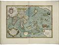
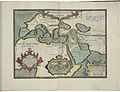
 Map of Asia by Abraham Ortelius.jpeg 3,021 × 2,333; 2.46 MB
-
 Map of Austria by Abraham Ortelius.jpeg 3,033 × 2,353; 2.34 MB
-
 Map of Barbary by Abraham Ortelius.jpeg 1,557 × 1,179; 546 KB
-
 Map of Bavaria by Abraham Ortelius.jpeg 1,578 × 1,185; 654 KB
-
 Map of Bohemia by Abraham Ortelius.jpeg 3,045 × 2,348; 2.2 MB
-
 Map of Brabant by Abraham Ortelius.jpeg 3,048 × 2,379; 2.33 MB
-
 Map of Brandenburg by Abraham Ortelius.jpeg 3,066 × 2,360; 2.31 MB
-
 Map of China by Abraham Ortelius.jpeg 1,579 × 1,189; 632 KB
-
 Map of Cyprus and inset map of Lemnos by Abraham Ortelius.jpeg 1,595 × 1,181; 619 KB
-
 Map of Dacia and Moesia by Abraham Ortelius.jpeg 1,540 × 1,182; 543 KB
-
 Map of East Friesland and inset map of part of Reiderland by Abraham Ortelius.jpeg 1,539 × 1,174; 622 KB
-
 Map of England and Ireland, and the Progeny of the kings of England by Abraham Ortelius.jpeg 3,027 × 2,343; 3.29 MB
-
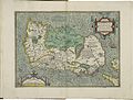
 Map of England by Abraham Ortelius.jpeg 3,061 × 2,351; 2.59 MB
-
 Map of England, Scotland, and Ireland by Abraham Ortelius.jpeg 3,042 × 2,352; 2.63 MB
-
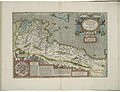
 Map of Europe 1 by Abraham Ortelius.jpeg 1,567 × 1,187; 569 KB
-
 Map of Europe 2 by Abraham Ortelius.jpeg 1,536 × 1,178; 595 KB
-
 Map of Flanders and inset map of part of Zeeland by Abraham Ortelius.jpeg 1,585 × 1,176; 650 KB
-
 Map of Florence by Abraham Ortelius.jpeg 1,582 × 1,179; 549 KB
-
 Map of Forum Julii by Abraham Ortelius.jpeg 1,579 × 1,187; 569 KB
-
 Map of France 1 by Abraham Ortelius.jpeg 3,062 × 2,348; 2.42 MB
-
 Map of France 2 by Abraham Ortelius.jpeg 3,060 × 2,332; 2.8 MB
-
 Map of Friesland by Abraham Ortelius.jpeg 1,584 × 1,188; 560 KB
-
 Map of Galicia by Abraham Ortelius.jpeg 1,536 × 1,190; 619 KB
-
 Map of Gallia Belgica by Abraham Ortelius.jpeg 3,045 × 2,343; 2.39 MB
-

-
-
 Map of Gallic Italy by Abraham Ortelius.jpeg 3,058 × 2,364; 2.23 MB
-
 Map of Gelderland by Abraham Ortelius.jpeg 3,039 × 2,355; 2.43 MB
-
 Map of Germania by Abraham Ortelius.jpeg 3,051 × 2,350; 2.41 MB
-
 Map of Germany by Abraham Ortelius.jpeg 3,057 × 2,361; 2.76 MB
-
 Map of Greece 1 by Abraham Ortelius.jpeg 1,583 × 1,182; 635 KB
-
 Map of Greece 2 by Abraham Ortelius.jpeg 3,052 × 2,343; 2.34 MB
-
 Map of Holland by Abraham Ortelius.jpeg 1,584 × 1,178; 636 KB
-
 Map of Hungary (2nd) by Abraham Ortelius.jpeg 1,590 × 1,171; 635 KB
-
 Map of Hungary by Abraham Ortelius.jpeg 1,583 × 1,180; 643 KB
-
 Map of Iceland by Abraham Ortelius.jpeg 1,595 × 1,184; 577 KB
-
 Map of Illyricum by Abraham Ortelius.jpeg 1,581 × 1,178; 610 KB
-
 Map of India and the Maluku Islands by Abraham Ortelius.jpeg 1,562 × 1,186; 596 KB
-
 Map of Ireland 1 by Abraham Ortelius.jpeg 3,063 × 2,334; 2.32 MB
-
 Map of Ireland 2 by Abraham Ortelius.jpeg 1,546 × 1,172; 824 KB
-
 Map of Ischia by Abraham Ortelius.jpeg 1,611 × 1,176; 610 KB
-
 Map of Israel by Abraham Ortelius.jpeg 3,054 × 2,348; 2.24 MB
-
 Map of Italy by Abraham Ortelius.jpeg 1,564 × 1,184; 587 KB
-
 Map of Japan by Abraham Ortelius.jpeg 3,068 × 2,362; 2.3 MB
-
 Map of Latium and inset map of Mount Circe by Abraham Ortelius.jpeg 3,035 × 2,356; 2.16 MB
-
 Map of Liége by Abraham Ortelius.jpeg 3,054 × 2,367; 2.48 MB
-
 Map of Lorainne by Abraham Ortelius.jpeg 3,029 × 2,357; 2.31 MB
-
 Map of Luxembourg by Abraham Ortelius.jpeg 3,030 × 2,369; 2.3 MB
-

-
 Map of Mansfield by Abraham Ortelius.jpeg 3,021 × 2,360; 2.27 MB
-
 Map of Moravia by Abraham Ortelius.jpeg 3,006 × 2,357; 2.18 MB
-
 Map of New Spain by Abraham Ortelius.jpeg 3,066 × 2,337; 2.42 MB
-
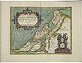
 Map of Palestine by Abraham Ortelius.jpeg 3,057 × 2,352; 2.25 MB
-
 Map of Pannonia and Illyria by Abraham Ortelius.jpeg 3,034 × 2,339; 2.18 MB
-
 Map of Picardy by Abraham Ortelius.jpeg 3,020 × 2,347; 2.16 MB
-
 Map of Poitou (province in France) by Abraham Ortelius.jpeg 3,035 × 2,338; 2.38 MB
-
 Map of Poland and Lithuania by Abraham Ortelius.jpeg 1,580 × 1,176; 593 KB
-
 Map of Portugal by Abraham Ortelius.jpeg 1,538 × 1,171; 616 KB
-
 Map of Prester John (Ethiopia) by Abraham Ortelius.jpeg 6,095 × 4,674; 6.5 MB
-
 Map of Provence by Abraham Ortelius.jpeg 3,059 × 2,373; 2.42 MB
-
 Map of Prussia by Abraham Ortelius.jpeg 1,580 × 1,188; 622 KB
-
 Map of Roman Africa and inset map of Carthage by Abraham Ortelius.jpeg 3,049 × 2,347; 2.31 MB
-
 Map of Romania by Abraham Ortelius.jpeg 1,598 × 1,183; 576 KB
-
 Map of Russia, or the Empire of the Grand Duke of Moscovia, by Abraham Ortelius.jpeg 1,580 × 1,174; 500 KB
-
 Map of sacred geography by Abraham Ortelius.jpeg 3,041 × 2,340; 2.17 MB
-
 Map of Salzburg by Abraham Ortelius.jpeg 3,024 × 2,333; 2.28 MB
-
 Map of Scandinavia by Abraham Ortelius.jpeg 1,590 × 1,183; 588 KB
-
 Map of Scotland by Abraham Ortelius.jpeg 2,895 × 2,336; 2.4 MB
-
 Map of Silesia by Abraham Ortelius.jpeg 3,042 × 2,352; 2.06 MB
-
 Map of Slavonia, Croatia, Carnia, Istria, and Bosnia by Abraham Ortelius.jpeg 1,597 × 1,188; 540 KB
-
 Map of Spain and inset map of Cadiz by Abraham Ortelius.jpeg 3,055 × 2,345; 2.63 MB
-
 Map of Spain by Abraham Ortelius.jpeg 3,054 × 2,336; 2.73 MB
-
 Map of Switzerland by Abraham Ortelius.jpeg 1,584 × 1,181; 565 KB
-
 Map of Tartaria by Abraham Ortelius.jpeg 1,574 × 1,179; 546 KB
-
 Map of the Americas by Abraham Ortelius.jpeg 3,070 × 2,365; 2.54 MB
-
 Map of the Azore Islands by Abraham Ortelius.jpeg 3,018 × 2,361; 2.38 MB
-
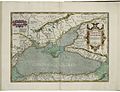 Map of the Black Sea by Abraham Ortelius.jpeg 3,053 × 2,351; 2.34 MB
-
 Map of the British Isles by Abraham Ortelius.jpeg 1,538 × 1,185; 625 KB
-
 Map of the County of Burgundy by Abraham Ortelius.jpeg 3,035 × 2,345; 2.16 MB
-
 Map of the County of Hainaut by Abraham Ortelius.jpeg 1,596 × 1,186; 624 KB
-
 Map of the diocese of Seville in Andalusia by Abraham Ortelius.jpeg 1,541 × 1,203; 594 KB
-
 Map of the Duchy of Burgundy by Abraham Ortelius.jpeg 3,033 × 2,360; 2.17 MB
-
 Map of the Duchy of Limburg by Abraham Ortelius.jpeg 3,059 × 2,348; 2.23 MB
-
 Map of the Duchy of Milan by Abraham Ortelius.jpeg 1,574 × 1,189; 629 KB
-
 Map of the Duchy of Piedmont by Abraham Ortelius.jpeg 1,582 × 1,181; 640 KB
-
 Map of the Duchy of Württemberg by Abraham Ortelius.jpeg 6,317 × 4,738; 7.19 MB
-
 Map of the Earldom of Namur by Abraham Ortelius.jpeg 3,057 × 2,369; 2.37 MB
-
 Map of the Holy Land by Abraham Ortelius.jpeg 3,063 × 2,360; 2.3 MB
-
 Map of the Ile de France by Abraham Ortelius.jpeg 3,050 × 2,349; 2.09 MB
-
 Map of the Kingdom of Naples by Abraham Ortelius.jpeg 1,610 × 1,184; 679 KB
-
 Map of the Kingdom of Persia by Abraham Ortelius.jpeg 1,564 × 1,186; 566 KB
-

-
 Map of the liberties of Brest by Abraham Ortelius.jpeg 1,580 × 1,173; 539 KB
-

-
 Map of the liberties of Perugia by Abraham Ortelius.jpeg 1,584 × 1,187; 565 KB
-
 Map of the liberties of Verona by Abraham Ortelius.jpeg 1,574 × 1,178; 536 KB
-
 Map of the Netherlands by Abraham Ortelius.jpeg 3,066 × 2,367; 2.36 MB
-
 Map of the Ottoman Empire by Abraham Ortelius.jpeg 3,046 × 2,353; 2.43 MB
-
 Map of the Pacific Ocean by Abraham Ortelius.jpeg 2,510 × 1,747; 1.97 MB
-
-
 Map of the Touraine by Abraham Ortelius.jpeg 1,538 × 1,173; 554 KB
-
 Map of the voyage of Aeneas by Abraham Ortelius.jpeg 1,536 × 1,180; 554 KB
-

-
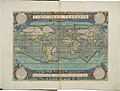 Map of the world by Abraham Ortelius.jpeg 1,538 × 1,166; 582 KB
-
 Map of Transylvania by Abraham Ortelius.jpeg 1,574 × 1,180; 533 KB
-
 Map of Tuscia by Abraham Ortelius.jpeg 1,596 × 1,181; 588 KB
-
 Map of Upper Saxony by Abraham Ortelius.jpeg 3,036 × 2,344; 2.29 MB
-
 Map of Valencia by Abraham Ortelius.jpeg 3,013 × 2,346; 2.25 MB
-
 Map of Wales by Abraham Ortelius.jpeg 3,030 × 2,358; 2.43 MB
-

-
 Map of Westphalia by Abraham Ortelius.jpeg 3,030 × 2,404; 2.24 MB
-
 Map of Zeeland by Abraham Ortelius.jpeg 1,589 × 1,189; 542 KB
-
 Maps of Anatolia, of Egypt, and of Carthage by Abraham Ortelius.jpeg 1,553 × 1,184; 538 KB
-
 Maps of Apulia and of Calabria by Abraham Ortelius.jpeg 1,606 × 1,194; 531 KB
-
 Maps of Berry and of Limagne by Abraham Ortelius.jpeg 1,536 × 1,175; 504 KB
-
 Maps of Braunschweig and Lüneberg and of the territory of Nuremberg by Abraham Ortelius.jpeg 3,006 × 2,377; 1.99 MB
-
 Maps of Buchonia and of the County of Waldeck by Abraham Ortelius.jpeg 3,027 × 2,351; 2.08 MB
-
 Maps of Calais and Boulogne and of Vermandois by Abraham Ortelius.jpeg 3,062 × 2,352; 2.15 MB
-
 Maps of Carpetania, of Gipuzkoa, and of Cadiz by Abraham Ortelius.jpeg 3,047 × 2,360; 2.22 MB
-

-

-
 Maps of Culiacán and of Hispaniola and Cuba by Abraham Ortelius.jpeg 3,033 × 2,338; 2.37 MB
-
 Maps of Denmark and of the Cimbrian (Jutland) Peninsula by Abraham Ortelius.jpeg 3,071 × 2,343; 2.28 MB
-
 Maps of Dietmarsh and of Oldenburg by Abraham Ortelius.jpeg 3,059 × 2,360; 2.13 MB
-
 Maps of Franconia and of the Bishopric of Münster by Abraham Ortelius.jpeg 3,063 × 2,354; 2.33 MB
-
 Maps of Hennenberg and of Hesse by Abraham Ortelius.jpeg 1,540 × 1,174; 512 KB
-

-

-
-

-
 Maps of Narbonne, of Savoie, and of the Comtat Venaissin by Abraham Ortelius.jpeg 3,029 × 2,367; 2.29 MB
-

-

-

-
 Maps of the Argonautica by Abraham Ortelius.jpeg 3,043 × 2,352; 2.27 MB
-
 Maps of the Blois region and of Limousin by Abraham Ortelius.jpeg 3,065 × 2,368; 2.15 MB
-

-

-

-
 Maps of the liberties of Padua and of the liberties of Treviso by Abraham Ortelius.jpeg 1,577 × 1,174; 557 KB
-
 Maps of the peregrination of Ulysses by Abraham Ortelius.jpeg 3,012 × 2,363; 2.28 MB
-

-
 Maps of the territory of Basel and of the Swabian Circle by Abraham Ortelius.jpeg 1,589 × 1,189; 599 KB
-
 Maps of Thuringia and of the province of Meissen by Abraham Ortelius.jpeg 3,066 × 2,355; 1.87 MB
-
 The Order of the German Empire in the West 1 by Abraham Ortelius.jpeg 1,555 × 1,176; 557 KB
-
 The Order of the German Empire in the West 2 by Abraham Ortelius.jpeg 1,540 × 1,178; 541 KB
-
 Urola Kosta by Abraham Ortelius (cropped).jpeg 241 × 357; 43 KB


.jpeg)


.jpg)


_by_Abraham_Ortelius.jpeg)


_by_Abraham_Ortelius.jpeg)


_by_Abraham_Ortelius.jpeg)


_by_Abraham_Ortelius.jpeg)


_Peninsula_by_Abraham_Ortelius.jpeg)


_by_Abraham_Ortelius.jpeg)

_and_of_Brittany_and_Normandy_by_Abraham_Ortelius.jpeg)


_by_Abraham_Ortelius.jpeg)


.jpeg)