Category:Ski resort maps
Jump to navigation
Jump to search
Subcategories
This category has the following 2 subcategories, out of 2 total.
C
- Cross-country skiing maps (5 F)
Media in category "Ski resort maps"
The following 23 files are in this category, out of 23 total.
-
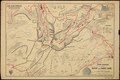
 21-22 Saddleback Trail Map.png 1,309 × 855; 2.67 MB
-
 631136102 CA DEL 1890.pdf 4,837 × 3,239; 6.59 MB
-
 976 11 Selce, Slovakia - panoramio (10).jpg 1,600 × 1,200; 522 KB
-
 Allenspark ski jumps map.jpg 2,862 × 2,391; 523 KB
-
 Arosa-Lenzerheide-Pistenplan-Talseiten.jpg 900 × 1,202; 352 KB
-
 Colorado ski country, USA - DPLA - d4eaf3f9461c9818b348c3c47189250b.jpg 8,999 × 6,306; 9.74 MB
-
 Courchevel ski resort map.svg 641 × 743; 3.07 MB
-
 Hermonnmap.png 781 × 786; 164 KB
-
 Innerkrems Wintersportzentrum Nockberge, Kärnten.jpg 1,500 × 972; 1.04 MB
-
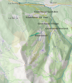
 Kaart Espace Killy.jpg 325 × 155; 11 KB
-
 LovelandTrailMaps&Ads.jpg 800 × 600; 134 KB
-
 MAP ONLY FROM BETSEY.png 1,313 × 858; 2.85 MB
-
 Pistenplan Hirschberg.jpg 3,036 × 2,254; 2.31 MB
-
 Pistenplan Patscherkofelbahn.jpg 3,912 × 2,710; 4.03 MB
-
 Pistenplan Savognin 2015.jpg 4,940 × 3,877; 14.92 MB
-
 Plan piste.jpg 640 × 440; 231 KB
-
 Seekopf-panorama.jpg 640 × 480; 118 KB
-
 Ski resorts in the world.png 1,357 × 628; 122 KB
-
 SnowKing winter trail map-1024x799.jpg 1,024 × 799; 362 KB
-
 SPSA map 18.jpg 864 × 1,728; 250 KB
-
 SPSA map 88.jpg 3,449 × 2,376; 6.63 MB
-
 Walmendingerhorn schigebiet.jpg 1,810 × 1,269; 562 KB
-
 Yosemite map.jpg 700 × 687; 103 KB

.jpg)


