Category:Signs in Manitoba
Jump to navigation
Jump to search
Provinces and territories of Canada: Alberta · British Columbia · Manitoba · New Brunswick · Newfoundland and Labrador · Nova Scotia · Ontario · Prince Edward Island · Quebec · Saskatchewan · Northwest Territories · Nunavut · Yukon
Subcategories
This category has the following 19 subcategories, out of 19 total.
B
- Banners in Manitoba (5 F)
- Bus stop signs in Manitoba (3 F)
C
- Signs in Churchill, Manitoba (14 F)
G
O
- Open signs in Manitoba (2 F)
P
- Parking signs in Manitoba (1 F)
- Place name signs in Manitoba (21 F)
R
S
- Signs in Lower Fort Garry (7 F)
- Signs in Selkirk, Manitoba (1 F)
- Street signs in Manitoba (5 F)
W
- Warning signs in Manitoba (3 F)
Media in category "Signs in Manitoba"
The following 48 files are in this category, out of 48 total.
-
 19940717mon903mn mb.jpg 1,617 × 2,856; 704 KB
-
 2008OctBisonJmpSign.jpg 1,280 × 960; 799 KB
-
 Angle Inlet MN Unmanned Border Crossing - panoramio.jpg 623 × 582; 84 KB
-
 Basic weather forecasting (6360758785).jpg 3,009 × 4,434; 3.55 MB
-
 Bison Encloser Riding Mountain National Park Manitoba Canada (4).JPG 3,264 × 2,448; 1.9 MB
-
 Blue Sky Expeditions (6387480871).jpg 5,184 × 3,456; 8.64 MB
-
 Boissevain, Manitoba (43925145892).jpg 5,184 × 1,811; 5.94 MB
-
 Boundary Trail Heritage Region Near Boissevain, Manitoba (43973654571).jpg 5,184 × 3,888; 5.81 MB
-
 Brockington Pound Historic Site.jpg 4,032 × 3,024; 9.25 MB
-
 Canada-United States Border, Northwest Angle, Minnesota (43925984292).jpg 5,184 × 3,888; 7.14 MB
-

-
 Delta Marsh Manitoba Canada.JPG 3,264 × 2,448; 2 MB
-
 Distance (6355215913).jpg 5,184 × 3,456; 6.71 MB
-
 Junction of Manitoba Highways 2 and 3 Near Winnipeg, Manitoba (29035421547).jpg 3,805 × 2,046; 3.93 MB
-
 Lake Stormon, Scenic Loop, International Peace Garden, Manitoba (43255053344).jpg 5,184 × 3,209; 13.84 MB
-
 Law office, Killarney, Manitoba, Canada.jpg 540 × 356; 110 KB
-
 Limestone-Roadsign-Manitoba.JPG 3,072 × 2,304; 1.03 MB
-
 Linear Burial Mounds Interpretive Sign.tif 2,947 × 2,943; 36 MB
-
 Lower Fort Garry Historic Site Manitoba Canada.JPG 2,448 × 3,264; 2.09 MB
-
 Lyleton native grass plot.jpg 6,000 × 4,000; 12.7 MB
-
 Lynx-Dwells-Pisew-Falls.JPG 3,072 × 2,304; 989 KB
-
 Manitoba Invasive Species Alert (36611715844).jpg 2,560 × 1,707; 2.97 MB
-
 Manitoba welcome sign on the Trans-Canada Highway at the Saskatchewan border.jpg 2,240 × 2,310; 2.11 MB
-
 Mystery-Mountain-Winter-Park.JPG 3,072 × 2,304; 1.09 MB
-
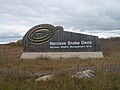
 Narcisse Snake Dens Information Sign 01.jpg 5,184 × 3,456; 3.22 MB
-
 Narcisse Snake Dens Information Sign 04.jpg 3,456 × 5,184; 3.17 MB
-
 Narcisse Snake Dens Information Sign 06.jpg 3,456 × 5,184; 3.39 MB
-
 Narcisse Snake Dens Information Sign 12.jpg 5,184 × 3,456; 4.32 MB
-
 Narcisse Snake Dens Sign.JPG 1,600 × 1,200; 1.05 MB
-
 Northwest Angle Provincial Forest, Manitoba (43255766904).jpg 5,184 × 3,888; 6.89 MB
-
 Oak Hammock Marsh Interpretive Centre, 1 Snow Goose Bay, Stonewall (493250) (9863364866).jpg 4,000 × 2,248; 3.22 MB
-
 Red Sucker Airport sign.jpg 2,592 × 1,944; 2.26 MB
-
 Redliners (4002431659).jpg 1,600 × 1,200; 699 KB
-
 Riding Mountain National Park Manitoba Canada (7).JPG 2,448 × 3,264; 1.9 MB
-
 Riding Mountain National Park Manitoba Canada.JPG 3,264 × 2,448; 2.22 MB
-
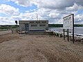 SDControlStructure.JPG 3,264 × 2,448; 3.15 MB
-
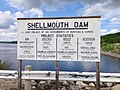 ShellmouthDamSign.JPG 3,264 × 2,448; 2.81 MB
-
 Sugar Point Cottage Entrance - panoramio.jpg 2,592 × 1,944; 2.58 MB
-

-
 Three (6371351055).jpg 3,690 × 1,708; 1.66 MB
-
 Town life (6360993411).jpg 5,184 × 3,456; 6.27 MB
-
 Town of Gimli (48241170356).jpg 4,240 × 2,832; 1.16 MB
-
 Trail sign (6374818025).jpg 2,051 × 2,708; 1.51 MB
-
 Turn-off to Northwest Angle, Minnesota (30105930558).jpg 5,184 × 3,888; 7.8 MB
-
 Wagons Ho (2935156033).jpg 1,600 × 1,200; 616 KB
-
 Warning - Polar Bears! (6411603325).jpg 457 × 603; 100 KB
-
 Warning high medical costs ahead billboard enter US (36178515731).jpg 3,735 × 2,502; 5.63 MB
-
 You've been warned! (6386259497).jpg 1,687 × 2,304; 1.2 MB


.jpg)
.JPG)
.jpg)
.jpg)

.jpg)

.jpg)
.jpg)
.jpg)


.jpg)


.jpg)
_(9863364866).jpg)

.jpg)
.JPG)


.jpg)
.jpg)
.jpg)
.jpg)
.jpg)
.jpg)
.jpg)
.jpg)
.jpg)
.jpg)
.jpg)
_Between_Winnipeg,_Manitoba_and_Ontario_Border_(43974635301).jpg)