Category:Shilin District, Taipei
Jump to navigation
Jump to search
日本語: 士林区。
中文(臺灣):士林區。
A district of Taipei   | |||||
| Upload media | |||||
| Instance of | |||||
|---|---|---|---|---|---|
| Part of | |||||
| Location |
| ||||
| Population |
| ||||
| Area |
| ||||
| Elevation above sea level |
| ||||
| Replaces |
| ||||
| official website | |||||
 | |||||
Subcategories
This category has the following 56 subcategories, out of 56 total.
*
2
- 2013 in Shilin District, Taipei (32 F)
B
- Bailing Bridge (9 F)
- Bailing Sport Park (1 F)
C
F
- FuGuo Road (Taipei) (23 F)
- Fulin Bridge (12 F)
H
- Hougang Park (2 F)
- Huanbei Interchange (2 F)
- Huanhe Expressway (10 F)
J
- Jingshan Suspension Bridge (16 F)
- Juansi Waterfall Trail (4 F)
K
L
- Lanya Park (23 F)
M
- Meilun Park (4 F)
- Mount Qigu (2 F)
Q
R
- Reverse compass stone (6 F)
S
- Shengren Waterfall (1 F)
- Shilin Bridge (2 F)
- Shuangxi Park and Chinese Garden (44 F)
- Southern Sulfur Creek (36 F)
T
- Taipei European School (2 F)
- Taipei Flower Village (9 F)
- Taipei Maple Secret Resort (22 F)
- Tianfu Park (7 F)
- Tomb of Lin Yutang (3 F)
- Tomb of Pan Gong chou (57 F)
W
- Wenchang Bridge (Taipei) (4 F)
- Wuyun Villa (29 F)
Y
- Yan Xishan's Tomb (20 F)
- Yuanshan Bridge (9 F)
Z
- Zhoumei Expressway (4 F)
- Ziqiang Tunnel (3 F)
Media in category "Shilin District, Taipei"
The following 200 files are in this category, out of 596 total.
(previous page) (next page)-
 111, Taiwan, 台北市士林區菁山里 - panoramio.jpg 1,200 × 800; 1,014 KB
-
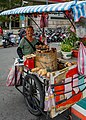
 2009-04-20 roadside street food vendors in Shilin, Taipei.jpg 1,536 × 2,048; 716 KB
-
 2010-12-28 Alley in Taipei 01.jpg 3,000 × 4,000; 4.36 MB
-
 2010-12-28 Shilin District, Taipei.jpg 4,000 × 3,000; 6.83 MB
-
 2010-12-31 FuGang Street in Shilin, Taipei.jpg 3,000 × 4,000; 4.7 MB
-
 2010-12-31 under a road bridge in Taipei.jpg 3,000 × 4,000; 4.75 MB
-
 2014-11-21 shops near the MRT Shilin Station.jpg 4,928 × 3,264; 4.3 MB
-
 2015-04-29 Shilin or Bladerunner?.jpg 4,299 × 2,866; 3.38 MB
-
 2017士林區玉皇宮米祭典創作.jpg 4,896 × 3,264; 6.71 MB
-
 2018 GuGong Road Shilin District, Taipei.jpg 6,016 × 4,016; 19 MB
-
 30劍潭幻影.jpg 3,402 × 2,821; 2.88 MB
-
 Apple Watch 5 (51133349873).jpg 4,508 × 3,005; 8.5 MB
-
 Asus ZenFone 3 照片 (28497577131).jpg 4,656 × 2,620; 5.95 MB
-
 CaoDong St. (E.).jpg 4,032 × 3,024; 4.21 MB
-
 CaoDong St. (W.).jpg 4,032 × 3,024; 3.37 MB
-
 CaoDong St. Intersection.jpg 4,032 × 3,024; 3.47 MB
-
 Chengde Rd. and Shishang Rd. intersection 20101231.jpg 4,000 × 3,000; 6.8 MB
-
 Cholera vaccination in Shirin, Formosa 1919.jpg 2,048 × 1,314; 562 KB
-
 Dog feces container by Fulin Village Office, Shilin District, Taipei City 20170405.jpg 3,456 × 4,608; 4.46 MB
-
 DSC01陽明山永明寺001.jpg 1,856 × 1,232; 1.03 MB
-
 Expressway Shilin.jpg 1,200 × 778; 288 KB
-
 Ferry near Shirin 1930s.jpg 1,988 × 1,291; 290 KB
-
 Food Stand In Shilin (243774469).jpeg 2,000 × 1,334; 765 KB
-
 Interior of Taoist Temple, Taipei.jpg 547 × 883; 211 KB
-
 Iphone試拍..相機型號:Apple iPhone 3GS - panoramio (6).jpg 2,048 × 1,536; 1.07 MB
-
 Iphone試拍..相機型號:Apple iPhone 3GS - panoramio (7).jpg 2,048 × 1,536; 1.26 MB
-
 Koi Pond 錦鯉池 - panoramio.jpg 4,000 × 3,000; 3.1 MB
-
 Motorcyklister.jpg 3,005 × 1,214; 1.25 MB
-
 NHK plate on Dabei Road 20190217.jpg 2,100 × 2,800; 876 KB
-
 Pathway between JianNan Rd. Ln. 204 and ZhiShan Rd. Sec. 2 Ln. 266.jpg 4,032 × 3,024; 2.44 MB
-
 Petercurry - panoramio.jpg 1,600 × 1,200; 284 KB
-
 Petercurrys in Tianmu - panoramio.jpg 2,248 × 4,000; 1.89 MB
-
 Ptyas dhumnades 62027063.jpg 2,048 × 1,536; 1.52 MB
-
 Ptyas dhumnades 62027076.jpg 2,048 × 1,536; 1.57 MB
-
 Ptyas dhumnades 62027090.jpg 2,048 × 1,536; 1.83 MB
-
 Red Leaves 紅葉 - panoramio.jpg 3,264 × 2,448; 1.52 MB
-
 Scooter of Tianshou Li.jpg 3,024 × 4,032; 5.09 MB
-
 Sec 2, Zhishan Rd, Shilin District Birdview 20121020a.jpg 4,000 × 3,000; 6.35 MB
-
 Serene 0429.jpg 1,108 × 1,478; 367 KB
-
 Shihlin district taipei1.JPG 1,024 × 768; 145 KB
-
 Shihlin district taipei2.JPG 1,024 × 768; 119 KB
-
 Shilin District, Taipei City, Taiwan 111 - panoramio.jpg 3,264 × 2,448; 8.15 MB
-
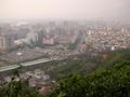
 Shilin, Taipei Skyline.jpg 4,032 × 3,024; 3.22 MB
-
 Shilin翠山雙福宮.jpg 6,016 × 4,016; 18.2 MB
-
 Sideway of Chung Shang North Road.jpg 576 × 768; 134 KB
-
 Smoking Area (263302691).jpeg 2,000 × 1,334; 429 KB
-
 Taipei MRT Danshui Line between Shilin Station and Zhishan Station.jpg 4,000 × 3,000; 3.3 MB
-
 Taipei Performing Arts Center 20221215 (cropped).jpg 2,000 × 1,400; 687 KB
-
 Taipei Performing Arts Center 20221215.jpg 4,032 × 3,024; 2.25 MB
-
 Taipei Taiwan Sweet-Potato-Hawker-with-his-mobile-stall-01.jpg 3,476 × 4,866; 10.8 MB
-
 Taipei Taiwan Sweet-Potato-Hawker-with-his-mobile-stall-02.jpg 5,760 × 3,840; 11.03 MB
-
 Taipei, Keelung City, Taiwan - panoramio (25).jpg 4,000 × 2,248; 2.6 MB
-
 Taipei-TRTS-Shilin.jpg 640 × 480; 86 KB
-
 Taiwan Taxi Corp 607-ES right side on Zhongzheng Road 20080803.jpg 2,592 × 1,944; 845 KB
-
 Take a Break Coffee Shop - panoramio.jpg 2,970 × 3,962; 4.94 MB
-
 Tapei underground passage 1.jpg 576 × 768; 99 KB
-
 Tatung TT-001 on Lane 461, Section 5, Zhongshan North Road 20230304.jpg 2,250 × 3,000; 1.4 MB
-
 TGST Chapel January 12 2023.jpg 4,032 × 3,024; 2.84 MB
-
-
 View of the mountain from the bus stop in Taipei, Taiwan.jpg 1,501 × 2,001; 214 KB
-
 Water Wheel in Pool of Park at Shilin District, Taipei 20150102.jpg 4,896 × 3,264; 6.49 MB
-
 XiaDongShi Industrial Road, Shilin, Taipei, Taiwan.jpg 4,032 × 3,024; 3.17 MB
-
 Youth Daily News North District Management Office bulletin board 20171111.jpg 3,280 × 2,460; 1.77 MB
-
 Zhi Shan Road East Birdview from Foot Bridge 20131010a.JPG 4,000 × 3,000; 6.47 MB
-
 Zhishan Road entrance, Chih-te Garden Path 20230819.jpg 5,200 × 3,900; 4.34 MB
-
 Zhongshan North Road Section 6 in Shilin District, Taipei 20150102.jpg 4,896 × 3,264; 2.02 MB
-
 三腳渡碼頭.jpg 3,264 × 2,448; 2.01 MB
-
 下班時段的街頭 (49972752223).jpg 3,944 × 2,629; 4.31 MB
-
 下雨的公車亭 (52330129971).jpg 7,397 × 4,934; 25.04 MB
-
 下雨的巷弄 (52351924852).jpg 2,600 × 3,898; 7.43 MB
-
 下雨的巷弄 (52351924967).jpg 8,192 × 5,464; 19.91 MB
-
 中國文化大學4017.jpg 4,608 × 3,456; 3.75 MB
-
 中山北路七段底(水管古道前).jpg 3,264 × 2,448; 2.62 MB
-
 中正路上的福榮街小巷 - panoramio.jpg 2,592 × 1,944; 660 KB
-
 人潮稀落的士林夜市 (51392394938).jpg 8,192 × 5,464; 21.49 MB
-
 仰德大道一段下雨天路景.jpg 3,264 × 2,448; 1.99 MB
-
 佔車位用途的腳踏車 (37255124192).jpg 4,035 × 3,118; 7.89 MB
-
 傍晚的堤防巷道 (51846945758).jpg 4,657 × 6,982; 23.74 MB
-
 充滿年代感的投幣式公用電話 (52269022492).jpg 4,914 × 7,368; 19.06 MB
-
 內雙溪 - panoramio (1).jpg 2,448 × 3,264; 3.31 MB
-
 內雙溪 - panoramio.jpg 2,306 × 3,459; 3.1 MB
-
 凌晨的街道 (51799322684).jpg 7,586 × 5,060; 28.2 MB
-
 前街和美德街口.jpg 3,264 × 2,448; 2.09 MB
-
 原巴旅館澡堂101930.jpg 4,597 × 3,309; 3.1 MB
-
 台北天空的火燒雲 20220904.jpg 7,385 × 4,926; 23.45 MB
-
 台北市市街取景 - panoramio - Tianmu peter (21).jpg 2,592 × 1,944; 910 KB
-
 台北市建築物攝影 - panoramio - Tianmu peter (44).jpg 2,592 × 1,944; 952 KB
-
 台北市建築物攝影 - panoramio - Tianmu peter (46).jpg 2,592 × 1,944; 964 KB
-
 台北市建築物攝影 - panoramio - Tianmu peter (47).jpg 2,592 × 1,944; 963 KB
-
 台北市景觀 - panoramio (39).jpg 4,000 × 2,248; 2.18 MB
-
 回家 (42757582231).jpg 5,285 × 2,973; 8.44 MB
-
 回家 (42757582471).jpg 5,284 × 3,523; 11.36 MB
-
 坪頂古圳11.jpg 3,456 × 4,608; 2.49 MB
-
 坪頂古圳12.jpg 4,608 × 3,456; 2.52 MB
-
 坪頂古圳13.jpg 4,608 × 3,456; 2.9 MB
-
 坪頂古圳14.jpg 3,330 × 4,257; 3.53 MB
-
 坪頂古圳15.jpg 4,608 × 3,456; 2.85 MB
-
 坪頂古圳16.jpg 4,608 × 3,453; 3.81 MB
-
 坪頂古圳17.jpg 4,608 × 3,456; 4.15 MB
-
 坪頂古圳19.jpg 3,828 × 2,896; 3.55 MB
-
 坪頂古圳20.jpg 4,608 × 3,456; 4.13 MB
-
 坪頂古圳21.jpg 4,608 × 3,456; 2.72 MB
-
 坪頂古圳22.jpg 4,608 × 3,456; 2.6 MB
-
 坪頂古圳23.jpg 4,608 × 3,456; 3 MB
-
 坪頂古圳24.jpg 4,608 × 3,456; 2.51 MB
-
 坪頂古圳27.jpg 3,456 × 4,608; 2.43 MB
-
 坪頂古圳28.jpg 4,224 × 2,368; 3.32 MB
-
 坪頂古圳8996.jpg 4,608 × 3,456; 2.49 MB
-
 坪頂古圳8997.jpg 4,608 × 3,456; 2.99 MB
-
 坪頂古圳9001.jpg 4,608 × 3,456; 3.6 MB
-
 坪頂古圳9009.jpg 3,456 × 4,608; 3.77 MB
-
 坪頂古圳9010.jpg 4,608 × 3,456; 2.71 MB
-
 坪頂古圳9011.jpg 3,456 × 4,608; 3.87 MB
-
 坪頂古圳9018.jpg 4,608 × 3,456; 2.78 MB
-
 坪頂古圳9025.jpg 3,456 × 4,608; 3.57 MB
-
 坪頂古圳9026.jpg 3,456 × 4,608; 4.17 MB
-
 坪頂古圳9029.jpg 4,608 × 3,456; 3.77 MB
-
 坪頂古圳9032.jpg 4,608 × 3,456; 2.97 MB
-
 坪頂古圳9034.jpg 4,608 × 3,456; 3.26 MB
-
 坪頂古圳9035.jpg 3,456 × 4,608; 3.83 MB
-
 坪頂古圳9036.jpg 3,456 × 4,608; 3.94 MB
-
 坪頂古圳9041.jpg 4,608 × 3,456; 2.71 MB
-
 坪頂古圳9043.jpg 4,608 × 3,456; 3.59 MB
-
 坪頂古圳9044.jpg 4,608 × 3,456; 3.79 MB
-
 坪頂古圳9045.jpg 4,608 × 3,456; 3.59 MB
-
 坪頂古圳9050.jpg 4,608 × 3,456; 3.46 MB
-
 坪頂古圳9054.jpg 4,608 × 3,456; 3.73 MB
-
 坪頂古圳9055.jpg 4,608 × 3,456; 3.89 MB
-
 坪頂古圳9057.jpg 3,456 × 4,608; 2.68 MB
-
 坪頂古圳9058.jpg 3,456 × 4,608; 3.92 MB
-
 坪頂古圳9064.jpg 4,608 × 3,456; 3.31 MB
-
 坪頂古圳9068.jpg 3,456 × 4,608; 3.24 MB
-
 坪頂古圳9070.jpg 4,608 × 3,456; 4.11 MB
-
 坪頂古圳9073.jpg 4,608 × 3,456; 4.18 MB
-
 坪頂古圳9075.jpg 3,456 × 4,608; 3.01 MB
-
 坪頂古圳9077.jpg 3,456 × 4,608; 3.49 MB
-
 坪頂古圳9081.jpg 3,456 × 4,608; 3.39 MB
-
 坪頂古圳9082.jpg 4,608 × 3,456; 2.85 MB
-
 坪頂古圳N9019.jpg 3,456 × 4,608; 2.85 MB
-
 坪頂古圳(坪頂舊圳、新圳、登峰圳).jpg 4,608 × 3,456; 2.99 MB
-
 坪頂古圳(坪頂舊圳、新圳、登峰圳)2.jpg 4,608 × 3,456; 2.85 MB
-
 坪頂古圳(坪頂舊圳、新圳、登峰圳)2B.jpg 4,608 × 3,456; 2.63 MB
-
 基河路 - panoramio - susan curry.jpg 1,944 × 2,592; 962 KB
-
 士林209號綠地.jpg 3,264 × 2,448; 3.64 MB
-
 士林89號綠地 - panoramio - Tianmu peter (1).jpg 2,592 × 1,944; 937 KB
-
 士林中正路街景 - panoramio - Tianmu peter (4).jpg 2,592 × 1,944; 876 KB
-
 士林中正路街景 - panoramio - Tianmu peter (5).jpg 2,592 × 1,944; 901 KB
-
 士林中正路街景(捷運士林站) - panoramio - Tianmu peter (2).jpg 2,592 × 1,944; 739 KB
-
 士林中正路街景(捷運士林站) - panoramio - Tianmu peter (3).jpg 2,592 × 1,944; 732 KB
-
 士林中正路街景(捷運士林站) - panoramio - Tianmu peter.jpg 2,592 × 1,944; 679 KB
-
 士林公有市場 7197.jpg 4,928 × 3,264; 7.19 MB
-
 士林公有市場 7198.jpg 4,928 × 3,264; 7.1 MB
-
 士林公有市場 7205.jpg 4,928 × 3,264; 7.32 MB
-
 士林公有市場8506.jpg 4,608 × 3,456; 2.58 MB
-
 士林公有市場8520.jpg 4,608 × 3,456; 2.98 MB
-
 士林公有市場8525.jpg 4,608 × 3,456; 2.2 MB
-
 士林北區監理站經百齡橋至社子 - panoramio - Tianmu peter (12).jpg 3,072 × 2,304; 1.22 MB
-
 士林區芝山里區里長候選人2魏雅郁 - panoramio (32).jpg 2,048 × 1,536; 716 KB
-
 士林區芝山里區里長候選人2魏雅郁 - panoramio (34).jpg 2,048 × 1,536; 801 KB
-
 士林區芝山里區里長候選人2魏雅郁 - panoramio (35).jpg 2,048 × 1,536; 560 KB
-
 士林區芝山里區里長候選人2魏雅郁 - panoramio (36).jpg 2,048 × 1,536; 656 KB
-
 士林區芝山里區里長候選人2魏雅郁 - panoramio (37).jpg 2,048 × 1,536; 837 KB
-
 士林區芝山里區里長候選人2魏雅郁 - panoramio (38).jpg 2,048 × 1,536; 568 KB
-
 士林區芝山里區里長候選人2魏雅郁 - panoramio (41).jpg 2,048 × 1,536; 787 KB
-
 士林區芝山里區里長候選人2魏雅郁 - panoramio (42).jpg 2,048 × 1,536; 640 KB
-
 士林區芝山里區里長候選人2魏雅郁 - panoramio (58).jpg 2,048 × 1,536; 687 KB
-
 士林區芝山里區里長候選人2魏雅郁 - panoramio (60).jpg 2,048 × 1,536; 695 KB
-
 士林區菁山路72巷20弄6號(巫雲山莊)5867.jpg 4,928 × 3,264; 8.86 MB
-
 士林區街景 - panoramio (14).jpg 2,048 × 1,536; 1.21 MB
-
 士林區街景 - panoramio (15).jpg 2,048 × 1,536; 1.12 MB
-
 士林區街景 - panoramio (16).jpg 2,048 × 1,536; 1.01 MB
-
 士林區街景 - panoramio (17).jpg 1,536 × 2,048; 995 KB
-
 士林區街景 - panoramio.jpg 2,048 × 1,536; 1.01 MB
-
 士林幸福街.jpg 3,264 × 2,448; 3.1 MB
-
 士林橋河景 (50828216507).jpg 6,341 × 3,567; 16.53 MB
-
 士林潘宅 7188.jpg 3,264 × 4,928; 6.55 MB
-
 士林潘宅 7189.jpg 3,264 × 4,928; 6.99 MB
-
 士林潘宅 7227.jpg 4,928 × 3,264; 5.57 MB
-
 士林潘宅 7228.jpg 3,264 × 4,928; 6.58 MB
-
 士林潘宅7229.jpg 4,928 × 3,264; 7.19 MB
-
 士林潘宅8502.jpg 3,456 × 4,608; 2.78 MB
-
 士林潘宅8503.jpg 4,608 × 3,456; 3.93 MB
-
 士林潘宅8504.jpg 3,456 × 4,608; 2.96 MB
-
 士林潘宅8505.jpg 3,456 × 4,608; 2.51 MB
-
 士林站芝山站淡水線高架橋FUJI5033.JPG 4,896 × 3,264; 6.67 MB
-
 士林街頭 (52207832566).jpg 8,192 × 5,464; 30.23 MB
-
 士林街頭 (52208329560).jpg 7,527 × 5,020; 23.93 MB
-
 大樓攝影 - panoramio.jpg 2,592 × 1,944; 795 KB
-
 天母 Tianmu - panoramio (12).jpg 2,248 × 4,000; 2.06 MB
-
 天母 Tianmu - panoramio (13).jpg 4,000 × 2,248; 1.86 MB
-
 天母 Tianmu - panoramio (14).jpg 4,000 × 2,248; 1.9 MB
-
 天母 Tianmu - panoramio (15).jpg 2,248 × 4,000; 1.75 MB
-
 天母 Tianmu - panoramio (16).jpg 4,000 × 2,248; 3.44 MB
-
 天母 Tianmu - panoramio (17).jpg 4,000 × 2,248; 3.65 MB
-
 天母 Tianmu - panoramio (18).jpg 4,000 × 2,248; 3.39 MB
-
 天母 Tianmu - panoramio (19).jpg 4,000 × 2,248; 3.4 MB
-
 天母 Tianmu - panoramio (20).jpg 4,000 × 2,248; 3.5 MB
-
 天母 Tianmu - panoramio (28).jpg 4,000 × 2,248; 1.84 MB
-
 天母東路 - panoramio (1).jpg 4,000 × 2,248; 2.11 MB
-
 天母東路 - panoramio (10).jpg 4,000 × 2,248; 1.94 MB


.jpg)
.jpg)
.jpg)
.jpg)


.jpeg)

.jpg)
.jpg)


.jpeg)

.jpg)


.jpg)


.jpg)
.jpg)
.jpg)
.jpg)


.jpg)

.jpg)
.jpg)
.jpg)
.jpg)

.jpg)


.jpg)
.jpg)
.jpg)
.jpg)
.jpg)
.jpg)
.jpg)


.jpg)
.jpg)
.jpg)
_-_panoramio_-_Tianmu_peter_(2).jpg)
_-_panoramio_-_Tianmu_peter_(3).jpg)
_-_panoramio_-_Tianmu_peter.jpg)


.jpg)
.jpg)
.jpg)
.jpg)
.jpg)
.jpg)
.jpg)
.jpg)
.jpg)
.jpg)
.jpg)

.jpg)
.jpg)
.jpg)
.jpg)


.jpg)


.jpg)
.jpg)

.jpg)
.jpg)
.jpg)
.jpg)
.jpg)
.jpg)
.jpg)
.jpg)
.jpg)
.jpg)
.jpg)
.jpg)