Category:SVG maps of countries
Jump to navigation
Jump to search
| NO WIKIDATA ID FOUND! Search for SVG maps of countries on Wikidata | |
| Upload media |

Subcategories
This category has the following 2 subcategories, out of 2 total.
L
T
Media in category "SVG maps of countries"
The following 7 files are in this category, out of 7 total.
-
 Fuller projection with largest countries CIA.svg 512 × 288; 196 KB
-
 Fuller projection with largest countries.svg 512 × 341; 203 KB
-
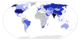
 GNP world.svg 863 × 443; 1.63 MB
-
 Narendra Modi foreign trips.svg 940 × 477; 1.33 MB
-
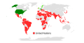 Operation Rubikon Länder.svg 940 × 477; 1.57 MB
-
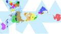
 Transcontinental nations.svg 863 × 443; 1.6 MB
-
 Worldwide Photovoltaic Deployment in Watts per Capita by Country.svg 1,405 × 601; 197 KB


