Category:Publicly available global data sets
Jump to navigation
Jump to search
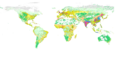
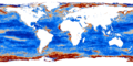
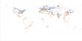
Global maps on our environment (both remote sensing-based and thematic) are nowadays increasingly attractive for environmental modelling. A variety of publicly available maps can be obtained at no cost at resolutions up to 1 km or better. This article reviews some of the most known global datasets of interest for various environmental modeling projects (see also some similar galleries of world maps by Google Earth, FAO's GeoNetwork, UNEP/GRID GEO DataPortal, UNEP/GRID-Arendal, The Environmental Information Portal of the World Resources Institute, and/or GeoPortal).
Subcategories
This category has the following 3 subcategories, out of 3 total.
Pages in category "Publicly available global data sets"
This category contains only the following page.
Media in category "Publicly available global data sets"
The following 60 files are in this category, out of 60 total.
-
 Airroute.png 3,600 × 1,800; 640 KB
-
 Anthroms.png 3,600 × 1,800; 429 KB
-
 Biocl1.png 3,600 × 1,800; 561 KB
-
 Biocl12.png 3,600 × 1,800; 578 KB
-
 Biocl2.png 3,600 × 1,800; 606 KB
-
 Biocl5.png 3,600 × 1,800; 642 KB
-
 Biodvhot.png 3,600 × 1,800; 199 KB
-
 Burned.png 3,600 × 1,800; 33 KB
-
 CHLOm.png 3,600 × 1,800; 1.07 MB
-
 CHLOs.png 3,600 × 1,800; 1.87 MB
-
 CLOUDFm.png 3,600 × 1,800; 3.07 MB
-
 Countries.png 3,600 × 1,800; 334 KB
-
 Dcoast.png 3,600 × 1,800; 1.6 MB
-
 Ecoflor.png 3,600 × 1,800; 103 KB
-
 Forestd.png 3,600 × 1,800; 697 KB
-
 FRA2000.png 3,600 × 1,800; 263 KB
-
 Gaccessm.png 3,600 × 1,800; 1.04 MB
-
 Gcarb.png 3,600 × 1,800; 591 KB
-
 Geographies of Tor.png 3,508 × 2,244; 432 KB
-
 Geotagged articles in English Wikipedia.png 3,351 × 1,968; 920 KB
-
 Geowiki disagreement africa.png 3,000 × 1,500; 129 KB
-
 Glc2000.png 3,600 × 1,800; 484 KB
-
 Glcrop.png 3,600 × 1,800; 607 KB
-
 Globcov.png 3,600 × 1,800; 535 KB
-
 Globedem.png 3,600 × 1,800; 2.06 MB
-
 Gmia.png 3,600 × 1,800; 304 KB
-
 Hazardmap.png 3,600 × 1,800; 657 KB
-
 Himpact.png 3,600 × 1,800; 454 KB
-
 Hwsdmu.png 3,600 × 1,800; 649 KB
-
 Iflworld.png 3,600 × 1,800; 54 KB
-
 LAIm.png 3,600 × 1,800; 671 KB
-
 LAIs.png 3,600 × 1,800; 745 KB
-
 Land cover IGBP.png 3,600 × 1,800; 1.79 MB
-
 Lightning map.png 3,600 × 1,800; 644 KB
-
 LSTDm.png 3,600 × 1,800; 659 KB
-
 LSTDs.png 3,600 × 1,800; 1,001 KB
-
 Map Motorcycles vs cars by population millions 2002.png 1,443 × 730; 502 KB
-
 Nlights.png 3,600 × 1,800; 427 KB
-
 PCEVI1.png 3,600 × 1,800; 944 KB
-
 PCEVI2.png 3,600 × 1,800; 898 KB
-
 PCEVI3.png 3,600 × 1,800; 975 KB
-
 PCEVI4.png 3,600 × 1,800; 954 KB
-
 Pcnligh1.png 3,600 × 1,800; 704 KB
-
 Pcnligh2.png 3,600 × 1,800; 329 KB
-
 Pcpopd1.png 3,600 × 1,800; 258 KB
-
 Pcpopd2.png 3,600 × 1,800; 258 KB
-
 PHH2Oreg.png 3,600 × 1,800; 915 KB
-
 PRECm.png 3,600 × 1,800; 970 KB
-
 Quakein.png 3,600 × 1,800; 226 KB
-
 Shipping routes red black.png 3,600 × 1,800; 2.63 MB
-
 Shipping routes.png 3,600 × 1,800; 1.25 MB
-
 Slope.png 3,600 × 1,800; 3.62 MB
-
 SNOWCm.png 3,600 × 1,800; 620 KB
-
 Soilmask.png 3,600 × 1,800; 521 KB
-
 SSTm.png 3,600 × 1,800; 542 KB
-
 SSTs.png 3,600 × 1,800; 1.18 MB
-
 Stormtr.png 3,600 × 1,800; 2.54 MB
-
 Treecov.png 3,600 × 1,800; 755 KB
-
 Wildness.png 3,600 × 1,800; 66 KB
-
 Wwfeco.png 7,200 × 3,600; 1.02 MB


