Category:Political maps of the world
Jump to navigation
Jump to search
Subcategories
This category has the following 32 subcategories, out of 32 total.
- Political world map projections (33 F)
*
- SVG political maps of the world (156 F)
B
C
- Maps of communist countries (28 F)
- Conflict maps of the world (54 F)
D
- DMA World map 1987 (6 F)
E
F
G
- Maps of Global Peace Index (14 F)
M
- Maps of the Eastern World (9 F)
- Maps of the Western World (33 F)
N
- Maps of the Non-Aligned Movement (15 F)
P
S
T
W
- World maps of the Cold War (46 F)
- World outline map, 1961 (3 F)
Media in category "Political maps of the world"
The following 200 files are in this category, out of 253 total.
(previous page) (next page)-
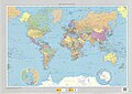
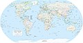
 (Political map of the world). LOC 2001620596.jpg 3,260 × 2,027; 680 KB
-
 1-12 Africa Green-Grey.png 4,609 × 2,500; 2.3 MB
-
 1-12 Antarctica Green-Grey.png 4,609 × 2,500; 2.27 MB
-
 1-12 Central America Green-Grey.png 4,609 × 2,500; 2.26 MB
-
 1-12 Color Map World.png 4,572 × 2,500; 2.63 MB
-
 1-12 East Asia Green-Grey.png 4,609 × 2,500; 2.36 MB
-
 1-12 Europe Green-Grey.png 4,609 × 2,500; 2.2 MB
-
 1-12 Middle East Green-Grey.png 4,609 × 2,500; 2.31 MB
-
 1-12 North America Green-Grey.png 4,609 × 2,500; 2.3 MB
-
 1-12 South America Green-Grey.png 4,609 × 2,500; 2.28 MB
-
 1-12 South Asia Green-Grey.png 4,609 × 2,500; 2.23 MB
-
 18-IV-1946.png 1,425 × 868; 62 KB
-

-

-
 1922 world map.png 3,495 × 2,374; 17.29 MB
-
 2000 test1.png 2,000 × 2,000; 73 KB
-
 2002 six-color world political map.png 1,425 × 628; 37 KB
-
 2006-Not-Free-Countries.png 1,357 × 628; 30 KB
-
 2010 Nobel Peace Prize diplomatic boycott.png 1,425 × 625; 56 KB
-
 2022 six-color world political map.png 1,357 × 648; 44 KB
-
 400px-LatinUnion1.png 400 × 185; 38 KB
-
 A Ordem DeMolay no Mundo.PNG 1,357 × 628; 78 KB
-
 ACS (with observers).png 1,357 × 628; 48 KB
-
 ACTA 1.png 432 × 296; 48 KB
-
 AGS World map 1947.jpg 8,839 × 5,566; 4.17 MB
-
 American Colonies.png 1,425 × 625; 48 KB
-
 Anarchist map.png 4,500 × 2,234; 1.17 MB
-
 Antarctic Circle.jpg 634 × 311; 275 KB
-
 ARCTIC CIRCLE 021106.jpg 634 × 311; 275 KB
-
 Armenian Genocide survivors map.png 1,357 × 636; 51 KB
-
 AT&T Lobby 4.jpg 5,617 × 3,737; 9.8 MB
-
 Auslandseinsätze der Bundeswehr 2006.png 1,427 × 628; 40 KB
-
 Außengebiete der Vereinigten Staaten.png 2,200 × 1,121; 366 KB
-
 BiH diplomatic relations.png 1,357 × 628; 47 KB
-
 Blank world map with all administrative divisions.png 4,455 × 2,138; 349 KB
-
 BlankMap-World-large-limited-recognition (1).png 2,752 × 1,552; 154 KB
-
 Blocos Economicos 2010.png 1,425 × 625; 66 KB
-
 BSEC Central Asia + Japan Map.png 1,357 × 628; 53 KB
-
 Bản đồ thế giới.jpg 4,032 × 2,842; 1.09 MB
-
 Canada – countries visited.jpg 1,480 × 625; 377 KB
-
 Cbre implantations monde.jpg 850 × 508; 112 KB
-
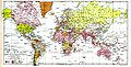
 CIA Political World Map 2002.jpg 3,206 × 1,698; 874 KB
-
 CIA WorldFactBook-Political world-ee.png 4,792 × 2,604; 2.54 MB
-
 CIA WorldFactBook-Political world.pdf 6,300 × 3,600; 23.25 MB
-
 CIA WorldFactBook-Political world.png 6,000 × 3,271; 4.39 MB
-
 Civil liberties world.PNG 1,350 × 625; 48 KB
-
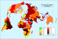
 Climate change performance index of various countries.png 6,460 × 3,480; 1.38 MB
-
 Color revolutions map.png 1,280 × 657; 148 KB
-
 Commonwealth of Australia - Map of extradition treaties by country.PNG 1,357 × 628; 30 KB
-
 Complex Humanitarian Emergencies, 1996.jpg 668 × 409; 94 KB
-

-
 Countries by highest point map(U.S. Standard Measurements).png 1,352 × 638; 67 KB
-
 Countries by highest point map.PNG 1,352 × 638; 36 KB
-
 Countries that do not celebrate New Year’s Day on 1st January.png 2,000 × 882; 281 KB
-
 Countries that recognize Christmas as a Public Holiday-ar.png 1,434 × 623; 40 KB
-
 Countries that recognize Christmas as a Public Holiday.png 1,434 × 623; 42 KB
-
 Countries where the MIR payment system operates.svg 1,010 × 666; 1.23 MB
-
 Countries where the UnionPay payment system operates.svg 1,010 × 666; 1.4 MB
-
 Countries with multiple capitals (Updated).jpg 1,360 × 632; 92 KB
-
 Countries with multiple capitals.png 1,360 × 632; 53 KB
-

-
 Countries without a primate city.png 2,754 × 1,398; 475 KB
-

-
 Democracy Improvement Ranking 2013 (World Map).png 3,508 × 2,480; 620 KB
-
 Dijagram Zemljopisne Sirine.PNG 717 × 306; 107 KB
-
 Diplomatic missions in the Holy See.PNG 1,425 × 625; 64 KB
-
 Disappearing forests UN map as of 1994.jpg 622 × 348; 74 KB
-
 DOD Selected Failed States (UN Estimate, 1996).png 704 × 479; 43 KB
-
 Día Nacional por países.png 1,024 × 768; 153 KB
-
 Earth map of global phase-out of leaded petrol in road vehicles, 2005.png 3,400 × 2,400; 832 KB
-
 Emerging Countries.png 1,900 × 900; 259 KB
-
 EN Worldwide coups d'état.PNG 1,393 × 628; 37 KB
-
 Equal-Earth-Political map in esperanto.png 1,925 × 1,015; 894 KB
-
 Equidistante cilinder projectie 60NB ZB.PNG 517 × 517; 30 KB
-
 Ethnicity and race in censuses.png 1,336 × 626; 41 KB
-
 Failed States Index Map 2007.png 1,350 × 625; 93 KB
-
 Failed-states-index-2007.png 1,425 × 625; 20 KB
-
 Failed-states-index-2010.png 1,425 × 625; 51 KB
-
 Failed-states-index-2011.png 1,425 × 625; 51 KB
-
 Failed-states-index-2012.png 1,425 × 625; 33 KB
-
 Flight path TN064.jpg 2,486 × 1,756; 661 KB
-
 FNPR Places Participats.png 6,176 × 3,120; 2.01 MB
-
 Fragile State Index 2018.png 2,000 × 1,027; 334 KB
-
 Frankreich-Niederlande-Ueberseegebiete.png 1,427 × 628; 540 KB
-
 Franska kolonier 1953.png 1,143 × 490; 104 KB
-
 G-laender-weltkarte.png 1,357 × 628; 52 KB
-
 G20.png 1,425 × 625; 52 KB
-
 G20brokendown2.png 1,425 × 625; 51 KB
-
 Gauche Droite Alternatif parti.png 6,460 × 3,480; 1.67 MB
-
 Global Agenda.jpg 800 × 558; 171 KB
-
 Global cities.png 1,357 × 617; 48 KB
-
 Global effect of 1989-1991 Revolutions.png 6,300 × 3,400; 1.56 MB
-
 Global Regional Powers.png 1,357 × 628; 48 KB
-
 Gnomonische projectie Schiphol.PNG 597 × 599; 42 KB
-
 GOPAC Members.png 691 × 442; 89 KB
-
 Great Powers with Russian Crimea.png 1,920 × 986; 234 KB
-
 ICAO-countries.png 4,500 × 2,234; 260 KB
-
 Ideologies of the ruling parties.png 1,600 × 812; 264 KB
-
 IDGov2016.jpg 6,460 × 3,230; 974 KB
-
 In-2015-region-map-web-world.jpg 2,559 × 1,690; 1.52 MB
-
 Innocence of muslims protest map.png 1,357 × 617; 47 KB
-
 Intermediate Region FR.jpg 1,429 × 1,030; 188 KB
-
 JUSCANZ Countries.png 1,357 × 617; 28 KB
-
 Land naar politiek-systeem.png 1,357 × 628; 54 KB
-
 Languages in censuses.png 1,336 × 626; 56 KB
-
 Largest World Subdivisions Area.png 4,500 × 2,234; 566 KB
-
 Lezgi WP countries.png 1,425 × 625; 56 KB
-
 Major international economic organizations.GIF 695 × 621; 82 KB
-
 Map of Countries that do not recognize Christmas as Public Holiday.png 2,000 × 882; 249 KB
-
 Map of monarchies.png 1,357 × 628; 63 KB
-
 Map of Parties to the 1990 Strasbourg Convention.png 2,754 × 1,397; 471 KB
-
 Map of parties to the 2005 Warsaw Convention.png 2,749 × 1,390; 466 KB
-
 Map of the world 1998.jpg 11,527 × 6,505; 7.54 MB
-
 Map of Transcontiental nations.png 1,425 × 625; 40 KB
-
 Map of unitary states.png 800 × 411; 95 KB
-
 Map-Europe-Outermost-regions-ar.PNG 1,427 × 628; 567 KB
-
 Map-Europe-Outermost-regions-de.png 1,427 × 628; 565 KB
-
 Map-Europe-Outermost-regions-fr.png 1,427 × 628; 592 KB
-
 Map-Francophonie organisation 2006.png 1,425 × 625; 35 KB
-
 Map-Projection-Eckert-I.png 840 × 440; 24 KB
-
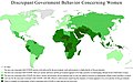 Map5.1Discrepant Behavior compressed.jpg 2,400 × 1,502; 433 KB
-
 Mapa-Planisferio-Politico-IBGE-Brasil.pdf 2,481 × 1,754; 2.76 MB
-
 Mega-cities, 1997.gif 562 × 331; 29 KB
-
 Mercator grid.png 532 × 385; 58 KB
-
 Mercator world map (physical, political, population).jpg 6,944 × 4,432; 7.28 MB
-
 Middle power Map.PNG 1,500 × 775; 76 KB
-
 Middle Powers.PNG 1,350 × 625; 36 KB
-
 MiddlePowers.png 1,357 × 628; 29 KB
-
 Misiones diplomaticas de la Republica Dominicana.jpg 1,434 × 756; 153 KB
-
 Mundo Mapa-politico-del-mundo-1-30.000.000 2018 mapa 16902 spa.jpg 10,713 × 8,425; 17.35 MB
-
 Mundo Mapa-politico-del-mundo-1-30.000.000 2023 mapa 19010 spa.jpg 10,752 × 8,408; 17.31 MB
-
 Mundo Mapa-politico-del-mundo-1-60.000.000 1993 mapa 16951 spa.jpg 11,684 × 8,320; 47.26 MB
-
 Mundo Mapa-politico-del-mundo-1-60.000.000 2004 mapa 16970 spa.jpg 7,419 × 5,227; 14.45 MB
-
 Mundo Mapa-politico-del-mundo-1-60.000.000 2010 mapa 16971 spa.jpg 6,995 × 4,947; 10.72 MB
-
 Mundo Mapa-politico-del-mundo-1-60.000.000 2016 mapa 16162 spa.jpg 8,267 × 5,905; 22.42 MB
-
 Mundos.png 1,357 × 628; 29 KB
-
 Mural - mapa central.jpg 2,336 × 1,184; 1,022 KB
-
 NatGeo northern hemisphere 1946.jpg 3,508 × 3,839; 5.15 MB
-
 NatGeo world hemispheres 1943.jpg 4,917 × 2,583; 5.46 MB
-
 NatGeo World map 1935.jpg 4,961 × 2,567; 5.02 MB
-
 NatGeo World map 1943.jpg 4,961 × 3,202; 7.43 MB
-
 NatGeo World map 1951.jpg 4,840 × 3,114; 6.59 MB
-
 NatGeo World map 1960.jpg 3,072 × 2,312; 4.73 MB
-
 National Atlas 1970 - World general reference.jpg 3,874 × 2,500; 5.32 MB
-
 National days by states.png 1,024 × 768; 147 KB
-
 National Days map (cropped).png 1,421 × 702; 21 KB
-
 National Days map.png 1,844 × 843; 23 KB
-
 National-wing by current ruling party.png 1,425 × 625; 49 KB
-
 Nonstate rogues – DOD selected problem areas, 1998.GIF 692 × 473; 60 KB
-
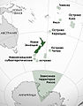
 NZ Realm of New Zealand.png 1,357 × 617; 38 KB
-
 NZLrealms-rus.jpg 1,112 × 1,416; 284 KB
-
 Obama international agreements and air strikes.png 1,427 × 628; 20 KB
-
 OIC members.png 1,425 × 625; 38 KB
-
 Outposts of tyranny.png 1,357 × 628; 45 KB
-
 Overseas Empires of European Powers, January 1914, H. G. Wells' Outline of History, page 529.jpg 3,488 × 2,175; 1,002 KB
-
 PA2015.png 856 × 433; 96 KB
-
 Palestine-recognition-map-ar.png 905 × 419; 84 KB
-
 Pariah states.png 1,480 × 685; 59 KB
-
 Part de fremas elegidas dins lei parlaments nacionaus en 2016.png 1,707 × 1,148; 367 KB
-
 PAT - World political.gif 4,200 × 2,160; 266 KB
-
 Paulina Luisi - 1929 - Planisferio.jpg 6,832 × 4,464; 19.64 MB
-
 Physical Political World Map.jpg 6,480 × 3,888; 5.69 MB
-
 Physical Political World Map.png 3,240 × 1,944; 6.97 MB
-
 Pieni 2 0791.jpg 5,039 × 2,552; 3.46 MB
-
 Political Grey Map World.png 4,572 × 2,500; 3.11 MB
-
 Political Map Biased.png 6,460 × 5,445; 2.33 MB
-
 Political map NE.jpg 11,827 × 6,178; 8.9 MB
-
 Political Map of the World (august 2013).png 11,479 × 6,269; 5.35 MB
-
 Political Map of the World (january 2015).pdf 6,600 × 5,100; 1.5 MB
-
 Political Map of the World (january 2015).png 17,392 × 9,478; 16.84 MB
-
 Political map of the World (June 2009).jpg 700 × 381; 265 KB
-
 Political Map of the World (june 2010).png 11,650 × 6,322; 5.3 MB
-
 Political map of the World (November 2011).png 4,572 × 2,500; 3.46 MB
-
 Political Map of the World, 2013.png 7,677 × 4,196; 2.51 MB
-
 Political map of the world, April 2001 (3856492780).jpg 2,000 × 1,172; 1.82 MB
-
 Political map of the world, April 2004. LOC 2004633133.jpg 11,624 × 6,576; 8.04 MB
-
 Political map of the world, April 2007. LOC 2009582401.jpg 11,798 × 6,586; 5.19 MB
-
 Political map of the world, February 1995. LOC 2011589549.jpg 7,948 × 4,401; 3.08 MB
-
 Political map of the world, June 1999. LOC 00552799.jpg 11,655 × 6,561; 6.05 MB
-
 Political map of the world, June 2003. LOC 2003621829.jpg 11,714 × 6,551; 12.1 MB
-
 Political map of the world, June 2009. LOC 2010593029.jpg 15,408 × 8,334; 11.09 MB
-
 Political map of the world, June 2011. LOC 2012592862.jpg 15,730 × 8,572; 11.58 MB
-
 Political Map of the World.png 4,572 × 2,500; 3.43 MB
-
 Political World Map (with disputed territories).png 6,000 × 3,271; 3.95 MB
-
 Polity data series map 2003.png 1,350 × 625; 48 KB
-
 Refugees and asylum seekers by host country.jpg 646 × 432; 69 KB
-
 Regional powers 2012 updated3.png 1,425 × 625; 56 KB
-
 Regional powers in the world.png 1,280 × 657; 152 KB
-
 Regional powers updated.png 1,425 × 625; 49 KB
-
 Regional Powers2011.png 1,373 × 661; 50 KB
-
 RegionalPowers.png 1,357 × 628; 48 KB
-
 Republicas no mundo.png 1,349 × 631; 55 KB
-
 Rogue states.png 2,753 × 1,400; 111 KB
-
 Second French Empire.png 1,425 × 625; 35 KB
-
 SecularStates.png 1,425 × 625; 37 KB
-
 Simpol-Map-World-Merged.png 2,000 × 882; 368 KB
-
 Sino-US 2.png 1,280 × 657; 137 KB
-
 Sino-US.png 1,280 × 657; 138 KB
-
 Sinusoïdale projectie.PNG 953 × 477; 46 KB
-
 Six-color world political map.png 3,220 × 1,755; 704 KB
._LOC_2001620596.jpg)


_-_Geographicus_-_World-colton-1852.jpg)


.png)


.png)


.jpg)


.png)


.png)


.jpg)


.png)


.png)
.png)
.jpg)
.png)
.png)

.jpg)


.png)


.png)