Category:Old maps of the United Kingdom
Jump to navigation
Jump to search
Countries of Europe: Albania · Andorra · Armenia‡ · Austria · Azerbaijan‡ · Belarus · Belgium · Bosnia and Herzegovina · Bulgaria · Croatia · Cyprus‡ · Czech Republic · Denmark · Estonia · Finland · France‡ · Georgia‡ · Germany · Greece · Hungary · Iceland · Republic of Ireland · Italy · Kazakhstan‡ · Latvia · Lithuania · Luxembourg · Malta · Moldova · Monaco · Montenegro · Netherlands‡ · Norway · Poland · Portugal‡ · Romania · Russia‡ · Serbia · Slovakia · Slovenia · Spain‡ · Sweden · Switzerland · Turkey‡ · Ukraine · United Kingdom · Vatican City
Specific status: Faroe Islands · Gibraltar · Bailiwick of Guernsey · Isle of Man · Jersey · Svalbard – Limited recognition: Kosovo · Transnistria
‡: partly located in Europe
Specific status: Faroe Islands · Gibraltar · Bailiwick of Guernsey · Isle of Man · Jersey · Svalbard – Limited recognition: Kosovo · Transnistria
‡: partly located in Europe
Wikimedia category | |||||
| Upload media | |||||
| Instance of | |||||
|---|---|---|---|---|---|
| |||||
Use the right category for your map showing all or a large part of the United Kingdom. See subcategories for smaller areas.
Constituent countries of the United Kingdom: England · Northern Ireland · Scotland · Wales – British Crown dependencies: the Bailiwick of Guernsey ≈ Bailiwick of Guernsey · the Isle of Man ≈ Isle of Man · Jersey
British overseas territories: Akrotiri and Dhekelia · Anguilla · Bermuda · the British Antarctic Territory ≈ British Antarctic Territory · the British Indian Ocean Territory ≈ British Indian Ocean Territory · the British Virgin Islands ≈ British Virgin Islands · the Cayman Islands ≈ Cayman Islands · the Falkland Islands ≈ Falkland Islands · Gibraltar · the Pitcairn Islands ≈ Pitcairn Islands · Saint Helena, Ascension and Tristan da Cunha · South Georgia and the South Sandwich Islands · the Turks and Caicos Islands ≈ Turks and Caicos Islands
British overseas territories: Akrotiri and Dhekelia · Anguilla · Bermuda · the British Antarctic Territory ≈ British Antarctic Territory · the British Indian Ocean Territory ≈ British Indian Ocean Territory · the British Virgin Islands ≈ British Virgin Islands · the Cayman Islands ≈ Cayman Islands · the Falkland Islands ≈ Falkland Islands · Gibraltar · the Pitcairn Islands ≈ Pitcairn Islands · Saint Helena, Ascension and Tristan da Cunha · South Georgia and the South Sandwich Islands · the Turks and Caicos Islands ≈ Turks and Caicos Islands
Subcategories
This category has the following 23 subcategories, out of 23 total.
Media in category "Old maps of the United Kingdom"
The following 77 files are in this category, out of 77 total.
-

-
 134 of 'British Battles on Land and Sea' (11101997784).jpg 2,030 × 1,621; 696 KB
-

-

-

-

-

-

-

-
 58 of 'History of the English People ... With ... maps' (11119920643).jpg 2,048 × 1,395; 495 KB
-
 75 of 'The History of Shavington, in the County of Salop' (11210682705).jpg 2,668 × 3,685; 976 KB
-

-

-

-
 A general atlas Fleuron T221425-16.png 1,936 × 3,782; 343 KB
-
 A history of England (1916) (14760556486).jpg 1,880 × 2,692; 805 KB
-

-

-
 A shorter history of England and greater Britain (1920) (14759981176).jpg 2,040 × 3,040; 762 KB
-

-

-
 Bognor regismap1945s.jpg 3,504 × 2,544; 1.06 MB
-
 Built up bit from london NW OS map 1944.jpg 4,880 × 5,760; 4.45 MB
-
 CanuteEngland.jpg 2,700 × 2,014; 2.11 MB
-
 Chambers's encyclopædia; a dictionary of universal knowledge (1868) (14799025693).jpg 1,804 × 2,082; 576 KB
-

-
 Cornelii Taciti de vita Agricolae (1922) (14774358631).jpg 2,072 × 2,924; 357 KB
-
 Detail of plate showing Porlok and Minhed Wellcome L0071620.jpg 3,600 × 4,500; 4.32 MB
-
 Great Thurlow Historical Map.png 953 × 720; 1.31 MB
-
 Halesworthmap 1921.jpg 2,544 × 3,504; 1.35 MB
-
 Harlestonmap 1921.jpg 2,544 × 3,504; 1.23 MB
-
 Harper's school geography (1885) (14586866247).jpg 2,484 × 3,286; 1.25 MB
-

-
 Image taken from page 102 of 'The Port of Cardiff. (With map.)' (11151386383).jpg 2,753 × 4,285; 2.02 MB
-

-
-

-

-
 Karte von Grossbritannien und Ireland, nach Kitchin, Dorret und Jefferys.jpg 7,852 × 6,205; 14.09 MB
-
 London.png 695 × 392; 216 KB
-
 Malria in England. Wellcome L0024499.jpg 1,242 × 1,744; 929 KB
-
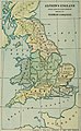
 Map of England & Wales showing population, 1700s. Wellcome M0000912.jpg 1,025 × 1,646; 422 KB
-
 New popular edition map numbers.jpg 656 × 1,024; 146 KB
-
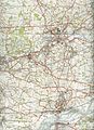
 Nueaton Hinkley 1961 OS.jpg 6,482 × 4,978; 9.98 MB
-

-

-

-

-

-
 A new map of Great Britain (NYPL b15369994-1630441).jpg 4,351 × 6,934; 38.86 MB
-
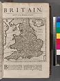 Britain (NYPL b15373374-1505122).jpg 4,640 × 6,299; 7.07 MB
-
 Ocean trade and shipping (1914) (14759161046).jpg 2,992 × 3,700; 1.82 MB
-
 Our own islands; an elementary study in geography (1907) (14578835140).jpg 1,806 × 2,170; 569 KB
-
 Our own islands; an elementary study in geography (1907) (14579000749).jpg 1,818 × 2,878; 769 KB
-
 Our own islands; an elementary study in geography (1907) (14579190837).jpg 1,806 × 2,146; 450 KB
-
 Our own islands; an elementary study in geography (1907) (14762390351).jpg 2,832 × 1,782; 789 KB
-
 Our own islands; an elementary study in geography (1907) (14763301914).jpg 1,826 × 2,864; 1.01 MB
-
 Outing (1885) (14596143377).jpg 1,398 × 2,026; 595 KB
-

-
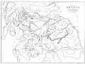
 Physical map british isles ref 1926.png 1,101 × 1,768; 3.09 MB
-
 Sketch map of Haire de Grace Wellcome M0012867.jpg 3,822 × 2,923; 1.88 MB
-
 St hellensmap1947.jpg 2,544 × 3,504; 1.65 MB
-
 SwanseaMaliphantSidingsMap.png 728 × 614; 749 KB
-

-
 The British nation a history - by George M. Wrong (1910) (14590137830).jpg 1,380 × 2,242; 621 KB
-
 The earth and its inhabitants (1881) (14781875964).jpg 2,368 × 2,660; 1.11 MB
-
 The earth and its inhabitants (1881) (14783861172).jpg 2,448 × 3,024; 1.26 MB
-

-
 The History of CRGS Map (page 2).png 822 × 752; 42 KB
-
 The History of CRGS Map (page 8).png 1,212 × 822; 100 KB
-
 The National Archives UK - CO 1069-202-3.jpg 1,196 × 905; 170 KB
-

-
 The Quarterly journal of the Geological Society of London (1862) (14741453676).jpg 2,350 × 3,614; 939 KB
-
 UBBasel Map 1556 Kartenslg AA 20 Britannia.tiff 8,745 × 12,909, 2 pages; 323 MB
-
 Walham Green and North End c.1860.jpg 2,032 × 2,884; 1.58 MB
-
 World Factbook (1990) United Kingdom.jpg 501 × 523; 78 KB
-
 Y Gogledd.jpg 1,000 × 751; 94 KB
.jpg)
.jpg)
.jpg)
%27_(11006646315).jpg)
.jpg)
.jpg)
.jpg)
.jpg)
%27_(11052901214).jpg)
.jpg)
.jpg)
.jpg)
.jpg)
.jpg)

_(14760556486).jpg)
_(14597813417).jpg)
_(14761331346).jpg)
_(14759981176).jpg)
_(14577089379).jpg)


_(14799025693).jpg)

_(14774358631).jpg)


_(14586866247).jpg)
%27_(11090417035).jpg)
%27_(11151386383).jpg)
.jpg)
.jpg)
.jpg)
.jpg)


.jpg)
.jpg)
.jpg)
.jpg)
.jpg)
.jpg)
_(14759161046).jpg)
_(14578835140).jpg)
_(14579000749).jpg)
_(14579190837).jpg)
_(14762390351).jpg)
_(14763301914).jpg)
_(14596143377).jpg)


_(14595813460).jpg)
_(14590137830).jpg)
_(14781875964).jpg)
_(14783861172).jpg)
_(14593958778).jpg)
.png)
.png)

.jpg)
_(14741453676).jpg)

_United_Kingdom.jpg)
