Category:Old maps of Prussia
Jump to navigation
Jump to search
Subcategories
This category has the following 13 subcategories, out of 13 total.
- 17th-century maps of Prussia (12 F)
- 20th-century maps of Prussia (8 F)
E
O
- Old maps of Pomerania Province (51 F)
- Old maps of Potsdam (46 F)
R
W
Media in category "Old maps of Prussia"
The following 99 files are in this category, out of 99 total.
-
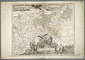
 (Meyer) Prussia, 1134-1871.jpg 3,436 × 2,939; 2.13 MB
-
 1493--Nuremberg chronicles - map 2--Fragment.jpg 950 × 760; 295 KB
-
 SchlachtvonFehrbellin.jpg 1,345 × 1,049; 369 KB
-
 Warmia1.jpg 3,267 × 2,953; 2.62 MB
-
 The Development of Brandenburg to a Prussian Power.jpg 1,505 × 2,591; 2.02 MB
-
 B-HH-Bahn-Map.jpg 1,107 × 586; 322 KB
-
 Provinz Brandenburg 1905.png 1,800 × 1,368; 1.43 MB
-
 AKE Streckennetz.png 1,600 × 1,200; 3.08 MB
-
 487 of 'The Illustrated History of the War against Russia. Plates' (11045661606).jpg 2,880 × 1,879; 1.14 MB
-
 540 of 'Die Eroberung Preussens durch die Deutschen' (11097914315).jpg 1,419 × 2,304; 588 KB
-
 541 of 'Die Eroberung Preussens durch die Deutschen' (11096700924).jpg 1,419 × 2,304; 525 KB
-
 A chart of PRUSSIA and Coerland from Rygshead to Der Winda NYPL1640728.tiff 7,230 × 5,428; 112.28 MB
-
 Alt und Neu Lönnewitz Karte.jpg 1,147 × 714; 298 KB
-
-
 Atlas von dem Preussischen Staate (Titelblatt).jpg 6,039 × 7,675; 10.7 MB
-
 Prussia, and the German States (NYPL b13663520-1510832).jpg 6,299 × 5,248; 8.15 MB
-
 Bahnhof Goehrde Stielers Handatlas 1891.jpg 1,000 × 682; 300 KB
-
 Bahnstrecke Wittenberge-Buchholz.jpg 1,398 × 819; 576 KB
-
 Bergrevier Dillenburg.jpg 1,504 × 1,331; 376 KB
-
 Biadaszki from ;David Gilly Spezialkarte fur Sudpreussen 1803.jpg 181 × 187; 14 KB
-
 Brandenburg 1806.jpg 1,467 × 1,275; 1.2 MB
-
 Brandenburg Prussia 1525–1648.png 1,662 × 1,029; 2.69 MB
-
 Brandenburg-Preußen1688.JPG 615 × 442; 69 KB
-
 Bransk AGE 1804.jpg 924 × 644; 330 KB
-
 Breslau-Schweidnitz-Freiburger Eisenbahn-Gesellschaft.png 1,036 × 1,548; 3.14 MB
-
 Caspar Hennenberger. Map of Old Prussia, and the ancient Prussian lands.jpg 2,048 × 1,774; 1.61 MB
-
 Central europe 1648 sheperd.jpg 2,314 × 1,880; 925 KB
-
 D579- N° 414. La Prusse au dix-huitièms siècle. - liv3-ch15.png 1,446 × 1,262; 215 KB
-
 Prussia (NYPL b15404146-1632221).tiff 7,230 × 5,428; 112.28 MB
-
 Ein Theil Preusen Handritade Kartverk 12 front.tif 14,723 × 6,302; 166.92 MB
-
 Elsterregulierung 1850 2.jpg 2,397 × 1,672; 3.16 MB
-
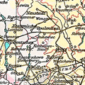
 Ermland.png 290 × 205; 124 KB
-
 Floßgraben Elsterwerda 2.jpg 4,276 × 4,310; 8.59 MB
-
 Floßgraben Elsterwerda.jpg 3,673 × 2,952; 4.67 MB
-

-

-
 General-Carte der gesamten Königlichen Preussischen Länder.jpg 11,292 × 7,975; 16.66 MB
-

-

-
 Heidaer Heide Karte.jpg 1,242 × 963; 1.25 MB
-
 Image-Prussia ethnicity.JPG 395 × 343; 30 KB
-
 Karte Elsterwerda Grödel Floßkanal.jpg 1,813 × 2,040; 1.39 MB
-
-
 Koenigsberg, Map by Bering 1613.jpg 4,846 × 2,269; 2.8 MB
-
 Komornictwo olsztyńskie.jpg 916 × 897; 162 KB
-
 Konkolewo Hauland.png 294 × 294; 154 KB
-
 Kostuchna map-1827.jpg 388 × 285; 71 KB
-
 Kostuchna-late XVIIIcent map.jpg 269 × 274; 44 KB
-
 Kreis Liebenwerda.jpg 8,275 × 7,190; 17.47 MB
-
 Landkreis Liebenwerda 1860.jpg 4,408 × 3,240; 13.09 MB
-
 Lohme-Nipmerow 1829.jpg 1,000 × 885; 516 KB
-
 Map of Brandenburg-Preussen.jpg 615 × 375; 55 KB
-
 Map of Palmnicken 1946 Archive of Kaliningrad Amber Combine.jpg 4,509 × 6,620; 22.83 MB
-
 Map of Prussia by Abraham Ortelius.jpeg 1,580 × 1,188; 622 KB
-
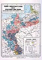 Mapa narodowosciowa 1910.jpg 3,409 × 4,833; 8.66 MB
-
 Mariaeburgum 0414.028.005 Front.tif 10,100 × 7,329; 141.47 MB
-
 Meyers b13 s0781a.jpg 1,561 × 2,048; 815 KB
-
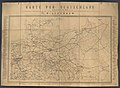
 Nord-Östliches Deutschland.jpg 5,540 × 4,488; 8.3 MB
-
 Nordöstliches Deutschland.jpg 2,004 × 1,694; 1.08 MB
-
 Ost-See. Deutsche Küste, Preussen.jpg 13,618 × 9,046; 17.47 MB
-
 OstrzeszówKępnoSycówRychtal 1910-1920.png 1,788 × 1,890; 5.76 MB
-
 Poland - claims of the partitioners.jpg 897 × 754; 176 KB
-
 Pommerellen.png 288 × 226; 132 KB
-
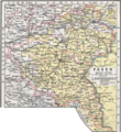 Posen 1905.png 1,360 × 1,485; 1.09 MB
-
 Bornstedt 1910.jpg 499 × 401; 66 KB
-
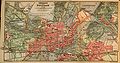 Potsdam in 1910.jpg 2,300 × 1,212; 1.04 MB
-
 Preußen 1440-1795 und 1807-1866.jpg 748 × 899; 181 KB
-
 Preußen 1807.gif 511 × 327; 157 KB
-
 Province Saxony (1815-1937).jpg 2,927 × 2,279; 1.55 MB
-
 Provinz Schleswig-Holstein 1905.png 1,360 × 2,000; 5.18 MB
-
 Prusy Dolne 1920.jpg 1,740 × 1,296; 1.31 MB
-

-
 Regnum Borussiae - a Ioh. Baptista Homanno - btv1b53040606d.jpg 7,805 × 6,064; 8.87 MB
-
 Regnum Borussiae - à Ioh. Baptista Homanno - btv1b530410949.jpg 7,862 × 6,011; 9.36 MB
-

-

-

-

-

-
 Reilly Karte von dem Koenigreiche Preussen.jpg 735 × 601; 126 KB
-
 Sachsen 1905.png 2,100 × 1,510; 1.5 MB
-
 Śląska Kolej Górska.png 1,727 × 1,122; 3.51 MB
-
 J.D. Schleuen - General Carte der gesammten Königlichen Preussischen Länder (1750).jpg 5,614 × 4,635; 16.14 MB
-
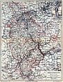
 South Prussia 1795–1806 administrative map with departments, districts and all towns.jpg 3,000 × 2,225; 1.38 MB
-
 Special Karte von Suedpreussen - IfL Signatur HK892-899 Zusatz.jpg 3,670 × 2,632; 3.12 MB
-
 Special Karte von Suedpreussen - IfL Signatur HK892.jpg 8,914 × 6,811; 19.31 MB
-
 Special Karte von Suedpreussen - IfL Signatur HK893.jpg 8,900 × 6,727; 17.94 MB
-
 Special Karte von Suedpreussen - IfL Signatur HK894.jpg 7,754 × 6,737; 16.43 MB
-
 Special Karte von Suedpreussen - IfL Signatur HK895.jpg 7,846 × 6,855; 21.01 MB
-
 Special Karte von Suedpreussen - IfL Signatur HK896.jpg 8,853 × 6,694; 22.24 MB
-
 Special Karte von Suedpreussen - IfL Signatur HK897.jpg 9,018 × 6,847; 25.92 MB
-
 Special Karte von Suedpreussen - IfL Signatur HK898.jpg 8,903 × 6,741; 25.3 MB
-
 Special Karte von Suedpreussen - IfL Signatur HK899.jpg 8,956 × 6,872; 24.81 MB
-
 Sveriges Krig 2.12 front.tif 20,221 × 9,236; 358.94 MB
-
 Sveriges Krig 2.16 front.tif 8,532 × 5,948; 97.96 MB
-
 Sveriges Krig 2.17 front.tif 10,312 × 7,592; 152.44 MB
-
 Sveriges Krig 2.35 front.tif 6,172 × 4,604; 60.37 MB
-
 Sveriges Krig 2.39 front.tif 11,794 × 4,890; 109.3 MB
-
 Sveriges Krig 6.23 front.tif 11,838 × 8,007; 181.06 MB
_Prussia,_1134-1871.jpg)


.jpg)
.jpg)
.jpg)

.jpeg)
.jpg)
.jpg)


.jpg)


.jpg)


