Category:Old county maps of Northamptonshire
Jump to navigation
Jump to search
Ceremonial counties of England: Bedfordshire · Berkshire · Buckinghamshire · Cambridgeshire · Cheshire · Cornwall · Derbyshire · Devon · Dorset · Durham · East Riding of Yorkshire · Essex · Gloucestershire · Hampshire · Herefordshire · Hertfordshire · Kent · Lancashire · Leicestershire · Lincolnshire · Norfolk · Northamptonshire · Northumberland · Nottinghamshire · Oxfordshire · Rutland · Shropshire · Somerset · Staffordshire · Suffolk · Surrey · Warwickshire · Wiltshire · Worcestershire
City-counties:
Former historic counties: Cumberland · Huntingdonshire · Middlesex · North Riding of Yorkshire · Sussex · West Riding of Yorkshire · Westmorland · Yorkshire
Other former counties:
City-counties:
Former historic counties: Cumberland · Huntingdonshire · Middlesex · North Riding of Yorkshire · Sussex · West Riding of Yorkshire · Westmorland · Yorkshire
Other former counties:
Media in category "Old county maps of Northamptonshire"
The following 12 files are in this category, out of 12 total.
-
 Speed Northampton.jpg 6,240 × 4,680; 24.29 MB
-
 Comitatus Northantonensis vernacule Northampton Shire (8642405161).jpg 800 × 666; 131 KB
-
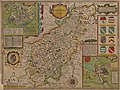
 "Comitatus Northantonensis, vernacule Northamton Shire" (22073119709).jpg 3,699 × 3,095; 1.95 MB
-

-
 Maps of England circa 1670, Northampton 27 of 40 (13432747854).jpg 6,542 × 4,948; 4.24 MB
-

-
 Aikin(1800) p187 - Northamptonshire.jpg 1,193 × 1,660; 321 KB
-
 Gray1824.northants.jpg 808 × 974; 155 KB
-
 Pigot and Co (1842) p2.280 - Map of Northamptonshire.jpg 1,310 × 2,158; 922 KB
-
 Bodleian Libraries, A map of the County of Oxford 19.jpg 675 × 992; 79 KB
-
 CAPPER(1825) p02.13 - Northamptonshire.jpg 2,413 × 1,360; 862 KB
-
 Comitatus Northantonensis vernacule Northamton Shire - CBT 6597036.jpg 5,692 × 4,439; 7.06 MB

.jpg)
.jpg)
.5.(26).jpg)
.jpg)

_p187_-_Northamptonshire.jpg)

_p2.280_-_Map_of_Northamptonshire.jpg)

_p02.13_-_Northamptonshire.jpg)
