Category:Notre-Dame (Echarlens)
Jump to navigation
Jump to search
| Object location | | View all coordinates using: OpenStreetMap |
|---|
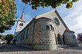
chapel in Echarlens in the canton of Fribourg, Switzerland  | |||||
| Upload media | |||||
| Instance of | |||||
|---|---|---|---|---|---|
| Part of | |||||
| Location | Echarlens, Gruyère District, Canton of Fribourg, Switzerland | ||||
| Street address |
| ||||
| Diocese | |||||
| Architect | |||||
| Heritage designation | |||||
 | |||||
Media in category "Notre-Dame (Echarlens)"
The following 3 files are in this category, out of 3 total.
-
 Echarlens.jpg 1,936 × 2,592; 1.64 MB
-
 Notre-Dame de l'Assomption.jpg 5,591 × 3,733; 16.17 MB
-
 Notre-Dame Echarlens Oct 2010.jpg 4,752 × 3,168; 6.06 MB

