Category:Nederlands Hervormde Kerk, Wateringen
Jump to navigation
Jump to search
| Object location | | View all coordinates using: OpenStreetMap |
|---|
church steeple in Wateringen, The Netherlands  | |||||
| Upload media | |||||
| Instance of |
| ||||
|---|---|---|---|---|---|
| Location | Wateringen, Westland, South Holland, Netherlands | ||||
| Street address |
| ||||
| Located on street |
| ||||
| Heritage designation |
| ||||
| Inception |
| ||||
 | |||||
Kerk:
|
This is a category about rijksmonument number 38410
|
Toren:
|
This is a category about rijksmonument number 38411
|
| Address |
|
Subcategories
This category has only the following subcategory.
I
Media in category "Nederlands Hervormde Kerk, Wateringen"
The following 40 files are in this category, out of 40 total.
-

-
 Detail omloop toren - Wateringen - 20251208 - RCE.jpg 1,192 × 1,200; 249 KB
-
 Detail omloop toren - Wateringen - 20251209 - RCE.jpg 1,185 × 1,200; 134 KB
-
 Detail westgevel - Wateringen - 20251207 - RCE.jpg 1,200 × 953; 363 KB
-
 Gezicht op het dorp Wateringen.jpg 1,479 × 1,030; 818 KB
-
 Graftegel gevonden op verdieping toren - Wateringen - 20251241 - RCE.jpg 1,197 × 1,200; 355 KB
-
 Hervormde Kerk - Wateringen (1).JPG 2,736 × 3,648; 3.45 MB
-
 Hervormde Kerk - Wateringen (10).JPG 2,736 × 3,648; 3.45 MB
-
 Hervormde Kerk - Wateringen (2).JPG 2,736 × 3,648; 3.61 MB
-
 Hervormde Kerk - Wateringen (3).JPG 2,736 × 3,648; 3.6 MB
-
 Hervormde Kerk - Wateringen (4).JPG 2,736 × 3,648; 3.57 MB
-
 Hervormde Kerk - Wateringen (5).JPG 3,648 × 2,736; 4.05 MB
-
 Hervormde Kerk - Wateringen (7).JPG 2,736 × 3,648; 3.49 MB
-
 Hervormde Kerk - Wateringen (8).JPG 2,736 × 3,648; 3.46 MB
-
 Hervormde Kerk - Wateringen (9).JPG 2,736 × 3,648; 3.48 MB
-
 Interieur, preekstoel - Wateringen - 20357615 - RCE.jpg 958 × 1,200; 185 KB
-
 Kerk naar het noord-oosten - Wateringen - 20251175 - RCE.jpg 889 × 1,200; 226 KB
-
 Kerk naar het noord-oosten - Wateringen - 20251176 - RCE.jpg 885 × 1,200; 187 KB
-
 Kerk naar het noord-westen - Wateringen - 20251178 - RCE.jpg 876 × 1,200; 236 KB
-
 Kerk naar het noord-westen - Wateringen - 20251179 - RCE.jpg 883 × 1,200; 286 KB
-
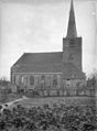
 Kerk naar het noorden - Wateringen - 20251173 - RCE.jpg 879 × 1,200; 231 KB
-
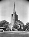
 Kerk naar het zuid-westen - Wateringen - 20251177 - RCE.jpg 878 × 1,200; 299 KB
-
 Kerk naar het zuiden - Wateringen - 20251174 - RCE.jpg 885 × 1,200; 203 KB
-
 Noordgevel - Wateringen - 20251206 - RCE.jpg 955 × 1,200; 303 KB
-
 Overzicht - Wateringen - 20251202 - RCE.jpg 1,200 × 948; 218 KB
-
 Toren - Wateringen - 20251252 - RCE.jpg 960 × 1,200; 219 KB
-
 Toren - Wateringen - 20251253 - RCE.jpg 950 × 1,200; 221 KB
-
 Toren naar het oosten - Wateringen - 20251198 - RCE.jpg 960 × 1,200; 188 KB
-
 Toren naar het zuid-westen - Wateringen - 20251200 - RCE.jpg 961 × 1,200; 222 KB
-
 Toren, balustrade - Wateringen - 20251219 - RCE.jpg 1,190 × 1,200; 180 KB
-
 Toren, balustrade - Wateringen - 20251220 - RCE.jpg 1,195 × 1,200; 377 KB
-
 Wateringen - Kerkgebouw aan plein 9.jpg 1,536 × 2,048; 1.59 MB
-
 Wateringen, straatzicht met kerk1 2009-09-27 12.47.JPG 3,456 × 2,592; 4.29 MB
-
 Wateringen2.JPG 2,112 × 2,816; 2.84 MB
-
 Westgevel - Wateringen - 20251203 - RCE.jpg 956 × 1,200; 224 KB
-
 Westgevel - Wateringen - 20251204 - RCE.jpg 955 × 1,200; 248 KB
-
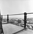
 Zicht op de kerktoren met omgeving - Wateringen - 20251192 - RCE.jpg 894 × 1,200; 161 KB
-
 Zijgevel rechts - Wateringen - 20251197 - RCE.jpg 1,200 × 958; 314 KB
-
 Zijgevel rechts - Wateringen - 20251201 - RCE.jpg 961 × 1,200; 260 KB
-
 Zuidgevel - Wateringen - 20251205 - RCE.jpg 957 × 1,200; 268 KB


.JPG)
.JPG)
.JPG)
.JPG)
.JPG)
.JPG)
.JPG)
.JPG)
.JPG)


