Category:Maps of Tristan da Cunha
Jump to navigation
Jump to search
Wikimedia category | |||||
| Upload media | |||||
| Instance of | |||||
|---|---|---|---|---|---|
| Category combines topics | |||||
| Tristan da Cunha | |||||
South Atlantic island group    .svg) | |||||
| Instance of | |||||
| Named after | |||||
| Location | Saint Helena, Ascension and Tristan da Cunha, UK | ||||
| Located in or next to body of water | |||||
| Capital | |||||
| Official language |
| ||||
| Anthem | |||||
| Time of discovery or invention |
| ||||
| Highest point | |||||
| Population |
| ||||
| Area |
| ||||
| Elevation above sea level |
| ||||
| official website | |||||
 | |||||
Subcategories
This category has only the following subcategory.
T
Pages in category "Maps of Tristan da Cunha"
This category contains only the following page.
Media in category "Maps of Tristan da Cunha"
The following 18 files are in this category, out of 18 total.
-

-
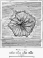
 IMRAY(1884) p0293 TRISTAN DA CUNHA.jpg 3,647 × 2,703; 4.1 MB
-
 D101- carte de Tristao d’Acunha. - L1-Ch2.png 1,508 × 2,052; 548 KB
-
 Gough Island - EVS Precision Map (1-52,000).png 1,276 × 900; 98 KB
-
 Gough Island EVS Precision Map 1 52000-sepia.png 1,276 × 900; 3.29 MB
-
 Gough Island Map.jpg 1,240 × 904; 436 KB
-
 Gough.png 760 × 939; 226 KB
-
 Islands In The Atlantic.jpg 4,747 × 5,614; 7.32 MB
-
 Location map Tristan da Cunha.png 841 × 946; 19 KB
-
 Tristan da Cunha location.JPG 227 × 117; 3 KB
-
 Tristan da Cunha map.svg 3,487 × 3,575; 74 KB
-
 Tristan Main Island Map.png 1,442 × 1,022; 312 KB
-
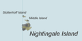 Tristan Map (cropped to Nightingdale Islands).png 900 × 450; 44 KB
-
 Tristan Map-be.jpg 2,787 × 2,441; 382 KB
-
 Tristan Map-be.png 2,787 × 2,441; 483 KB
-
 Tristan Map.png 2,787 × 2,441; 639 KB
-
 TristanDaCunha2021OSM.png 6,666 × 7,000; 2.75 MB
-
 TristandC-pos.png 782 × 385; 21 KB
.jpg)
_p0293_TRISTAN_DA_CUNHA.jpg)

.png)


.png)


