Category:Maps of Mostar
Jump to navigation
Jump to search
Wikimedia category | |||||
| Upload media | |||||
| Instance of | |||||
|---|---|---|---|---|---|
| Category combines topics | |||||
| Mostar | |||||
town in Bosnia and Herzegovina    | |||||
| Instance of | |||||
| Location | City of Mostar, Herzegovina-Neretva Canton, Federation of Bosnia and Herzegovina, B&H | ||||
| Located in or next to body of water | |||||
| Inception |
| ||||
| Significant event |
| ||||
| Area |
| ||||
| Elevation above sea level |
| ||||
| Different from | |||||
| official website | |||||
 | |||||
Subcategories
This category has only the following subcategory.
O
- OpenStreetMap maps of Mostar (1 F)
Media in category "Maps of Mostar"
The following 17 files are in this category, out of 17 total.
-

-
 35 43 Mostar Topographic Map, Published 1894.jpg 11,308 × 15,986; 50.32 MB
-
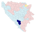
 BH municipality location-Mostar.gif 1,600 × 1,520; 148 KB
-
 Bosnien-Herzegowina BV043430187.jpg 4,758 × 5,362; 5.1 MB
-
 Location Mostar.svg 1,600 × 1,520; 350 KB
-
 Map of Gnojnice settlement in Mostar.png 1,285 × 656; 859 KB
-
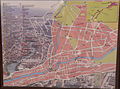 Map of Mostar.jpg 2,401 × 1,787; 2.01 MB
-
 Map of Vrapcici settlement in Mostar.png 1,421 × 785; 870 KB
-
 Mostar - naseljena mjesta Gnojnice.png 2,420 × 2,877; 319 KB
-
 Mostar 1887.png 1,157 × 600; 1.56 MB
-
 Mostar in BiH.svg 1,600 × 1,520; 349 KB
-
 Mostar local community of Gnojnice-Dracevice.png 4,251 × 2,897; 391 KB
-
 Mostar local community of Vrapcici.png 4,251 × 2,897; 390 KB
-
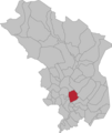
 Mostar Municipality Location.png 405 × 385; 77 KB
-
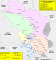 Mostar-administrativna.PNG 1,313 × 1,392; 146 KB
-
 Mostarlocation.svg 1,600 × 1,520; 769 KB
-
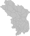 Settlements of Mostar.svg 512 × 609; 15 KB
_(14756391626).jpg)


