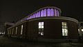
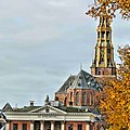
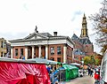
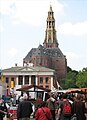
Category:Korenbeurs, Groningen
Jump to navigation
Jump to search
| Object location | | View all coordinates using: OpenStreetMap |
|---|
national heritage site in Groningen, Netherlands  | |||||
| Upload media | |||||
| Instance of | |||||
|---|---|---|---|---|---|
| Location | Groningen, Netherlands | ||||
| Architectural style | |||||
| Architect | |||||
| Manufacturer | |||||
| Heritage designation |
| ||||
| Inception |
| ||||
 | |||||
|
This is a category about rijksmonument number 18415
|
| Address |
|
Subcategories
This category has only the following subcategory.
H
Media in category "Korenbeurs, Groningen"
The following 38 files are in this category, out of 38 total.
-
 00 6821 Groningen Niederlande - Aa-Kirche.jpg 1,005 × 1,440; 564 KB
-
 20080612 Mercurius Korenbeurs Der Aakerk.jpg 620 × 753; 267 KB
-
 20090420 Korenbeurs 2745x1268.jpg 2,745 × 1,268; 2.36 MB
-
 20150611 Korenbeurs en Der Aa-kerk Groningen.jpg 4,575 × 3,627; 966 KB
-
 20151203 Ceres Korenbeurs.jpg 3,048 × 4,896; 728 KB
-
 20151203 Neptunus Korenbeurs.jpg 3,623 × 5,489; 1.21 MB
-
 20160404 De Korenbeurs Mercurius Groningen.jpg 3,672 × 4,896; 6.58 MB
-
 20160404 Mercurius De Korenbeurs Groningen.jpg 3,672 × 4,896; 6.38 MB
-
 20161116 Neptunus Korenbeurs Groningen (detail).jpg 3,456 × 5,184; 3.2 MB
-
 De Korenbeurs Groningen 20150929.jpg 4,200 × 2,625; 6.54 MB
-
 Der Aa kerk met Korenbeurs.jpg 2,110 × 1,467; 233 KB
-
 Ehem. Kornbörse und Aa-Kirche.jpg 2,400 × 3,000; 3.95 MB
-
 Groningen (stad), korenbeurs in Groningen. 13-06-2022. (actm.) 01.jpg 4,710 × 2,940; 9.93 MB
-
 Groningen (stad), korenbeurs in Groningen. 13-06-2022. (actm.) 02.jpg 4,732 × 3,380; 13.07 MB
-
 Groningen (stad), korenbeurs in Groningen. 13-06-2022. (actm.) 03.jpg 4,213 × 3,160; 10.69 MB
-
 Groningen - Korenbeurs achterzijde.jpg 4,606 × 2,591; 9.4 MB
-
 Groningen 003.jpg 960 × 1,280; 200 KB
-
 Groningen Sunset.jpg 1,062 × 1,416; 132 KB
-
 Groningen, de Korenbeurs RM18415 foto3 2015-03-22 11.30.jpg 4,352 × 3,264; 9 MB
-
 Groningen, Korenbeurs (2) RM-18415-WLM.jpg 3,648 × 2,736; 2.95 MB
-
 Groningen, Korenbeurs foto2 2009-06-28 10.27.JPG 2,272 × 1,704; 2.46 MB
-
 Groningen, Korenbeurs RM-18415-WLM.jpg 3,648 × 2,736; 2.45 MB
-
 Groningenkorenbeurs.jpg 300 × 225; 20 KB
-

-
 It's the Grain Market! (2265654266).jpg 1,007 × 673; 115 KB
-
 Korenbeurs - Neptunus.jpg 3,094 × 4,641; 12.4 MB
-
 Korenbeurs - zijaanzicht.jpg 4,206 × 2,366; 4.5 MB
-
 Korenbeurs Groningen (2022).jpg 4,608 × 2,592; 3.55 MB
-
 Korenbeurs Groningen.jpg 3,274 × 3,274; 1.06 MB
-
 Korenbeurs met toren Der Aa kerk Groningen 1510-045.jpg 3,648 × 3,648; 620 KB
-
 Korenbeurs met toren Der Aa kerk Groningen 1510-047.jpg 4,388 × 3,475; 988 KB
-
 Korenbeurs met toren Der Aa kerk Groningen 1510-048.jpg 5,472 × 3,648; 824 KB
-
 Korenbeurs met toren Der Aa kerk Groningen 1510-050.jpg 3,648 × 3,648; 1.09 MB
-
 Korenbeurs, Groningen 1102.jpg 2,442 × 3,134; 2.93 MB
-
 Korenbeurs, Groningen 1516.jpg 4,344 × 3,064; 6.78 MB
-
 Plaque of gratitute for Groninger humanitarian aid during the winter of starvation.jpg 2,592 × 1,944; 1,018 KB
-
 Torg med kirke bak.jpg 2,017 × 2,772; 2.74 MB
-
 Vismarkt, 9711 Groningen, Netherlands - panoramio.jpg 4,928 × 3,264; 4.92 MB


.jpg)


,_korenbeurs_in_Groningen._13-06-2022._(actm.)_01.jpg)
,_korenbeurs_in_Groningen._13-06-2022._(actm.)_02.jpg)
,_korenbeurs_in_Groningen._13-06-2022._(actm.)_03.jpg)


_RM-18415-WLM.jpg)


_at_the_A-kerkhof_Groningen,_Now_an_Albert_Heijn_shop_-_panoramio.jpg)
.jpg)


.jpg)


