Category:Indiae Orientalis Insularumque Adiacientium Typus
Jump to navigation
Jump to search
Several editions of Indiae Orientalis Insularumque Adiacientium Typus maps
Media in category "Indiae Orientalis Insularumque Adiacientium Typus"
The following 22 files are in this category, out of 22 total.
-

-
 Bodleian Libraries, Indiae Orientalis, insvlarvmqve adiacientivm typvs.jpg 1,000 × 675; 184 KB
-
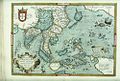
 Asia (1604).jpg 800 × 600; 170 KB
-
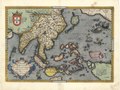
 Asia1(1588).jpg 800 × 600; 172 KB
-
 CEM-09-Asiae-Nova-Descriptio-SE-Asia-2505.jpg 2,560 × 1,920; 2.08 MB
-
 China is shown with no Korean peninsula.jpg 800 × 448; 119 KB
-
 India is mapped with dozens of place-names.jpg 500 × 650; 134 KB
-

-

-
 Map - Special Collections University of Amsterdam - OTM- HB-KZL- 34.11.57.tif 6,488 × 4,885; 90.68 MB
-
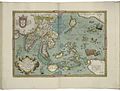
 Map of Asia (1600) south east.jpg 800 × 600; 166 KB
-
 Map of Asia (1628) South east.jpg 800 × 600; 156 KB
-
 Map of India and the Maluku Islands by Abraham Ortelius.jpeg 1,562 × 1,186; 596 KB
-

-

-

-

-

-
-

-

-
 Two mermaids comb their hair with sea-shell hand mirrors.jpg 749 × 428; 129 KB


.jpg)
.jpg)


_south_east.jpg)
_South_east.jpg)


Categories:
- Old maps of Asia
- 16th-century maps of Asia
- 17th-century maps of Asia
- Theatrum Orbis Terrarum
- Old maps of Southeast Asia
- Old maps of South Asia
- 16th-century maps of Indonesia
- Old maps of China
- Old maps of Japan
- Old maps of Vietnam
- 16th-century maps of the Philippines
- Old maps of Cambodia
- Old maps of Laos
- Old maps of Thailand
- Old maps of Malaysia
- Old maps of Bengal
- Old maps of Myanmar
- Old maps of India
- 16th-century maps of India
- Maps by Abraham Ortelius