Category:Hachure maps
Jump to navigation
Jump to search
English: Topographic maps depicting relief using hachures.
Deutsch: Karten auf denen die Geländeformen mit Schraffen dargestellt sind.
Italiano: Carte topografiche a tratteggio
mode of representing relief on a map  | |||||
| Upload media | |||||
| Instance of | |||||
|---|---|---|---|---|---|
| Subclass of |
| ||||
| |||||
Subcategories
This category has the following 2 subcategories, out of 2 total.
Media in category "Hachure maps"
The following 32 files are in this category, out of 32 total.
-

-
-
 Karte Kyffhäuser.jpg 748 × 1,009; 571 KB
-
 Battle of Brooklyn.gif 630 × 699; 148 KB
-
 Charles Wintersmith Map of Mount Independence.jpg 2,892 × 2,256; 3.95 MB
-
 Conquest mexico 1519 21.png 1,300 × 649; 1.45 MB
-
-
 Diapason carte.PNG 556 × 514; 75 KB
-
 Dufour-karte-bern 1-880x803.jpg 880 × 803; 274 KB
-

-

-

-
-

-

-

-
-
 Freiburg in Brockhaus 1937.jpg 1,579 × 2,672; 2.44 MB
-
 Hathing on map.JPG 270 × 235; 70 KB
-
 Karte von Syrien. den Manen Jacotin's und Burckhardt's gewidmet. von H. Berghaus.jpg 9,647 × 13,939; 23.6 MB
-

-
 Lange diercke sachsen gebiet des windbergs höhenschichten und schraffen.jpg 1,172 × 776; 586 KB
-
 Lange diercke sachsen gebiet des windbergs reichskarte.jpg 1,164 × 592; 482 KB
-
 Lange diercke sachsen gebiet des windbergs schraffen.jpg 1,180 × 774; 612 KB
-
 Lange diercke sachsen gebiet des windbergs.jpg 2,470 × 3,147; 6.86 MB
-
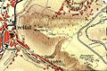
 Llaima y alrededores.jpg 1,400 × 620; 709 KB
-
 Meyers b10 s0459 b3.png 191 × 149; 11 KB
-
 Meyers b10 s0460 b1.png 138 × 243; 15 KB
-
 Neuenkotten1824.jpg 410 × 255; 34 KB
-

-
 Reilly 545.jpg 1,288 × 1,106; 582 KB
-
 Частные планы.jpg 2,472 × 1,952; 2.02 MB


.jpg)


.jpg)

