Category:Earth system science maps
Jump to navigation
Jump to search
Media in category "Earth system science maps"
The following 9 files are in this category, out of 9 total.
-
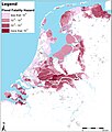 Flood-fatality-hazard-FFH-map-related-to-floods-from-the-main-waterways.jpg 2,067 × 2,432; 1.05 MB
-
 Flood-susceptibility-index.jpg 1,722 × 2,436; 1.78 MB
-
 Fontenelle Fire in Wyoming (8164369222).jpg 1,600 × 1,600; 1.03 MB
-
 Global pteropod distribution.png 472 × 259; 133 KB
-
-
 Schematic-geological-map-of-the-High-Agri-Valley.png 2,066 × 1,411; 838 KB
-
 Sensitivity-of-soil-texture-to-wind-erosion-based-on-soil-erodibility-index.jpg 2,067 × 1,430; 841 KB
-
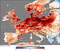
 Weuropelsta tmo 2006201 lrg.jpg 7,200 × 3,600; 3.94 MB
-
 Weuropelsta tmo 2006201.jpg 540 × 451; 117 KB


.jpg)


