Category:Devil's Bridge, Ceredigion surrounding area
Jump to navigation
Jump to search

Media in category "Devil's Bridge, Ceredigion surrounding area"
The following 14 files are in this category, out of 14 total.
-
 Across Cwm Mynach, Ceredigion - geograph.org.uk - 1215415.jpg 640 × 480; 140 KB
-
 Across Cwm Mynach, Ceredigion - geograph.org.uk - 1215419.jpg 480 × 640; 160 KB
-
 Across Cwm Mynach, Ceredigion - geograph.org.uk - 1216415.jpg 640 × 480; 157 KB
-
 Aerial ropeway retaining block - geograph.org.uk - 727738.jpg 640 × 480; 346 KB
-
 B4574 beside Coed Hafod - geograph.org.uk - 970718.jpg 640 × 480; 103 KB
-
 Cwm of the Nant Lletys - geograph.org.uk - 836990.jpg 640 × 428; 95 KB
-
 Entrance to Blaen Cwm-Magwr - geograph.org.uk - 208171.jpg 640 × 480; 125 KB
-
-
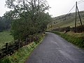
 Lane to Trisant - geograph.org.uk - 208194.jpg 640 × 480; 141 KB
-
 Mining remains, Rheidol Valley - geograph.org.uk - 70802.jpg 640 × 480; 142 KB
-
 Path through Coed Rheidol - geograph.org.uk - 214753.jpg 480 × 640; 192 KB
-
 Path through Coed Rheidol - geograph.org.uk - 215242.jpg 480 × 640; 139 KB
-
 Path to Devil's Bridge - geograph.org.uk - 214708.jpg 480 × 640; 189 KB
-
 The B4574 near Banc y Bont - geograph.org.uk - 285607.jpg 640 × 480; 237 KB


