Category:City of London
Jump to navigation
Jump to search
Ceremonial counties of England: Bedfordshire · Berkshire · Buckinghamshire · Cambridgeshire · Cheshire · Cornwall · Cumbria · Derbyshire · Devon · Dorset · Durham · East Riding of Yorkshire · East Sussex · Essex · Gloucestershire · Greater London · Greater Manchester · Hampshire · Herefordshire · Hertfordshire · Isle of Wight · Kent · Lancashire · Leicestershire · Lincolnshire · Merseyside · Norfolk · North Yorkshire · Northamptonshire · Northumberland · Nottinghamshire · Oxfordshire · Rutland · Shropshire · Somerset · South Yorkshire · Staffordshire · Suffolk · Surrey · Tyne and Wear · Warwickshire · West Midlands · West Sussex · West Yorkshire · Wiltshire · Worcestershire
City-counties: Bristol · City of London
Former historic counties: Cumberland · Huntingdonshire · London · Middlesex · North Riding of Yorkshire · Sussex · West Riding of Yorkshire · Westmorland · Yorkshire
Other former counties: Avon · Cambridgeshire and Isle of Ely · Cleveland · East Suffolk · Hereford and Worcester · Hexhamshire · Humberside · Huntingdon and Peterborough · Isle of Ely · Parts of Holland · Parts of Kesteven · Parts of Lindsey · Soke of Peterborough · West Suffolk
city, ceremonial county and local government district that contains the historic center and the primary central business district in the London Region in England, UK    _in_its_region.svg) | |||||
| Upload media | |||||
| Instance of |
| ||||
|---|---|---|---|---|---|
| Patron saint | |||||
| Location | London, England | ||||
| Located in or next to body of water | |||||
| Legislative body |
| ||||
| Executive body | |||||
| Head of government |
| ||||
| Significant event |
| ||||
| Diameter |
| ||||
| Population |
| ||||
| Area |
| ||||
| Elevation above sea level |
| ||||
| Different from | |||||
 | |||||

Subcategories
This category has the following 33 subcategories, out of 33 total.
Media in category "City of London"
The following 200 files are in this category, out of 4,241 total.
(previous page) (next page)-
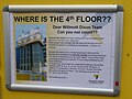 "Can you not count" - geograph.org.uk - 4864141.jpg 640 × 480; 235 KB
-
 "Face Masks" shop sign, City of London - geograph.org.uk - 6416987.jpg 1,024 × 768; 188 KB
-
 "Floating greenhouse" - geograph.org.uk - 4234754.jpg 1,000 × 667; 223 KB
-

-

-
 10 Fleet Place - geograph.org.uk - 2503389.jpg 449 × 640; 184 KB
-
 100 Wood Street - geograph.org.uk - 6311964.jpg 4,032 × 3,024; 1.76 MB
-
 11 Moorfields Highwalk - geograph.org.uk - 2594530.jpg 640 × 446; 190 KB
-
 14-16 Cullum Street - geograph.org.uk - 2541756.jpg 617 × 511; 199 KB
-
 20 Fenchurch Street, London EC3 - geograph.org.uk - 5027972.jpg 4,739 × 2,696; 1.24 MB
-
 201 Bishopsgate - geograph.org.uk - 5223496.jpg 960 × 1,280; 501 KB
-
 2019 City of London 3D model.jpg 3,362 × 1,891; 1.92 MB
-
 21 gun salute for the Diamond Jubilee - geograph.org.uk - 3106643.jpg 2,592 × 1,936; 1.08 MB
-
 23-33 Moorfields - geograph.org.uk - 2594555.jpg 438 × 640; 183 KB
-
 33 Holborn - geograph.org.uk - 6378640.jpg 1,024 × 768; 350 KB
-
 40-100 Victoria Embankment - geograph.org.uk - 4770499.jpg 640 × 454; 132 KB
-
 415A Pilgrim Street ^ - geograph.org.uk - 5749377.jpg 640 × 480; 97 KB
-
 43 Bartholomew Court - geograph.org.uk - 6110593.jpg 3,024 × 4,032; 3.52 MB
-
 5 Aldermanbury Square - geograph.org.uk - 2541679.jpg 469 × 640; 223 KB
-
 50 Shades of Grey - geograph.org.uk - 4895381.jpg 6,000 × 4,000; 5.22 MB
-
 8 Bishopsgate Construction.jpg 5,184 × 3,888; 15.72 MB
-
 9-13 St Andrew Street-65 Shoe Lane - geograph.org.uk - 5700802.jpg 750 × 1,000; 811 KB
-
 90-94 Old Broad Street - geograph.org.uk - 2552458.jpg 509 × 640; 214 KB
-
 97 Fleet Street, not actually on Fleet Street - geograph.org.uk - 2244205.jpg 1,024 × 681; 163 KB
-

-

-

-
 A Battle Remembered - geograph.org.uk - 2054966.jpg 640 × 475; 68 KB
-
 A bit of Roman London - geograph.org.uk - 3175550.jpg 1,024 × 741; 205 KB
-
 A City Growing up - geograph.org.uk - 4243373.jpg 4,000 × 2,671; 7.66 MB
-
 A dazzle ship at Temple, from the South Bank - geograph.org.uk - 4418185.jpg 1,024 × 681; 139 KB
-

-
-
-

-

-
-

-

-

-

-

-
-
-

-

-
-

-

-
-
-
-
-
-
-
-
-
-

-

-

-

-

-

-
-

-

-

-

-
-
-

-

-
-
-
-
-

-
-
-
-
-
-

-

-
-

-
-
-

-
-

-
 A glimpse of St Paul's - geograph.org.uk - 3893346.jpg 743 × 1,024; 188 KB
-
 A glimpse of St. Bride's - geograph.org.uk - 5749357.jpg 480 × 640; 114 KB
-
 A glimpse of St. Stephen's - geograph.org.uk - 5749227.jpg 480 × 640; 141 KB
-
 A Greenline on the 22 - geograph.org.uk - 3927395.jpg 3,456 × 2,592; 1.74 MB
-
 A Greenline on the 22 ^2 - geograph.org.uk - 3927400.jpg 3,456 × 2,592; 3.03 MB
-

-
 A looming presence in the City - geograph.org.uk - 5749197.jpg 480 × 640; 145 KB
-
 A new Blackfriars Pier^ - geograph.org.uk - 5738979.jpg 640 × 480; 93 KB
-
 A prospect of the City of London 1710 by Joseph Smith (detail) Line Engraving.jpg 4,128 × 2,322; 2.7 MB
-
 A side view Al Weiwei's "Stack" - geograph.org.uk - 4852171.jpg 3,872 × 2,592; 2.1 MB
-

-
 A tree trunk in the garden of St. Peter Cheap, Wood Street - geograph.org.uk - 4018381.jpg 3,872 × 2,592; 3.53 MB
-
 A view down river - geograph.org.uk - 3399805.jpg 640 × 426; 46 KB
-
 A view down river - geograph.org.uk - 3399831.jpg 640 × 426; 50 KB
-
 A view towards the Shard from Blackfriars Station - geograph.org.uk - 6074711.jpg 2,000 × 1,333; 1.42 MB
-
 A view up river - geograph.org.uk - 3399953.jpg 640 × 426; 59 KB
-
 A view up river - geograph.org.uk - 3399985.jpg 640 × 426; 45 KB
-

-
-

-

-

-
-

-
-
-
-

-

-
-

-
-

-

-
-
-

-
-

-
-
-

-
-
-

-

-

-

-

-
-
-
-
-

-
-
-

-
-
-
-

-
-

-
-
-

-
-
-
-
-
-
-

-

-

-
-

-

-

-
-

-

-
-
-
-
-
-
-
-
-

-

-

-

-

-
-

-
-

-

-
-

-

-

-

-
-
-


_General_Accident_in_Lloyd%27s_Avenue_-_geograph.org.uk_-_1710496.jpg)


_-_geograph.org.uk_-_5589612.jpg)
_-_geograph.org.uk_-_5589613.jpg)
_-_geograph.org.uk_-_5589615.jpg)
_-_geograph.org.uk_-_5589618.jpg)
_-_geograph.org.uk_-_5589619.jpg)
_-_geograph.org.uk_-_5589621.jpg)
_-_geograph.org.uk_-_5589623.jpg)
_-_geograph.org.uk_-_5589624.jpg)
_-_geograph.org.uk_-_5589625.jpg)
_-_geograph.org.uk_-_5589626.jpg)
_-_geograph.org.uk_-_5589627.jpg)
_-_geograph.org.uk_-_5589629.jpg)
_-_geograph.org.uk_-_5589630.jpg)
_-_geograph.org.uk_-_5589664.jpg)
_-_geograph.org.uk_-_5589666.jpg)
_-_geograph.org.uk_-_5589667.jpg)
_-_geograph.org.uk_-_5587901.jpg)
_-_geograph.org.uk_-_5587905.jpg)
_-_geograph.org.uk_-_5587912.jpg)
_-_geograph.org.uk_-_5587914.jpg)
_-_geograph.org.uk_-_5587922.jpg)
_-_geograph.org.uk_-_5587925.jpg)
_-_geograph.org.uk_-_5587931.jpg)
_-_geograph.org.uk_-_5588877.jpg)
_-_geograph.org.uk_-_5588878.jpg)
_-_geograph.org.uk_-_5588900.jpg)
_-_geograph.org.uk_-_5588925.jpg)
_-_geograph.org.uk_-_5589529.jpg)
_-_geograph.org.uk_-_5589535.jpg)
_-_geograph.org.uk_-_5589537.jpg)
_-_geograph.org.uk_-_5589538.jpg)
_-_geograph.org.uk_-_5589540.jpg)
_-_geograph.org.uk_-_5589541.jpg)
_-_geograph.org.uk_-_5589544.jpg)
_-_geograph.org.uk_-_5589545.jpg)
_-_geograph.org.uk_-_5589548.jpg)
_-_geograph.org.uk_-_5589550.jpg)
_-_geograph.org.uk_-_5589551.jpg)
_-_geograph.org.uk_-_5589553.jpg)
_-_geograph.org.uk_-_5589554.jpg)
_-_geograph.org.uk_-_5589556.jpg)
_-_geograph.org.uk_-_5589557.jpg)
_-_geograph.org.uk_-_5589559.jpg)
_-_geograph.org.uk_-_5589560.jpg)
_-_geograph.org.uk_-_5589561.jpg)
_-_geograph.org.uk_-_5589563.jpg)
_-_geograph.org.uk_-_5589566.jpg)
_-_geograph.org.uk_-_5589568.jpg)
_-_geograph.org.uk_-_5589575.jpg)
_-_geograph.org.uk_-_5589581.jpg)
_-_geograph.org.uk_-_5589582.jpg)
_-_geograph.org.uk_-_5589584.jpg)
_-_geograph.org.uk_-_5589585.jpg)
_-_geograph.org.uk_-_5589597.jpg)
_-_geograph.org.uk_-_5589600.jpg)
_-_geograph.org.uk_-_5589603.jpg)
_-_geograph.org.uk_-_5589606.jpg)
_-_geograph.org.uk_-_5589607.jpg)
_-_geograph.org.uk_-_5589609.jpg)
_-_geograph.org.uk_-_5589611.jpg)


_Line_Engraving.jpg)


_-_geograph.org.uk_-_5202427.jpg)
_-_geograph.org.uk_-_5207228.jpg)
_-_geograph.org.uk_-_5215298.jpg)
_-_geograph.org.uk_-_5215502.jpg)
_-_geograph.org.uk_-_5215510.jpg)
_-_geograph.org.uk_-_5215523.jpg)
_-_geograph.org.uk_-_5215530.jpg)
_-_geograph.org.uk_-_5215538.jpg)
_-_geograph.org.uk_-_5215553.jpg)
_-_geograph.org.uk_-_5215560.jpg)
_-_geograph.org.uk_-_5207314.jpg)
_-_geograph.org.uk_-_5207369.jpg)
_-_geograph.org.uk_-_5207389.jpg)
_-_geograph.org.uk_-_5207428.jpg)
_-_geograph.org.uk_-_5207452.jpg)
_-_geograph.org.uk_-_5207482.jpg)
_-_geograph.org.uk_-_5207492.jpg)
_-_geograph.org.uk_-_5202431.jpg)
_-_geograph.org.uk_-_5207504.jpg)
_-_geograph.org.uk_-_5207524.jpg)
_-_geograph.org.uk_-_5207533.jpg)
_-_geograph.org.uk_-_5207568.jpg)
_-_geograph.org.uk_-_5207599.jpg)
_-_geograph.org.uk_-_5207603.jpg)
_-_geograph.org.uk_-_5207612.jpg)
_-_geograph.org.uk_-_5208915.jpg)
_-_geograph.org.uk_-_5208946.jpg)
_-_geograph.org.uk_-_5202435.jpg)
_-_geograph.org.uk_-_5208950.jpg)
_-_geograph.org.uk_-_5208955.jpg)
_-_geograph.org.uk_-_5209906.jpg)
_-_geograph.org.uk_-_5209928.jpg)
_-_geograph.org.uk_-_5211136.jpg)
_-_geograph.org.uk_-_5211142.jpg)
_-_geograph.org.uk_-_5211531.jpg)
_-_geograph.org.uk_-_5211532.jpg)
_-_geograph.org.uk_-_5211534.jpg)
_-_geograph.org.uk_-_5211536.jpg)
_-_geograph.org.uk_-_5207033.jpg)
_-_geograph.org.uk_-_5211538.jpg)
_-_geograph.org.uk_-_5212211.jpg)
_-_geograph.org.uk_-_5212226.jpg)
_-_geograph.org.uk_-_5212241.jpg)
_-_geograph.org.uk_-_5212254.jpg)
_-_geograph.org.uk_-_5212269.jpg)
_-_geograph.org.uk_-_5212346.jpg)
_-_geograph.org.uk_-_5214153.jpg)
_-_geograph.org.uk_-_5214158.jpg)
_-_geograph.org.uk_-_5214171.jpg)
_-_geograph.org.uk_-_5207082.jpg)
_-_geograph.org.uk_-_5214194.jpg)
_-_geograph.org.uk_-_5214203.jpg)
_-_geograph.org.uk_-_5214500.jpg)
_-_geograph.org.uk_-_5214525.jpg)
_-_geograph.org.uk_-_5214536.jpg)
_-_geograph.org.uk_-_5214547.jpg)
_-_geograph.org.uk_-_5214572.jpg)
_-_geograph.org.uk_-_5214579.jpg)
_-_geograph.org.uk_-_5214619.jpg)
_-_geograph.org.uk_-_5207109.jpg)
_-_geograph.org.uk_-_5214623.jpg)
_-_geograph.org.uk_-_5214627.jpg)
_-_geograph.org.uk_-_5214633.jpg)
_-_geograph.org.uk_-_5214634.jpg)
_-_geograph.org.uk_-_5214635.jpg)
_-_geograph.org.uk_-_5214641.jpg)
_-_geograph.org.uk_-_5214643.jpg)
_-_geograph.org.uk_-_5214765.jpg)
_-_geograph.org.uk_-_5214777.jpg)
_-_geograph.org.uk_-_5207135.jpg)
_-_geograph.org.uk_-_5214787.jpg)
_-_geograph.org.uk_-_5214795.jpg)
_-_geograph.org.uk_-_5214807.jpg)
_-_geograph.org.uk_-_5214820.jpg)
_-_geograph.org.uk_-_5214833.jpg)
_-_geograph.org.uk_-_5214873.jpg)
_-_geograph.org.uk_-_5214903.jpg)
_-_geograph.org.uk_-_5214936.jpg)
_-_geograph.org.uk_-_5214952.jpg)
_-_geograph.org.uk_-_5207157.jpg)
_-_geograph.org.uk_-_5215007.jpg)
_-_geograph.org.uk_-_5215031.jpg)
_-_geograph.org.uk_-_5215041.jpg)
_-_geograph.org.uk_-_5215049.jpg)
_-_geograph.org.uk_-_5215059.jpg)
_-_geograph.org.uk_-_5215074.jpg)
_-_geograph.org.uk_-_5215187.jpg)
_-_geograph.org.uk_-_5215190.jpg)
_-_geograph.org.uk_-_5215210.jpg)
_-_geograph.org.uk_-_5215214.jpg)
Categories:
- Country subdivisions by name
- Counties of England
- London boroughs
- Country subdivisions in Europe
- Cities by name
- Cities in the United Kingdom by name
- Cities in England
- Cities in Europe by name
- Financial districts
- Districts in England by name
- City centres in England
- Urban settlements in London
- Unparished areas in London
- Districts of London
- Inner London
- North London
- Small cities