Category:1851 maps
Jump to navigation
Jump to search
| ← · 1850 · 1851 · 1852 · 1853 · 1854 · 1855 · 1856 · 1857 · 1858 · 1859 · → |
Deutsch: Karten mit Bezug zum Jahr 1851
English: Maps related to the year 1851
Español: Mapas relativos al año 1851
Français : Cartes concernant l’an 1851
Русский: Карты 1851 года
Subcategories
This category has the following 11 subcategories, out of 11 total.
A
E
G
N
O
- Orbis Antiqui Descriptio (4 F)
P
- Pilot chart of the South Pacific (11 F)
S
- 1851 maps of South America (6 F)
Media in category "1851 maps"
The following 100 files are in this category, out of 100 total.
-
 An atlas of antient geography (cartographic material) (IA atlasofantientge00butl 2).pdf 681 × 1,056, 136 pages; 7.56 MB
-

-
 Map of ERRIS and GALWAY.jpg 3,692 × 4,593; 9.47 MB
-
 THIRLWALL(1851) p6.410 THE MARCHES OF ALEXANDER.jpg 7,137 × 3,569; 11.3 MB
-
 1851 Bird's-eye view of New York City with Battery Park in the foreground.jpg 3,394 × 2,300; 4.37 MB
-
 1851 Black Map of Norway and Sweden (Scandinavia) - Geographicus - NorwaySweden-black-51.jpg 3,192 × 4,592; 2.43 MB
-
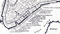
 1851 Map of Georgetown, crop from 1851 Map of the City.jpg 2,964 × 2,944; 5.57 MB
-
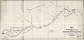
 1851 Medford and Stoneham Branch Railroad map.jpg 9,526 × 3,639; 4.5 MB
-

-

-
 A map of the town of Milford, Worcester County, Massachusetts (3120017239).jpg 1,485 × 2,000; 2.79 MB
-

-

-

-

-
 Birds-eye view of New York, 1851.png 3,200 × 2,148; 2.84 MB
-
 Bischberg und Umgebung 1851.jpg 1,381 × 1,394; 582 KB
-

-
 Canaan in possession of the twelve tribes of Israel (FL45582988 3925930).jpg 1,215 × 1,889; 962 KB
-
 Canaan of Palestine to illustrate the new Testament (FL45582993 3925935).jpg 1,234 × 2,027; 1.04 MB
-

-

-
 Carte du département de la Haute-Loire - 1851.jpg 11,014 × 7,964; 11.29 MB
-
 Carte routière du département du Jura - 1851.jpg 8,864 × 10,708; 12.3 MB
-
 China. LOC 2006629388.tif 6,471 × 5,360; 99.23 MB
-
-

-
 Colton's township map of the State of Wisconsin LOC 2018588058.jpg 7,385 × 8,528; 10.57 MB
-
 Colton's township map of the State of Wisconsin LOC 2018588058.tif 7,385 × 8,528; 180.19 MB
-
 Cuba in 1851. LOC 2012593347.jpg 7,928 × 6,301; 10.06 MB
-
 Cuba in 1851. LOC 2012593347.tif 7,928 × 6,301; 142.92 MB
-

-

-

-
 Dubai2 082.jpg 2,304 × 1,728; 1.47 MB
-
 Ecuador1851.png 758 × 391; 23 KB
-
 Exchange Ward Manchester Adshead.jpg 1,536 × 1,159; 480 KB
-
 General map of the Countries Mentioned In the Bible (FL45602891 3935170).jpg 3,216 × 2,644; 1.83 MB
-

-

-
 Iconographic Encyclopedia of Science, Literature and Art 062.jpg 2,811 × 2,318; 1.18 MB
-

-
 John Rapkin, Independent Tartary (FL36380642 2622257).jpg 8,649 × 6,231; 75.59 MB
-
 John Rapkin, Modern Palestine (FL51320669 2369431).jpg 6,275 × 8,521; 79.13 MB
-
 John Rapkin, Russia in Asia (FL147394489 2608011).jpg 8,538 × 6,218; 55.93 MB
-
 John Rapkin, Russia in Europe (FL147398619 2607999).jpg 6,166 × 8,551; 56.93 MB
-
 John-Tallis-1851-Tibet-Mongolia-and-Manchuria-NE.jpg 2,100 × 1,400; 2.34 MB
-
 Madeira - Its Climate and Scenery, 1851, map.png 2,500 × 3,963; 202 KB
-
 Maillard, Paris illustré et ses fortifications.jpg 4,382 × 3,422; 8.36 MB
-

-
 Map (of the) borough of Stonington, Connecticut, 1851. LOC 75692234.jpg 6,525 × 8,023; 7.52 MB
-
 Map (of the) borough of Stonington, Connecticut, 1851. LOC 75692234.tif 6,525 × 8,023; 149.78 MB
-

-
 Map of Columbia County, New York - from actual surveys LOC 2012593653.jpg 11,456 × 16,228; 22.75 MB
-
 Map of Lancaster County, Pennsylvania. LOC 2012592191.jpg 13,785 × 12,346; 21.8 MB
-
 Map of Lancaster County, Pennsylvania. LOC 2012592191.tif 13,785 × 12,346; 486.92 MB
-

-

-
 Map of Northampton County, Pennsylvania LOC 2012590206.jpg 10,562 × 8,338; 12.63 MB
-
 Map of Northampton County, Pennsylvania LOC 2012590206.tif 10,562 × 8,338; 251.96 MB
-

-

-
 Map of Providence County, Rhode Island, with some of the adjacent towns LOC 2013591359.jpg 15,938 × 11,954; 25.37 MB
-
 Map of the city of Augusta, capital of the state of Maine LOC 2008624046.jpg 9,560 × 10,826; 10.42 MB
-
 Map of the city of Augusta, capital of the state of Maine LOC 2008624046.tif 9,560 × 10,826; 296.11 MB
-
 Map of the city of Norfolk and the town of Portsmouth. LOC 2009575801.jpg 16,141 × 10,644; 21.24 MB
-

-
-

-
 Map of the town of Millbury (3855700871).jpg 2,000 × 1,339; 2.18 MB
-
 Map of the town of Wrentham (7557395614).jpg 5,888 × 7,608; 43.51 MB
-
 Map of the village of Concord, Merrimack County, N.H. (9144002304).jpg 667 × 800; 105 KB
-
 Meyer‘s Zeitungsatlas 106 – Holstein mit Lauenburg, Hamburg und Lübeck.jpg 7,243 × 6,070; 15.86 MB
-
 Persian Gulf, detail from Old Map of Arabia 1851 by Tallis & Rapkin.jpg 900 × 797; 180 KB
-
 Persian-gulf-dubai-mus.JPG 1,254 × 813; 116 KB
-

-

-

-
 Plan of Newburyport Mass. from an actual survey (3855701881).jpg 2,000 × 1,402; 2.44 MB
-
 Plan of part of Mystic River, with common low water mark of line of flats (2675201136).jpg 2,000 × 1,281; 2.24 MB
-
 Plan of the city of Baltimore, Maryland LOC 2004629026.jpg 13,414 × 10,643; 27.75 MB
-
 Plan of the town of Meriden, New Haven County, Connecticut (7557602798).jpg 2,000 × 1,743; 3.08 MB
-
 Plan showing proposed method of laying out the public grounds at Washington LOC 94681554.jpg 20,590 × 13,411; 24.79 MB
-
 Plan showing proposed method of laying out the public grounds at Washington LOC 94681554.tif 20,590 × 13,411; 790.02 MB
-
 Plan topographique et géométrique des communes d'Arles et des Saintes-Maries - 1851.jpg 13,583 × 10,766; 25.24 MB
-
 Plano de Manila 1851.jpg 2,609 × 2,067; 850 KB
-
 Plànol Sant Feliu de Llobregat 1851.jpg 2,631 × 2,071; 668 KB
-
 Port of New York 1851.jpg 766 × 432; 363 KB
-
 Qalaherriaiq map.jpg 1,013 × 1,293; 266 KB
-
 Raum bischberg2.jpg 1,291 × 1,288; 1.52 MB
-
 S. S. Downin's plat of Joseph Poffenberger LOC 2005625030.jpg 7,267 × 4,267; 2.33 MB
-
 S. S. Downin's plat of Joseph Poffenberger LOC 2005625030.tif 7,267 × 4,267; 88.72 MB
-
 Skeleton map of rail-roads between Cape Canso and St. Louis (2673752555).jpg 2,000 × 1,517; 2.47 MB
-

-
 Skeleton map of rail-roads between Cape Canso and St. Louis, LOC gm70002892.jpg 9,809 × 7,131; 9.78 MB
-
 Skeleton map of rail-roads between Cape Canso and St. Louis, LOC gm70002892.tif 9,809 × 7,131; 200.12 MB
-
 Tarapaca peru 1851.jpg 1,572 × 3,039; 876 KB
-
 The Holy Land and lower Egypt (FL35098684 3892706).jpg 3,803 × 5,640; 29.88 MB
-
 Trade wind chart of the Atlantic Ocean LOC 2009575918.jpg 10,914 × 7,383; 11.98 MB
-
 Trade wind chart of the Atlantic Ocean LOC 2009575918.tif 10,914 × 7,383; 230.54 MB
%27_(11036962446).jpg)

_p6.410_THE_MARCHES_OF_ALEXANDER.jpg)

_-_Geographicus_-_NorwaySweden-black-51.jpg)


_..._Con_un_plano_y_dos_vistas_de_la_capital%27_(11036017046).jpg)
.jpg)
.jpg)


_(20243874078).jpg)
.jpg)
.jpg)


.jpg)


.jpg)
.jpg)
.jpg)
.jpg)


_borough_of_Stonington,_Connecticut,_1851._LOC_75692234.jpg)


.jpg)

.jpg)
.jpg)
.jpg)


_(14597615467).jpg)
.jpg)
.jpg)
.jpg)
.jpg)

.jpg)


.jpg)


.jpg)
