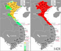
File:Vietnam (1407).png
From Wikimedia Commons, the free media repository
Jump to navigation
Jump to search

Size of this preview: 721 × 599 pixels. Other resolutions: 289 × 240 pixels | 577 × 480 pixels | 860 × 715 pixels.
Original file (860 × 715 pixels, file size: 53 KB, MIME type: image/png)
File information
Structured data
Captions
Captions
Add a one-line explanation of what this file represents
Summary[edit]
| DescriptionVietnam (1407).png |
English: Vietnam in 1407. |
| Date | |
| Source | Own work |
| Author | Night Lantern |
| Permission (Reusing this file) |
This file is licensed under the Creative Commons Attribution-Share Alike 3.0 Unported license.
|
File history
Click on a date/time to view the file as it appeared at that time.
| Date/Time | Thumbnail | Dimensions | User | Comment | |
|---|---|---|---|---|---|
| current | 01:37, 31 January 2020 |  | 860 × 715 (53 KB) | Doãn Hiệu (talk | contribs) | Chỉnh lại biên giới đông bắc (tỉnh Quảng Ninh) trước năm 1883. |
| 06:31, 25 February 2019 |  | 860 × 715 (53 KB) | Doãn Hiệu (talk | contribs) | chỉnh ranh giới Điện Biên-Sơn La. | |
| 02:04, 23 February 2019 |  | 860 × 715 (53 KB) | Doãn Hiệu (talk | contribs) | thêm chú thích nước Bồn Man. | |
| 01:58, 10 February 2019 |  | 860 × 715 (50 KB) | Doãn Hiệu (talk | contribs) | sửa biên giới tây Nghệ An. | |
| 02:45, 7 February 2019 |  | 860 × 715 (50 KB) | Doãn Hiệu (talk | contribs) | Điều chỉnh biên giới miền tây xứ Nghệ: cuối thời nhà Trần, các năm 1334-1336 Trần Minh Tông thu nạp đất Kiềm Châu sau gồm hai phủ Trà Lân, Ngọc Ma (nay khoảng các huyện Tương Dương, Con Quông, Hương Sơn, Hương Khê). | |
| 07:02, 6 February 2019 |  | 860 × 715 (48 KB) | Doãn Hiệu (talk | contribs) | Thêm bản đổ tổng hợp lãnh thổ bên phải bản đồ tiến trình. | |
| 13:35, 3 January 2019 |  | 428 × 713 (29 KB) | Doãn Hiệu (talk | contribs) | Điều chỉnh niên đại tiến trình. | |
| 01:54, 1 January 2019 |  | 428 × 713 (28 KB) | Doãn Hiệu (talk | contribs) | Điều chỉnh vùng lãnh thổ tỉnh Hà Giang ngày nay và vùng tây bắc Việt Nam thuộc các tỉnh Sơn la và Hòa Bình ngày nay. | |
| 08:09, 25 September 2018 |  | 428 × 713 (19 KB) | Night Lantern (talk | contribs) | correcting map as there is many error previously | |
| 01:32, 16 July 2017 |  | 1,080 × 1,799 (398 KB) | Night Lantern (talk | contribs) | User created page with UploadWizard |
You cannot overwrite this file.
File usage on Commons
The following 3 pages use this file:
File usage on other wikis
The following other wikis use this file:
- Usage on vi.wikipedia.org
Metadata
This file contains additional information such as Exif metadata which may have been added by the digital camera, scanner, or software program used to create or digitize it. If the file has been modified from its original state, some details such as the timestamp may not fully reflect those of the original file. The timestamp is only as accurate as the clock in the camera, and it may be completely wrong.
| Horizontal resolution | 37.8 dpc |
|---|---|
| Vertical resolution | 37.8 dpc |
| Software used |