File:Tunnel on Peak Forest Canal near Marple.jpg
Jump to navigation
Jump to search

Size of this preview: 800 × 600 pixels. Other resolutions: 320 × 240 pixels | 640 × 480 pixels | 1,024 × 768 pixels | 1,280 × 960 pixels.
Original file (1,280 × 960 pixels, file size: 718 KB, MIME type: image/jpeg)
Captions
Captions
Add a one-line explanation of what this file represents
Summary
[edit]
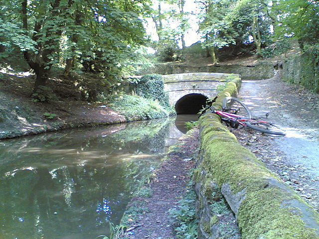
| Description | No towpath through here. Up and over you have to go, the other side is very close to Marple Aqueduct |
| Source | Own work |
| Author | Parrot of Doom |
| Camera location | | View this and other nearby images on: OpenStreetMap |
|---|
Licensing
[edit]
| This work has been released into the public domain by its author, I, Parrot of Doom. This applies worldwide. In some countries this may not be legally possible; if so: I, Parrot of Doom grants anyone the right to use this work for any purpose, without any conditions, unless such conditions are required by law. |
File history
Click on a date/time to view the file as it appeared at that time.
| Date/Time | Thumbnail | Dimensions | User | Comment | |
|---|---|---|---|---|---|
| current | 21:37, 14 July 2007 | | 1,280 × 960 (718 KB) | Parrot of Doom (talk | contribs) | {{Information |Description=No towpath through here. Up and over you have to go, the other side is very close to Marple Aqueduct |Source=self-made |Date= |Author= Parrot of Doom }} Category:Peak Forest Canal |
You cannot overwrite this file.
File usage on Commons
The following page uses this file: