File:Triângulo do extremo sul baiano.svg
Jump to navigation
Jump to search

Size of this PNG preview of this SVG file: 800 × 568 pixels. Other resolutions: 320 × 227 pixels | 640 × 454 pixels | 1,024 × 727 pixels | 1,280 × 908 pixels | 2,560 × 1,817 pixels | 1,409 × 1,000 pixels.
Original file (SVG file, nominally 1,409 × 1,000 pixels, file size: 130 KB)
Captions
Captions
Add a one-line explanation of what this file represents
Summary[edit]
| Description |
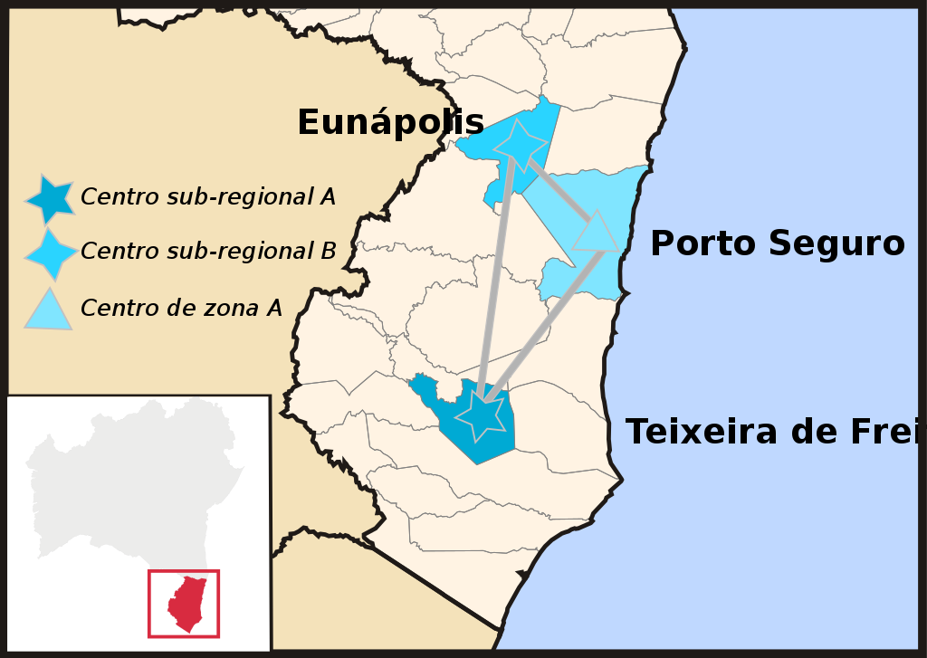
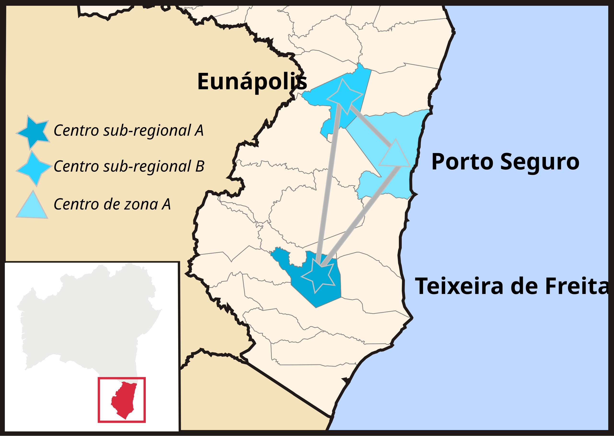
Português: Mapa do Extremo Sul da Bahia destacando a rede urbana triangular e hierarquia urbana entre o trio. |
| Date | (UTC) |
| Source |
This file was derived from: Municípios baianos na hierarquia urbana brasileira.svg:  |
| Author |
by Luan |
| This is a retouched picture, which means that it has been digitally altered from its original version. The original can be viewed here: Municípios baianos na hierarquia urbana brasileira.svg:
|
Licensing[edit]
I, the copyright holder of this work, hereby publish it under the following license:
This file is licensed under the Creative Commons Attribution-Share Alike 3.0 Brazil license.
- You are free:
- to share – to copy, distribute and transmit the work
- to remix – to adapt the work
- Under the following conditions:
- attribution – You must give appropriate credit, provide a link to the license, and indicate if changes were made. You may do so in any reasonable manner, but not in any way that suggests the licensor endorses you or your use.
- share alike – If you remix, transform, or build upon the material, you must distribute your contributions under the same or compatible license as the original.


|
I'd greatly appreciate, that you attribute this media file to Wikimedia Commons, if used outside Wikipedia or Commons. For use in publications such as books, newspapers, blogs, websites, please insert here the following line:
Attribution: Luan
|
File history
Click on a date/time to view the file as it appeared at that time.
| Date/Time | Thumbnail | Dimensions | User | Comment | |
|---|---|---|---|---|---|
| current | 20:17, 30 July 2012 | | 1,409 × 1,000 (130 KB) | Luan (talk | contribs) | correção da legenda |
| 20:11, 30 July 2012 |  | 1,409 × 1,000 (108 KB) | Luan (talk | contribs) | ||
| 20:08, 30 July 2012 |  | 1,409 × 1,000 (109 KB) | Luan (talk | contribs) | == {{int:filedesc}} == {{Information |Description={{pt|Mapa do Extremo Sul da Bahia destacando a rede urbana triangular e hierarquia urbana entre o trio.}} |Source={{Derived from|Municípios_baianos_na_hierarquia_urb... |
You cannot overwrite this file.
File usage on Commons
The following page uses this file: