File:Sudan RC Church diocese district map 2007.svg
Jump to navigation
Jump to search

Size of this PNG preview of this SVG file: 424 × 600 pixels. Other resolutions: 170 × 240 pixels | 339 × 480 pixels | 543 × 768 pixels | 724 × 1,024 pixels | 1,448 × 2,048 pixels | 744 × 1,052 pixels.
Original file (SVG file, nominally 744 × 1,052 pixels, file size: 159 KB)
Captions
Captions
Add a one-line explanation of what this file represents
| Description |
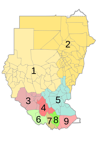
English: Map of Sudan and South Sudan — with district borders showing dioceses of the Roman Catholic church
Deutsch: Karte von Sudan mit Distrikt-Grenzen, die die Grenzen der Bistümer der Römisch-Katholischen Kirche zeigt, dabei stehen die Nummern für:
|
||
| Date | |||
| Source | own work, based on Image:Sudan district map.svg | ||
| Author | de:user:Sven-steffen arndt | ||
| Permission (Reusing this file) |
|
File history
Click on a date/time to view the file as it appeared at that time.
| Date/Time | Thumbnail | Dimensions | User | Comment | |
|---|---|---|---|---|---|
| current | 15:34, 19 February 2007 | | 744 × 1,052 (159 KB) | Sven-steffen arndt (talk | contribs) | {{Information |Description={{en|Map of Sudan with district borders showing dioceses of the roman catholic church}} {{de|Karte von Sudan mit Distrikt-Grenzen, die die Grenzen der Bistümer der Römisch-Katholischen Kirche zeigt, dabei stehen die Nummern f� |
You cannot overwrite this file.
File usage on Commons
The following page uses this file:
File usage on other wikis
The following other wikis use this file:
- Usage on ar.wikipedia.org
- Usage on cs.wikipedia.org
- Usage on de.wikipedia.org
- Usage on en.wikipedia.org
- Usage on fr.wikipedia.org
- Usage on id.wikipedia.org
- Usage on it.wikipedia.org
- Usage on jv.wikipedia.org
- Usage on nl.wikipedia.org
- Usage on no.wikipedia.org
- Usage on pl.wikipedia.org
View more global usage of this file.