File:Stream restoration works completed in Howen Bottom, New Forest - geograph.org.uk - 1432356.jpg
Jump to navigation
Jump to search
No higher resolution available.
Stream_restoration_works_completed_in_Howen_Bottom,_New_Forest_-_geograph.org.uk_-_1432356.jpg (640 × 427 pixels, file size: 109 KB, MIME type: image/jpeg)
Captions
Captions
Add a one-line explanation of what this file represents
Summary[edit]
| Description |
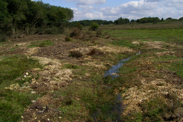
English: Stream restoration works completed in Howen Bottom, New Forest A view upstream in Howen Bottom. The area has been recently disturbed by work to restore the naturally meandering stream that ran in the valley bottom before the drainage ditch was dug. The work was done during June/July 2009 in order to have suitably dry conditions.
Apparently the Forestry Commission is undertaking this programme of restoring natural stream courses to prevent artificial over-deepening because it is a requirement to meet the governments target for favourable condition of the UKs SSSIs by 2010. |
| Date | |
| Source | From geograph.org.uk |
| Author | Jim Champion |
| Attribution (required by the license) | Jim Champion / Stream restoration works completed in Howen Bottom, New Forest / |
| Camera location | | View this and other nearby images on: OpenStreetMap |
|---|
_heading:67.00&language=en)
| Object location | | View this and other nearby images on: OpenStreetMap |
|---|
_heading:67.00&language=en)
Licensing[edit]

|
This image was taken from the Geograph project collection. See this photograph's page on the Geograph website for the photographer's contact details. The copyright on this image is owned by Jim Champion and is licensed for reuse under the Creative Commons Attribution-ShareAlike 2.0 license.
|
This file is licensed under the Creative Commons Attribution-Share Alike 2.0 Generic license.
Attribution: Jim Champion
- You are free:
- to share – to copy, distribute and transmit the work
- to remix – to adapt the work
- Under the following conditions:
- attribution – You must give appropriate credit, provide a link to the license, and indicate if changes were made. You may do so in any reasonable manner, but not in any way that suggests the licensor endorses you or your use.
- share alike – If you remix, transform, or build upon the material, you must distribute your contributions under the same or compatible license as the original.
File history
Click on a date/time to view the file as it appeared at that time.
| Date/Time | Thumbnail | Dimensions | User | Comment | |
|---|---|---|---|---|---|
| current | 23:56, 1 March 2011 | | 640 × 427 (109 KB) | GeographBot (talk | contribs) | == {{int:filedesc}} == {{Information |description={{en|1=Stream restoration works completed in Howen Bottom, New Forest A view upstream in Howen Bottom. The area has been recently disturbed by work to restore the naturally meandering stream that ran in th |
You cannot overwrite this file.
File usage on Commons
There are no pages that use this file.