File:SaintMartinIle.PNG
Jump to navigation
Jump to search
No higher resolution available.
SaintMartinIle.PNG (250 × 115 pixels, file size: 7 KB, MIME type: image/png)
Captions
Captions
Add a one-line explanation of what this file represents
| Description |
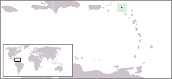
English: Localisation map of the Saint Martin island (France ; or Netherlands Antilles, Netherlands).
Français : Carte de localisation de l’île de Saint-Martin (France ; ou Antilles néerlandaises, Pays-Bas). |
||
| Source | à partir d'une carte du CIA WordFactBook | ||
| Author | Rémih | ||
| Permission (Reusing this file) |
|
File history
Click on a date/time to view the file as it appeared at that time.
| Date/Time | Thumbnail | Dimensions | User | Comment | |
|---|---|---|---|---|---|
| current | 09:23, 9 August 2006 | | 250 × 115 (7 KB) | Rémih (talk | contribs) | *Description:Carte de localisation de Saint-Martin, Antilles néerlandaises, Pays-Bas *Auteur:Rémih à partir d'une carte du CIA WordFactBook category:Netherlands Antilles |
You cannot overwrite this file.
File usage on Commons
The following page uses this file:
File usage on other wikis
The following other wikis use this file:
- Usage on es.wikipedia.org
- Usage on fr.wikipedia.org
- Usage on hu.wikipedia.org
- Usage on nl.wikipedia.org
- Usage on oc.wikipedia.org
- Usage on pl.wiktionary.org
- Usage on uk.wikipedia.org