File:Q2498653 P4291.jpg
Jump to navigation
Jump to search

Size of this preview: 800 × 132 pixels. Other resolutions: 320 × 53 pixels | 640 × 105 pixels | 1,024 × 168 pixels | 1,280 × 211 pixels | 2,560 × 421 pixels | 19,840 × 3,264 pixels.
Original file (19,840 × 3,264 pixels, file size: 41.23 MB, MIME type: image/jpeg)
Captions
Captions
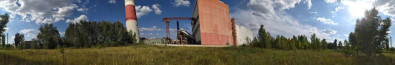
Kharkiv TEC-5 panoramic view
Summary[edit]
| Description |
English: panoramic view of Kharkiv TEC-5 |
| Date | |
| Source | https://geohashing.site/geohashing/2020-08-11_49_36 |
| Author | Nope https://geohashing.site/geohashing/Special:Contributions/Nope |
| Camera location | | View this and other nearby images on: OpenStreetMap |
|---|
Licensing[edit]

|
This file was originally uploaded to the Geohashing Wiki by Nope as 2020-08-11 49 36 4.jpg. Content at the Geohashing Wiki is compatibly-licensed to Commons.
|

|
Permission is granted to copy, distribute and/or modify this document under the terms of the GNU Free Documentation License, Version 1.3 only as published by the Free Software Foundation; with no Invariant Sections, no Front-Cover Texts, and no Back-Cover Texts. A copy of the license is included in the section entitled GNU Free Documentation License. | 1.3 only |
File history
Click on a date/time to view the file as it appeared at that time.
| Date/Time | Thumbnail | Dimensions | User | Comment | |
|---|---|---|---|---|---|
| current | 21:56, 20 August 2020 | 19,840 × 3,264 (41.23 MB) | Arlo Barnes (talk | contribs) | Uploaded a work by Nope https://geohashing.site/geohashing/Special:Contributions/Nope from https://geohashing.site/geohashing/2020-08-11_49_36 with UploadWizard |
You cannot overwrite this file.
File usage on Commons
The following page uses this file:
File usage on other wikis
The following other wikis use this file:
- Usage on www.wikidata.org