File:Poland powiaty.png
Jump to navigation
Jump to search
Size of this preview: 800 × 548 pixels. Other resolutions: 320 × 219 pixels | 640 × 439 pixels | 1,024 × 702 pixels | 1,281 × 878 pixels.
Original file (1,281 × 878 pixels, file size: 58 KB, MIME type: image/png)
Captions
Captions
Add a one-line explanation of what this file represents
Summary[edit]
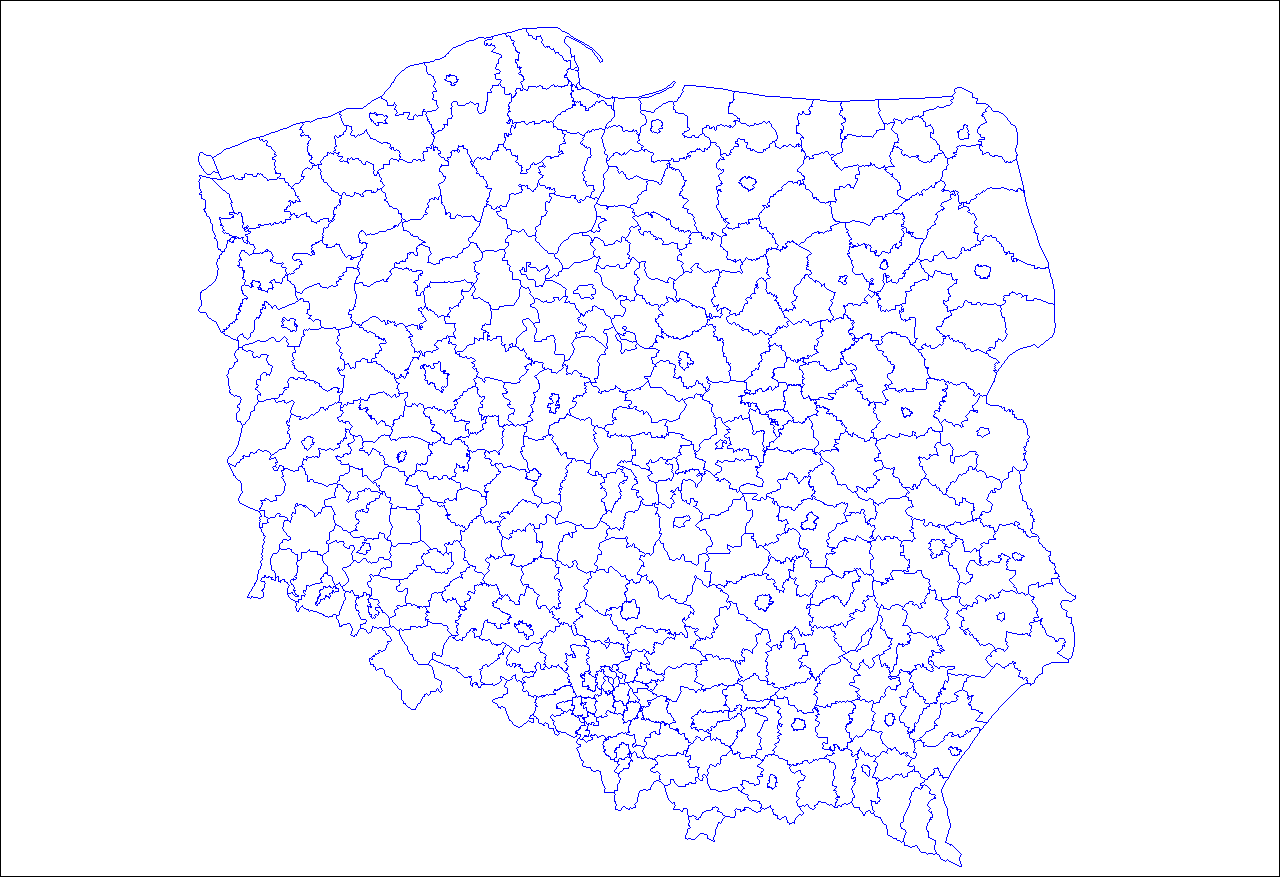
| Description | Map of the powiaty (counties) of Poland. Created by Rarelibra 03:07, 30 December 2006 (UTC) for public domain use, using MapInfo Professional v8.5 and various mapping resources. |
| Date | 30 December 2006 (original upload date) |
| Source | No machine-readable source provided. Own work assumed (based on copyright claims). |
| Author | No machine-readable author provided. Rarelibra assumed (based on copyright claims). |
Licensing[edit]
| I, the copyright holder of this work, release this work into the public domain. This applies worldwide. In some countries this may not be legally possible; if so: I grant anyone the right to use this work for any purpose, without any conditions, unless such conditions are required by law. |
derivative works[edit]
Derivative works of this file: Single seat constituencies - elections to the Senate of Poland.png
File history
Click on a date/time to view the file as it appeared at that time.
| Date/Time | Thumbnail | Dimensions | User | Comment | |
|---|---|---|---|---|---|
| current | 14:28, 16 March 2007 | | 1,281 × 878 (58 KB) | Rarelibra (talk | contribs) | Upload new and updated/accurate version. |
| 03:07, 30 December 2006 |  | 1,253 × 868 (41 KB) | Rarelibra (talk | contribs) | Map of the powiaty (counties) of Poland. Created by ~~~~ for public domain use, using MapInfo Professional v8.5 and various mapping resources. |
You cannot overwrite this file.
File usage on Commons
The following 2 pages use this file:
File usage on other wikis
The following other wikis use this file:
- Usage on en.wikipedia.org
- Usage on jv.wikipedia.org