File:Permyakia03.png
Jump to navigation
Jump to search
Size of this preview: 555 × 600 pixels. Other resolutions: 222 × 240 pixels | 444 × 480 pixels | 722 × 780 pixels.
Original file (722 × 780 pixels, file size: 41 KB, MIME type: image/png)
Captions
Captions
Add a one-line explanation of what this file represents
Summary[edit]
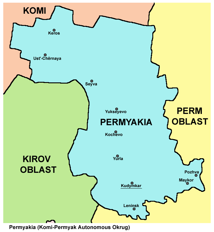
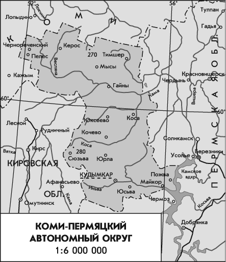
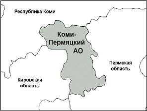
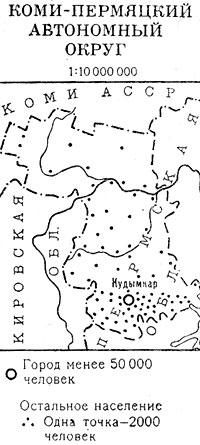
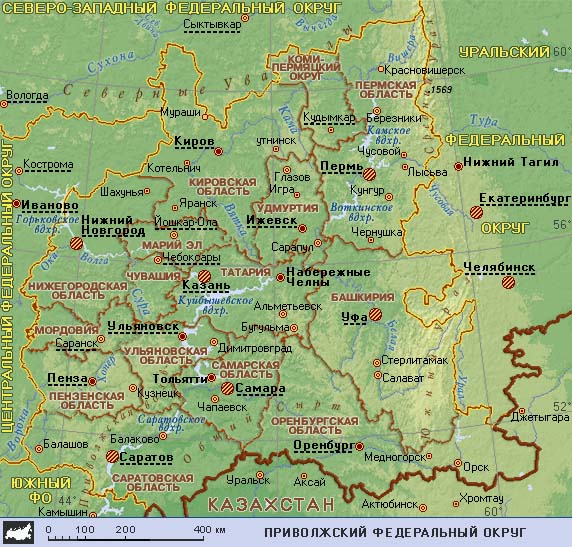
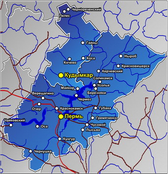
- Map of Permyakia (Komi-Permyak Autonomous Okrug) until 2005. Current Komi-Permyak Okrug has same borders, but different status.
Source and license[edit]

|
This map has been uploaded by Electionworld from en.wikipedia.org to enable the |
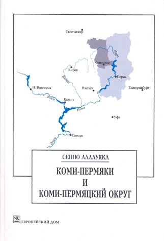
Map made by PANONIAN
| This work has been released into the public domain by its author, PANONIAN. This applies worldwide. In some countries this may not be legally possible; if so: |
References[edit]
- http://www.komipermyatskiiao.ru/images/karta(38).jpg
- http://www.giskpo.narod.ru/images/file1.jpg
- http://dic.academic.ru/pictures/enc_geo/Komi-permyatskiy_avtonomny_okrug.jpg
- http://www.map-site.ru/komipermack-1.jpg
- http://komiperm.ru/sites/default/files/img/КАРТА%20округа.jpg
- http://www.wdcb.ru/mining/obzor/Doc_1998/Maps/6-9f.gif
- http://letopisi.ru/images/f/fc/Karta-komi-permyatskogo-okruga.PNG
- http://nation.geoman.ru/demogr/item/f00/s00/e0000510/pic/000000.jpg
- http://gazelz.narod.ru/russia/pfo/pfo.jpg
- http://megadoski.ru/s_images/12463826079467.jpg
- http://ruskline.ru/images/2012/23034.jpg
- http://www.59.mchs.gov.ru/upload/salekhard/0001.jpg
- http://mariuver.files.wordpress.com/2011/03/lallukka_komi-permjaki.jpg
.jpg)
File history
Click on a date/time to view the file as it appeared at that time.
| Date/Time | Thumbnail | Dimensions | User | Comment | |
|---|---|---|---|---|---|
| current | 19:45, 15 July 2012 | | 722 × 780 (41 KB) | PANONIAN (talk | contribs) | improved version |
| 16:08, 29 December 2006 |  | 564 × 607 (17 KB) | Electionworld (talk | contribs) | {{ew|en|PANONIAN}} Map made by PANONIAN {{PD-user|PANONIAN}} Category:Maps of the Russian republics |
You cannot overwrite this file.
File usage on Commons
The following page uses this file:
File usage on other wikis
The following other wikis use this file:
- Usage on ca.wikipedia.org
- Usage on cs.wikipedia.org
- Usage on cv.wikipedia.org
- Usage on de.wikipedia.org
- Usage on en.wikipedia.org
- Usage on eo.wikipedia.org
- Usage on es.wikipedia.org
- Usage on et.wikipedia.org
- Usage on fi.wikipedia.org
- Usage on hr.wikipedia.org
- Usage on it.wikipedia.org
- Usage on ja.wikipedia.org
- Usage on koi.wikipedia.org
- Usage on ko.wikipedia.org
- Usage on kv.wikipedia.org
- Usage on lt.wikipedia.org
- Usage on nl.wikipedia.org
- Usage on nn.wikipedia.org
- Usage on pl.wikipedia.org
- Usage on pt.wikipedia.org
- Usage on sh.wikipedia.org
- Usage on sr.wikipedia.org
- Usage on udm.wikipedia.org
- Usage on uk.wikipedia.org
- Usage on zh.wikipedia.org