File:Maro map lrg.gif
Jump to navigation
Jump to search
No higher resolution available.
Maro_map_lrg.gif (600 × 547 pixels, file size: 17 KB, MIME type: image/gif)
Captions
Captions
Add a one-line explanation of what this file represents
Summary[edit]
| Description |
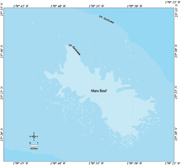
Deutsch: Bathymetrische Karte des Maroriffs, Nordwestliche Hawaii-Inseln
English: Bathymetric map of Maro Reef, Northwestern Hawaiian Islands |
| Date | not specified |
| Source | http://www.hawaiireef.noaa.gov/imagery/graphicmaps.html |
| Author | Christine Taylor, NOAA's National Marine Sanctuary Program |
| Permission (Reusing this file) |
credit to NOAA is preferred |
Licensing[edit]
This image is in the public domain because it contains materials that originally came from the U.S. National Oceanic and Atmospheric Administration, taken or made as part of an employee's official duties.
|
File history
Click on a date/time to view the file as it appeared at that time.
| Date/Time | Thumbnail | Dimensions | User | Comment | |
|---|---|---|---|---|---|
| current | 11:25, 20 August 2008 | | 600 × 547 (17 KB) | Telim tor (talk | contribs) | == Information == {{Information |Description= {{de|Bathymetrische Karte des Maroriffs, Nordwestliche Hawaii-Inseln}} {{en|Bathymetric map of Maro Reef, Northwestern Hawaiian Islands}} |Source=http://www.hawaiireef.noaa.gov/imagery/graphicmaps.html |Date=u |
You cannot overwrite this file.
File usage on Commons
There are no pages that use this file.
File usage on other wikis
The following other wikis use this file:
- Usage on ceb.wikipedia.org
- Usage on de.wikipedia.org
- Usage on eo.wikipedia.org
- Usage on frr.wikipedia.org
- Usage on ja.wikipedia.org
- Usage on nl.wikipedia.org
- Usage on pl.wikipedia.org
- Usage on pt.wikipedia.org
- Usage on ru.wikipedia.org
- Usage on vi.wikipedia.org
- Usage on zh.wikipedia.org