File:Map of Burzenland, 1959.jpg
Jump to navigation
Jump to search
Size of this preview: 367 × 599 pixels. Other resolutions: 147 × 240 pixels | 294 × 480 pixels | 470 × 768 pixels | 1,270 × 2,073 pixels.
Original file (1,270 × 2,073 pixels, file size: 1.99 MB, MIME type: image/jpeg)
Captions
Captions
Add a one-line explanation of what this file represents
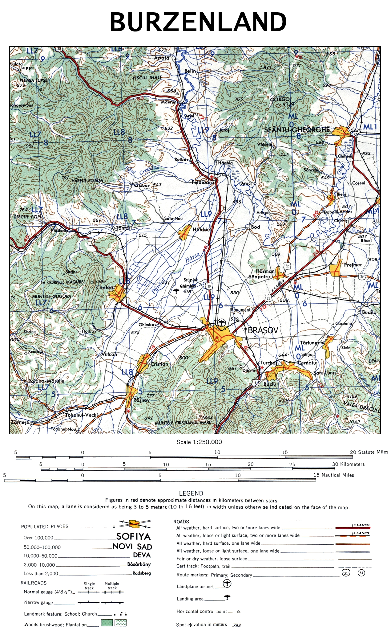
| Description | The map of Burzenland, Romania. |
| Date | |
| Source | University of Texas Libraries |
| Author | US Army Map Service, Corps of Engineers |
| Other versions |

This image or file is a work of a U.S. Army Corps of Engineers soldier or employee, taken or made as part of that person's official duties. As a work of the U.S. federal government, the image is in the public domain.
|
File history
Click on a date/time to view the file as it appeared at that time.
| Date/Time | Thumbnail | Dimensions | User | Comment | |
|---|---|---|---|---|---|
| current | 21:48, 12 November 2009 | | 1,270 × 2,073 (1.99 MB) | Alex:D (talk | contribs) | {{Information |Description= The map of Burzenland, Romania. |Source= [http://www.lib.utexas.edu/maps/ams/western_europe/ University of Texas Libraries] |Date= 1959 |Author= US Army Map Service, Corps of Engineers |Permission= |other_versions={{ExtractedFr |
You cannot overwrite this file.
File usage on Commons
The following 2 pages use this file:
File usage on other wikis
The following other wikis use this file:
- Usage on ca.wikipedia.org
- Usage on cs.wikipedia.org
- Usage on da.wikipedia.org
- Usage on de.wikipedia.org
- Usage on en.wikipedia.org
- Usage on es.wikipedia.org
- Usage on fr.wikipedia.org
- Usage on hu.wikipedia.org
- Usage on it.wikipedia.org
- Usage on ja.wikipedia.org
- Usage on pl.wikipedia.org
- Usage on ru.wikipedia.org
- Usage on sk.wikipedia.org
- Usage on zh.wikipedia.org