File:Kabardino-Balkaria-district.PNG
Jump to navigation
Jump to search

Size of this preview: 784 × 599 pixels. Other resolutions: 314 × 240 pixels | 628 × 480 pixels | 1,005 × 768 pixels | 1,280 × 979 pixels | 1,520 × 1,162 pixels.
Original file (1,520 × 1,162 pixels, file size: 235 KB, MIME type: image/png)
Captions
Captions
Add a one-line explanation of what this file represents

|
File:Kabardino-Balkaria location map.svg is a vector version of this file. It should be used in place of this PNG file when not inferior.
File:Kabardino-Balkaria-district.PNG → File:Kabardino-Balkaria location map.svg
For more information, see Help:SVG. |
 |
Summary[edit]
| Description |
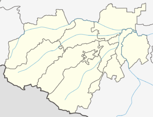
English: Locator map of Republic of Kabardino-Balkaria
Русский: Позиционная карта Республики Кабардино-Балкария |
| Date | |
| Source | Own work |
| Author | Дагиров Умар |
Licensing[edit]
I, the copyright holder of this work, hereby publish it under the following license:
This file is licensed under the Creative Commons Attribution-Share Alike 3.0 Unported license.
- You are free:
- to share – to copy, distribute and transmit the work
- to remix – to adapt the work
- Under the following conditions:
- attribution – You must give appropriate credit, provide a link to the license, and indicate if changes were made. You may do so in any reasonable manner, but not in any way that suggests the licensor endorses you or your use.
- share alike – If you remix, transform, or build upon the material, you must distribute your contributions under the same or compatible license as the original.
File history
Click on a date/time to view the file as it appeared at that time.
| Date/Time | Thumbnail | Dimensions | User | Comment | |
|---|---|---|---|---|---|
| current | 22:27, 30 November 2009 | | 1,520 × 1,162 (235 KB) | Пакко (talk | contribs) | corr |
| 22:22, 30 November 2009 |  | 1,549 × 1,183 (239 KB) | Пакко (talk | contribs) | upload new map version | |
| 17:31, 30 November 2009 |  | 3,425 × 2,635 (296 KB) | Takhirgeran Umar (talk | contribs) | Reverted to version as of 16:47, 30 November 2009 | |
| 17:29, 30 November 2009 |  | 3,425 × 2,635 (296 KB) | Takhirgeran Umar (talk | contribs) | Kabardino-Balkaria-district | |
| 16:47, 30 November 2009 |  | 3,425 × 2,635 (296 KB) | Takhirgeran Umar (talk | contribs) | Изменил красный цвет границ на черный | |
| 18:11, 25 October 2009 |  | 3,425 × 2,635 (295 KB) | Takhirgeran Umar (talk | contribs) | {{Information |Description={{en|1=Карта Кабардино-Балкарии}} {{ru|1=Karta Kabardino-Balkariy}} |Source=Own work by uploader |Author=Дагиров Умар |Date=25 10 2009 |Permission= |other_version |
You cannot overwrite this file.
File usage on Commons
The following page uses this file:
File usage on other wikis
The following other wikis use this file:
- Usage on fa.wikipedia.org
- Usage on id.wikipedia.org