File:Iran Faults map.svg
Jump to navigation
Jump to search

Size of this PNG preview of this SVG file: 695 × 600 pixels. Other resolutions: 278 × 240 pixels | 556 × 480 pixels | 890 × 768 pixels | 1,187 × 1,024 pixels | 2,373 × 2,048 pixels | 3,013 × 2,600 pixels.
Original file (SVG file, nominally 3,013 × 2,600 pixels, file size: 12.81 MB)
Captions
Captions
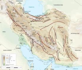
Iran Faults map
Summary[edit]
| Description | |
| Date | |
| Source | Own work |
| Author | Yamaha5 |
Licensing[edit]
I, the copyright holder of this work, hereby publish it under the following license:
This file is licensed under the Creative Commons Attribution-Share Alike 4.0 International license.
- You are free:
- to share – to copy, distribute and transmit the work
- to remix – to adapt the work
- Under the following conditions:
- attribution – You must give appropriate credit, provide a link to the license, and indicate if changes were made. You may do so in any reasonable manner, but not in any way that suggests the licensor endorses you or your use.
- share alike – If you remix, transform, or build upon the material, you must distribute your contributions under the same or compatible license as the original.

|
This SVG file contains embedded text that can be translated into your language, using any capable SVG editor, text editor or the SVG Translate tool. For more information see: About translating SVG files. |
File history
Click on a date/time to view the file as it appeared at that time.
| Date/Time | Thumbnail | Dimensions | User | Comment | |
|---|---|---|---|---|---|
| current | 15:01, 27 May 2020 | | 3,013 × 2,600 (12.81 MB) | Yamaha5 (talk | contribs) | File uploaded using svgtranslate tool (https://svgtranslate.toolforge.org/). Added translation for en. |
| 14:05, 8 May 2020 |  | 3,013 × 2,600 (12.81 MB) | Yamaha5 (talk | contribs) | File uploaded using svgtranslate tool (https://tools.wmflabs.org/svgtranslate/). Added translation for en. | |
| 14:04, 8 May 2020 |  | 3,013 × 2,600 (12.81 MB) | Yamaha5 (talk | contribs) | File uploaded using svgtranslate tool (https://tools.wmflabs.org/svgtranslate/). Added translation for en. | |
| 13:48, 8 May 2020 |  | 3,013 × 2,600 (12.71 MB) | Yamaha5 (talk | contribs) | File uploaded using svgtranslate tool (https://tools.wmflabs.org/svgtranslate/). Added translation for fa. | |
| 13:36, 8 May 2020 |  | 3,013 × 2,600 (13.56 MB) | Yamaha5 (talk | contribs) | Uploaded own work with UploadWizard |
You cannot overwrite this file.
File usage on Commons
The following page uses this file:
File usage on other wikis
The following other wikis use this file:
- Usage on ar.wikipedia.org
- Usage on de.wikipedia.org
- Usage on en.wikipedia.org
- Usage on fa.wikipedia.org
- فهرست زمینلرزههای ایران
- گسل شمال تهران
- گسل درونه
- الگو:گسلهای مهم ایران
- راندگی اصلی زاگرس
- کمربند چینخورده و رانده زاگرس
- گسل ریوند
- گسل کشفرود
- گسلهای ایران
- گسل مشاء-فشم
- گسل سراسری زاگرس
- گسل زاگرس بلند
- گسل کازرون
- گسل دنا
- گسل جوان زاگرس
- گسل نهبندان
- گسل میناب
- گسل اردل
- گسل زردکوه
- گسل آغاجاری
- گسل مارون
- گسل بشاگرد
- گسل هریرود
- گسل بینالود
- گسل میامی
- گسل دهشیر
- گسل نایبند
- گسل پشتبادام
- گسل کلمرد
- گسل ترود و انجیلو
- گسل قم–زفره
- گسل شهداد
- گسل کوهبنان
- گسل سروستان
- گسل جرجافک
- گسل گلباف
- گسل ایندس
- گسل تبریز
- گسل ارومیه–زرینهرود
- گسل آستارا
- گسل کندوان
- گسل سلطانیه
- گسل البرز
- گسل سمنان
- گسل دامغان
- گسل عطاری
View more global usage of this file.