File:India Ladakh locator map.svg

Original file (SVG file, nominally 1,574 × 1,738 pixels, file size: 966 KB)
Captions
Captions
Summary[edit]
| Description |
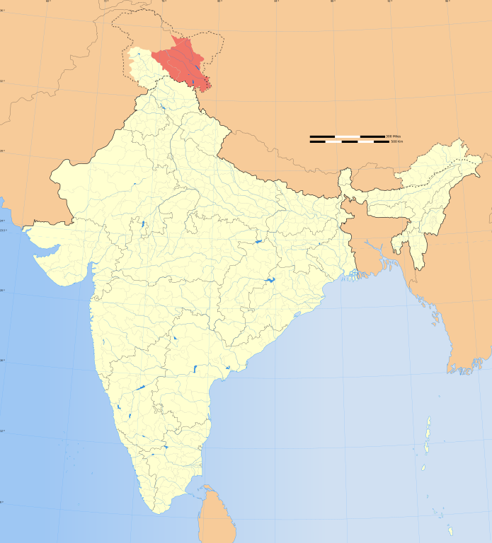
Ladakh locator map |
|||||||||
| Map legend |
 |
|||||||||
| Date | ||||||||||
| Source | File:India map blank.svg | |||||||||
| Creator |
|
|||||||||
| Permission (Reusing this file) |
|
|||||||||
| Geotemporal data | ||||||||||
| Map location | India | |||||||||
| Spatial reference system | conic | |||||||||
| Bounding box |
|
|||||||||
| Georeferencing | If inappropriate please set warp_status = skip to hide. | |||||||||
| Archival data | ||||||||||
| Notes | Part of WikiProject India Maps | |||||||||
| SVG development | ||||||||||
| Other versions |
|
|||||||||


Notes[edit]
Depiction of India's borders[edit]
- The territorial boundaries of India are shown as per the actual ground situation in accordance with international practices followed by the United Nations ([1], [2]) and the National Geographic Society ([3], [4])
- This map is meant to be for illustrative purpose only and is not authenticated by official government sources. Please check the list of sources and references used to create the map for a measure of accuracy and verifiability.
- The usage of these maps in India, Pakistan and China are governed by different laws that restrict depictions of boundaries other than what is officially recognized by the state. Please check local laws and modify the map accordingly before use.
Explanation of disputed boundaries[edit]


- Boundary of Indian claim : The territory India claims is legally theirs, but the claim is disputed by China and Pakistan.
- Line of Control/Line of Conflict : The de facto administrative boundary recognised by the international community. This UN ceasefire line is considered as a temporary solution to an ongoing conflict since the departure of the British Raj.
Borders of disputed regions[edit]
The depicted extent of the former territory of the British Indian Empire, succeeded by Republic of India, may not be accepted by few countries as legal due to ongoing border disputes:
- The northern Himalayan region of the disputed territory Indian-administered Kashmir is claimed by India including (Pakistan-administered Kashmir) and the Chinese-occupied territory of (Ladakh plateau). Since 1972, it is divided between all three countries. See also Line of Control and Line of Actual Control.
- Siachen glacier (shown white) is an actively contested region between India and Pakistan. Since 1984, the region is under Indian control.
- The northeastern territory of Arunachal Pradesh is almost entirely claimed by China as part of its Tibetan territory.
- Minor areas of eastern Kashmir's Ladakh division, Himachal Pradesh and Uttarakhand on the Chinese frontier are claimed by China. These areas are under Indian control.
- A small area of Uttarakhand adjoining the Nepal border along the Sarda river is disputed between the two countries.
For a detailed map of all disputed regions in South Asia, see Image:India disputed areas map.svg
Internal borders[edit]
The borders of the state of Meghalaya, Assam and Arunachal Pradesh are shown as interpreted from the North-Eastern Areas (Reorganisation) Act, 1971, but has yet to be verified.
Territorial waters[edit]
The limit of the territorial waters of India extends to twelve nautical miles measured from the appropriate baseline. See this for more information.
Licensing[edit]
- You are free:
- to share – to copy, distribute and transmit the work
- to remix – to adapt the work
- Under the following conditions:
- attribution – You must give appropriate credit, provide a link to the license, and indicate if changes were made. You may do so in any reasonable manner, but not in any way that suggests the licensor endorses you or your use.
- share alike – If you remix, transform, or build upon the material, you must distribute your contributions under the same or compatible license as the original.
File history
Click on a date/time to view the file as it appeared at that time.
| Date/Time | Thumbnail | Dimensions | User | Comment | |
|---|---|---|---|---|---|
| current | 08:23, 4 November 2020 | | 1,574 × 1,738 (966 KB) | Sbb1413 (talk | contribs) | Included Siachen Glacier in Ladakh. |
| 14:54, 21 October 2020 |  | 1,574 × 1,738 (966 KB) | Sbb1413 (talk | contribs) | == {{int:filedesc}} == {{Map |description=Ladakh locator map |legend=left |date=21 October 2020 |source=File:India map blank.svg |author={{U|Soumya-8974}}<br>{{User:PlaneMad/Info}} <br/> '''International Borders:''' [http://www.lib.utexas.edu/maps/ University of Texas map library] - [http://www.lib.utexas.edu/maps/middle_east_and_asia/india_pol01.jpg India Political map 2001]<br/> '''Disputed Borders:''' [http://www.lib.utexas.edu/maps/ University of Tex... |
You cannot overwrite this file.
File usage on Commons
The following 2 pages use this file:
File usage on other wikis
The following other wikis use this file:
- Usage on en.wikipedia.org
- Wikipedia:WikiProject India
- Wikipedia:Userboxes/Location/India
- Wikipedia:Userboxes/Life/Ethnicity/02
- Wikipedia:Userboxes/WikiProjects/Regional/05
- Wikipedia:WikiProject India/userbox templates
- Wikipedia:Userboxes/Life/Residence/04
- Wikipedia:Userboxes/Life/Origin/04
- Wikipedia:Userboxes/Life/Ancestry/06
- Wikipedia:WikiProject Ladakh
- Template:User in Ladakh
- Template:User Ladakh/doc1
- Template:User in Ladakh/doc
- Template:User citizen Ladakh
- Template:User citizen Ladakh/doc
- Template:User from Ladakh
- Template:User from Ladakh/doc
- Template:User interest Ladakh
- Template:User interest Ladakh/doc
- Template:User WP Ladakh
- Template:User WP Ladakh/doc
- Outline of Ladakh
- Template:User interest Kashmir
- Template:User Kashmir/doc1
- Template:User in Kashmir
- Template:User in Kashmir/doc
- Template:User interest Kashmir/doc
- Template:User from Kashmir
- Template:User from Kashmir/doc
- Wikipedia:Userboxes/Location/Kashmir/Subregions
- User:HarrySupertyphoon
- Wikipedia:Userboxes/Travel/India
- Usage on en.wiktionary.org
- Usage on it.wikipedia.org