File:Global Sea Surface Temperature - GPN-2003-00032.jpg
Jump to navigation
Jump to search
Size of this preview: 800 × 401 pixels. Other resolutions: 320 × 160 pixels | 640 × 320 pixels | 1,024 × 513 pixels | 1,280 × 641 pixels | 2,876 × 1,440 pixels.
Original file (2,876 × 1,440 pixels, file size: 5.31 MB, MIME type: image/jpeg)
Captions
Captions
Add a one-line explanation of what this file represents
| Description |
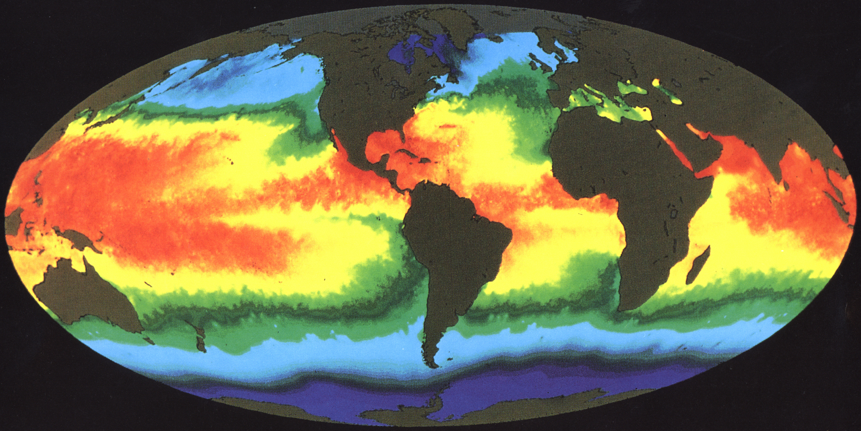
English: This illustration of Earth's sea surface temperature was obtained from two weeks of infrared observations by the Advanced Very High Resolution Radiometer (AVHRR), an instrument on board NOAA-7 during July 1984. Temperatures are color coded with red being warmest and decreasing through oranges, yellows, greens, and blues. Temperature patterns seen in this image are the result of many influences, including the circulation of the ocean, surface winds, and solar heating. The image indicates a large pool of warm water in the Western Pacific and a tongue of relatively cold water extending along the Equator westward from South America. Every few years, there occurs an interrelated set of changes in the global atmospheric and oceanic circulation known as an El Ni±o in which the region of warm equatorial water in the West extends eastward across the Pacific and blankets the cool, productive regions along the coast of South America. Fish, birds, and marine mammals that depend upon the normally phytoplankton-rich waters often die in large numbers during El Ni±o. Images of sea surface temperature such as this help scientists to better monitor and ultimately understand the changes to Earth caused by events such as El Ni±o. |
|||||
| Date | ||||||
| Source | Great Images in NASA Description | |||||
| Author | NASA | |||||
| Permission (Reusing this file) |
|

This image or video was catalogued by Goddard Space Flight Center of the United States National Aeronautics and Space Administration (NASA) under Photo ID: GPN-2003-00032 and Alternate ID: GSST. This tag does not indicate the copyright status of the attached work. A normal copyright tag is still required. See Commons:Licensing. Other languages:
|
| Annotations | This image is annotated: View the annotations at Commons |
File history
Click on a date/time to view the file as it appeared at that time.
| Date/Time | Thumbnail | Dimensions | User | Comment | |
|---|---|---|---|---|---|
| current | 10:14, 1 May 2015 | | 2,876 × 1,440 (5.31 MB) | Jcpag2012 (talk | contribs) | crop |
| 00:18, 10 April 2009 |  | 3,000 × 2,400 (6.22 MB) | BotMultichillT (talk | contribs) | {{Information |Description={{en|1=This illustration of Earth's sea surface temperature was obtained from two weeks of infrared observations by the Advanced Very High Resolution Radiometer (AVHRR), an instrument on board NOAA-7 during July 1984. Temperatur |
You cannot overwrite this file.
File usage on Commons
There are no pages that use this file.
File usage on other wikis
The following other wikis use this file:
- Usage on be.wikipedia.org
- Usage on ca.wikipedia.org
- Usage on crh.wikipedia.org
- Usage on en.wikipedia.org
- Usage on en.wikiversity.org
- Usage on eo.wikipedia.org
- Usage on it.wikipedia.org
- Usage on ja.wikiversity.org
- Usage on sw.wiktionary.org
- Usage on uk.wikipedia.org