File:Gdansk Bay Borderlines 1939 Esperanto.svg
Jump to navigation
Jump to search

Size of this PNG preview of this SVG file: 800 × 517 pixels. Other resolutions: 320 × 207 pixels | 640 × 414 pixels | 1,024 × 662 pixels | 1,280 × 828 pixels | 2,560 × 1,656 pixels | 1,339 × 866 pixels.
Original file (SVG file, nominally 1,339 × 866 pixels, file size: 161 KB)
Captions
Captions
Add a one-line explanation of what this file represents
| Description |
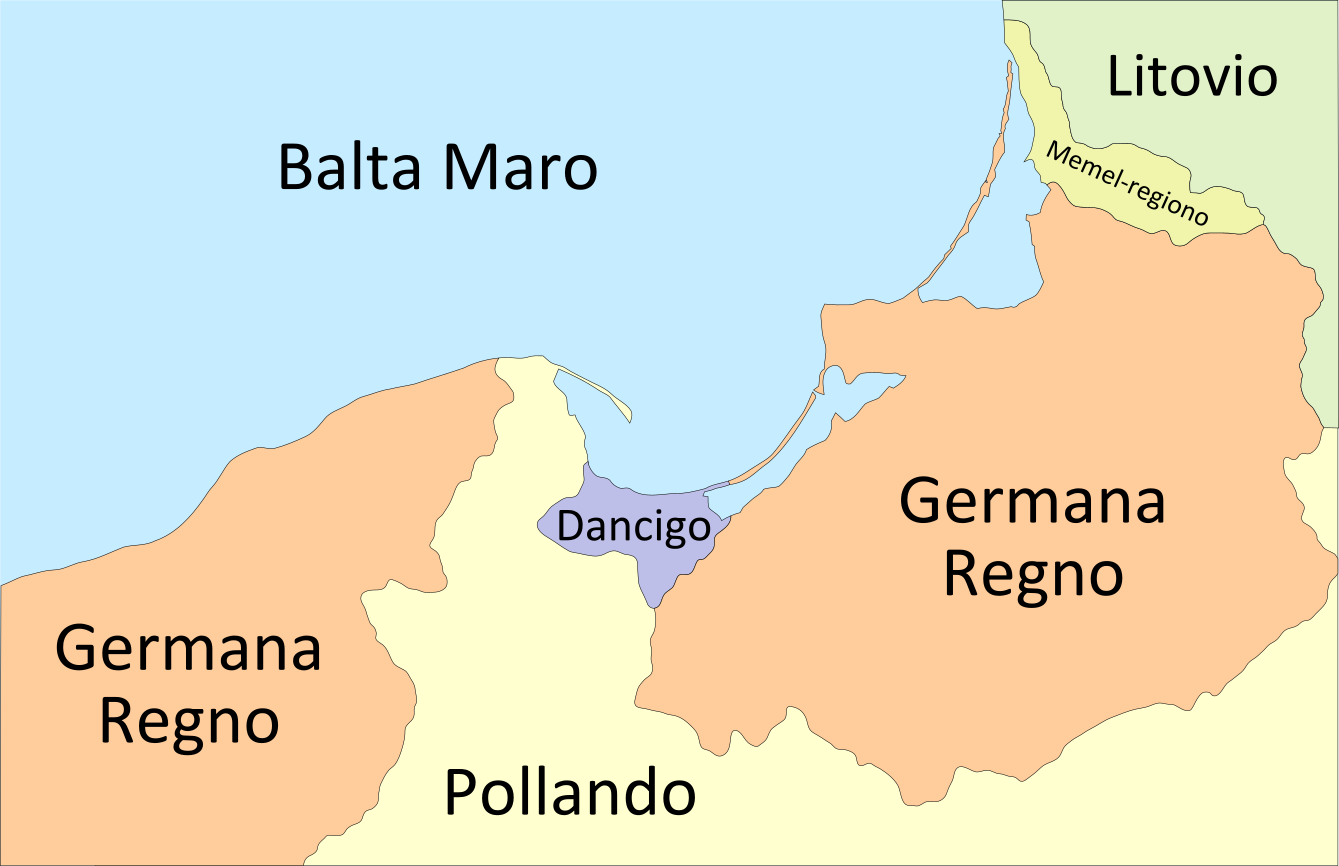
English: Map of the Gdańsk Bay in 1939. The Memel Territory was retransfered from Lithuania to Germany in March 1939. Deutsch: Karte der Danziger Bucht mit den Grenzen von 1939. Das Memelland ging im März 1939 von Litauen zurück an das Deutsche Reich Esperanto: Mapo de la eo:Golfo de Gdansko en 1939. eo:Memel-regiono apartenis ĝis marto 1939 al eo:Litovio, depost tiam - al eo:Germana Regno. |
| Date | (UTC) |
| Source | |
| Author |
|
| Other versions |
[]
|


I, the copyright holder of this work, hereby publish it under the following licenses:
| This file is licensed under the Creative Commons Attribution-Share Alike 3.0 Unported license. | ||
| ||
| This licensing tag was added to this file as part of the GFDL licensing update. |

|
Permission is granted to copy, distribute and/or modify this document under the terms of the GNU Free Documentation License, Version 1.2 or any later version published by the Free Software Foundation; with no Invariant Sections, no Front-Cover Texts, and no Back-Cover Texts. A copy of the license is included in the section entitled GNU Free Documentation License. |
You may select the license of your choice.
Original upload log[edit]
This image is a derivative work of the following images:
- File:Gdansk_Bay_Borderlines_1939_English.svg licensed with Cc-by-sa-3.0-migrated, GFDL
- 2009-11-21T00:11:17Z Justass 1339x866 (50372 Bytes) font
- 2009-11-21T00:09:17Z Justass 1339x866 (27314 Bytes) borders
- 2009-11-21T00:07:29Z Justass 1858x1202 (26882 Bytes) {{Information |Description={{en|Map of the [[:en:Gdańsk Bay|Gdańsk Bay]] in 1939. The [[:en:Klaipėda Region|Memel Territory]] was retransfered from [[:en:Lithuania|Lithuania]] to [[:en:Germany|Germany]] in March 1939.}}{{
Uploaded with derivativeFX
File history
Click on a date/time to view the file as it appeared at that time.
| Date/Time | Thumbnail | Dimensions | User | Comment | |
|---|---|---|---|---|---|
| current | 13:13, 4 October 2010 | | 1,339 × 866 (161 KB) | Wierzbowski (talk | contribs) | {{Information |Description={{en|Map of the Gdańsk Bay in 1939. The Memel Territory was retransfered from Lithuania to Germany in March 1939.}}{{de|Karte der [[:de:Danziger Bu |
You cannot overwrite this file.
File usage on Commons
The following 18 pages use this file:
- User:Blahma/Esperanto en Vikimedia Komunejo
- File:Danzig 1919–1939-ar.svg
- File:Danzig Bay Borderlines 1939 Hebrew.jpg
- File:Danzig Bay Borderlines 1939 Hebrew Danzig.jpg
- File:Danzigi linnriigi asukoht.jpg
- File:Gdansk Bay Borderlines 1939-hu.svg
- File:Gdansk Bay Borderlines 1939 Chinese.svg
- File:Gdansk Bay Borderlines 1939 English.svg
- File:Gdansk Bay Borderlines 1939 Esperanto.svg
- File:Gdansk Bay Borderlines 1939 Français.svg
- File:Gdansk Bay Borderlines 1939 German.png
- File:Gdansk Bay Borderlines 1939 Polish.png
- File:Gdansk Bay Borderlines 1939 Welsh.svg
- File:Gdansk Bay Borderlines 1939 blank.png
- File:Gdansk Bay Borderlines 1939 greek.png
- File:Gdansk Bay Borderlines 1939 ko.svg
- File:Gdansk Bay Details 1939 english.PNG
- Template:Other versions/Gdansk Bay Borderlines
File usage on other wikis
The following other wikis use this file:
- Usage on eo.wikipedia.org