File:Europe location AZN.png
Jump to navigation
Jump to search
Size of this preview: 800 × 600 pixels. Other resolutions: 320 × 240 pixels | 640 × 480 pixels | 1,024 × 768 pixels | 1,280 × 960 pixels | 1,600 × 1,200 pixels.
Original file (1,600 × 1,200 pixels, file size: 152 KB, MIME type: image/png)
Captions
Captions
Add a one-line explanation of what this file represents

|
This locator map image could be re-created using vector graphics as an SVG file. This has several advantages; see Commons:Media for cleanup for more information. If an SVG form of this image is available, please upload it and afterwards replace this template with
{{vector version available|new image name}}.
It is recommended to name the SVG file “Europe location AZN.svg”—then the template Vector version available (or Vva) does not need the new image name parameter. |
| Description |
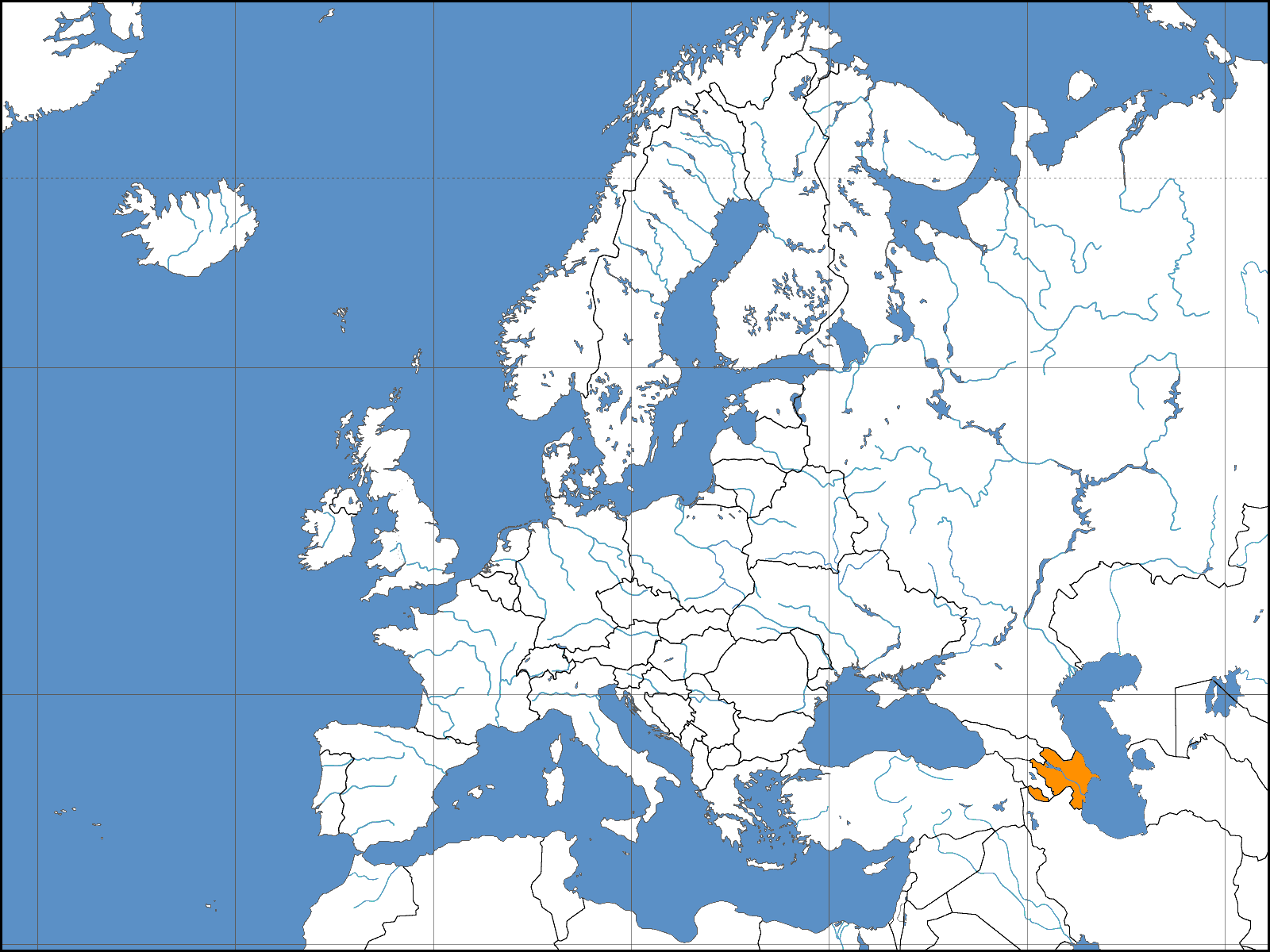
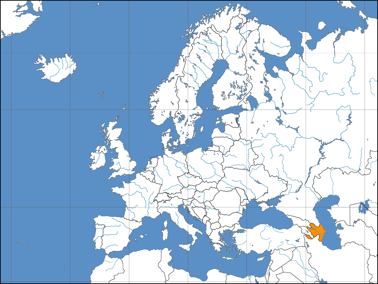
Deutsch: Lage der Republik Aserbaidschan in Europa Stand: November 2006 |
||||||||
| Date | 4.11.2006 | ||||||||
| Source | Based on work by David Liuzzo | ||||||||
| Author | Clevelander | ||||||||
| Permission (Reusing this file) |
I, the copyright holder of this work, hereby publish it under the following licenses:
This file is licensed under the Creative Commons Attribution-Share Alike 2.0 Germany license.
 You may select the license of your choice. |
||||||||
| Other versions | File:Europe location AZE.png: UNO-approved borders. |

File history
Click on a date/time to view the file as it appeared at that time.
| Date/Time | Thumbnail | Dimensions | User | Comment | |
|---|---|---|---|---|---|
| current | 15:08, 12 November 2006 | | 1,600 × 1,200 (152 KB) | Aivazovsky~commonswiki (talk | contribs) | |
| 07:23, 9 November 2006 |  | 1,600 × 1,200 (160 KB) | DLiuzzo (talk | contribs) | '''STOP CHANGING THE MAP!!!''' '''Don't Change the Borders on MY MAPS!!!''' {{Information| |Description={{de|Politische Karte des Kontinents Europa. Leere Lagekarte zur Darstellung der Lage von Staaten in Europa. Europa ist grau hervorgehoben.}} |Source | |
| 23:57, 8 November 2006 |  | 1,600 × 1,200 (156 KB) | Khoikhoi~commonswiki (talk | contribs) | Reverted to earlier revision | |
| 01:41, 8 November 2006 |  | 1,600 × 1,200 (160 KB) | DLiuzzo (talk | contribs) | '''STOP CHANGING THE MAP!!!''' '''Don't Change the Borders on MY MAPS!!!''' {{Information| |Description={{de|Politische Karte des Kontinents Europa. Leere Lagekarte zur Darstellung der Lage von Staaten in Europa. Europa ist grau hervorgehoben.}} |Source | |
| 19:00, 4 November 2006 |  | 1,600 × 1,200 (156 KB) | Aivazovsky~commonswiki (talk | contribs) | {{Information| |Description={{de|Lage der Republik Aserbaidschan in Europa<BR>Stand: November 2006}} |Source= Based on work by David Liuzzo |Date= 4.11.2006 |Author= Clevelander |Permission={{self2|GFDL|Cc-by-sa- |
You cannot overwrite this file.
File usage on Commons
The following page uses this file:
File usage on other wikis
The following other wikis use this file:
- Usage on de.wikinews.org
- Usage on de.wiktionary.org
- Usage on es.wikipedia.org
- Usage on uk.wikipedia.org