File:East Timor-regions Loro Sae.png
Jump to navigation
Jump to search

Size of this preview: 800 × 461 pixels. Other resolutions: 320 × 185 pixels | 640 × 369 pixels | 1,024 × 591 pixels | 1,280 × 738 pixels | 3,344 × 1,929 pixels.
Original file (3,344 × 1,929 pixels, file size: 179 KB, MIME type: image/png)
Captions
Captions
Add a one-line explanation of what this file represents
Summary[edit]
| Description |
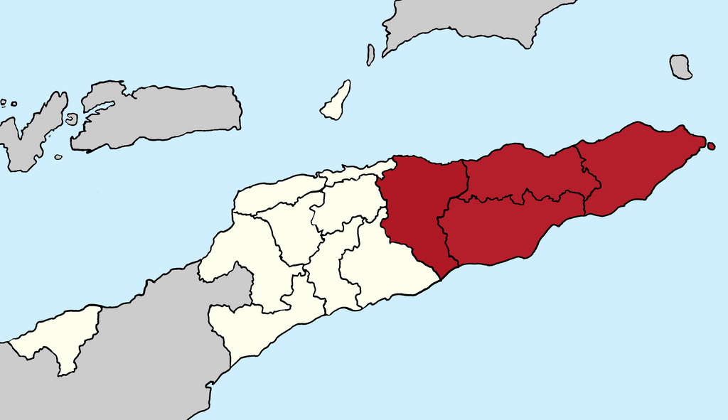
English: Map of East Timor showing the regions Loro Munu (white) and Loro Sae (red). Map after reformation of the municipalities borders 2015. |
| Date | |
| Source | Own work |
| Author | J. Patrick Fischer |
Licensing[edit]
I, the copyright holder of this work, hereby publish it under the following license:
This file is licensed under the Creative Commons Attribution-Share Alike 4.0 International license.
- You are free:
- to share – to copy, distribute and transmit the work
- to remix – to adapt the work
- Under the following conditions:
- attribution – You must give appropriate credit, provide a link to the license, and indicate if changes were made. You may do so in any reasonable manner, but not in any way that suggests the licensor endorses you or your use.
- share alike – If you remix, transform, or build upon the material, you must distribute your contributions under the same or compatible license as the original.
File history
Click on a date/time to view the file as it appeared at that time.
| Date/Time | Thumbnail | Dimensions | User | Comment | |
|---|---|---|---|---|---|
| current | 06:53, 1 June 2018 | | 3,344 × 1,929 (179 KB) | J. Patrick Fischer (talk | contribs) | {{Information |description={{en|1=Map of East Timor showing the regions Loro Munu (white) and Loro Sae (red). Map after reformation of the municipalities borders 2015.}} |date=2018-06-01 |source={{own}} |author=J. Patrick Fischer |permission= |other versions= }} =={{int:license-header}}== {{self|cc-by-sa-4.0}} Category:Maps of East Timor Category:Images by J. Patrick Fischer |
You cannot overwrite this file.
File usage on Commons
The following page uses this file:
File usage on other wikis
The following other wikis use this file:
- Usage on de.wikipedia.org
- Usage on el.wikipedia.org
- Usage on en.wikipedia.org