File:Earth dry elevation.png
Jump to navigation
Jump to search

Size of this preview: 800 × 400 pixels. Other resolutions: 320 × 160 pixels | 640 × 320 pixels | 1,024 × 512 pixels | 1,280 × 640 pixels | 2,160 × 1,080 pixels.
Original file (2,160 × 1,080 pixels, file size: 827 KB, MIME type: image/png)
Captions
Captions
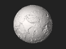
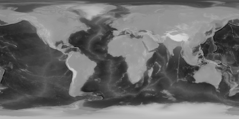
Equirectangular depthmap of Earth combining topography and bathymetry from NASA Visible Earth
Summary[edit]
| Description |
English: Equirectangular depthmap of Earth combining topography and bathymetry from NASA Visible Earth to generate File:Earth_dry_elevation.stl |
|
| Date | ||
| Source | http://visibleearth.nasa.gov/view.php?id=73934 (topography) and http://visibleearth.nasa.gov/view.php?id=73963 (bathymetry) | |
| Author | NASA Visible Earth and cmglee | |
| Other versions |
|
Licensing[edit]
| This file is in the public domain in the United States because it was solely created by NASA. NASA copyright policy states that "NASA material is not protected by copyright unless noted". (See Template:PD-USGov, NASA copyright policy page or JPL Image Use Policy.) | ||
 |
Warnings:
|
File history
Click on a date/time to view the file as it appeared at that time.
| Date/Time | Thumbnail | Dimensions | User | Comment | |
|---|---|---|---|---|---|
| current | 19:12, 1 April 2021 | | 2,160 × 1,080 (827 KB) | Cmglee (talk | contribs) | Uploaded a work by NASA Visible Earth and cmglee from http://visibleearth.nasa.gov/view.php?id=73934 (topography) and http://visibleearth.nasa.gov/view.php?id=73963 (bathymetry) with UploadWizard |
You cannot overwrite this file.
File usage on Commons
The following 2 pages use this file:
File usage on other wikis
The following other wikis use this file:
- Usage on id.wikipedia.org