File:Delta II with SMAP at VAFB SLC-2 (KSC-2015-1247).jpg
Jump to navigation
Jump to search
Size of this preview: 400 × 600 pixels. Other resolutions: 160 × 240 pixels | 320 × 480 pixels | 512 × 768 pixels | 682 × 1,024 pixels | 2,000 × 3,000 pixels.
Original file (2,000 × 3,000 pixels, file size: 4.67 MB, MIME type: image/jpeg)
Captions
Captions
Add a one-line explanation of what this file represents
Summary[edit]
.jpg&action=edit§ion=1)
| Description |
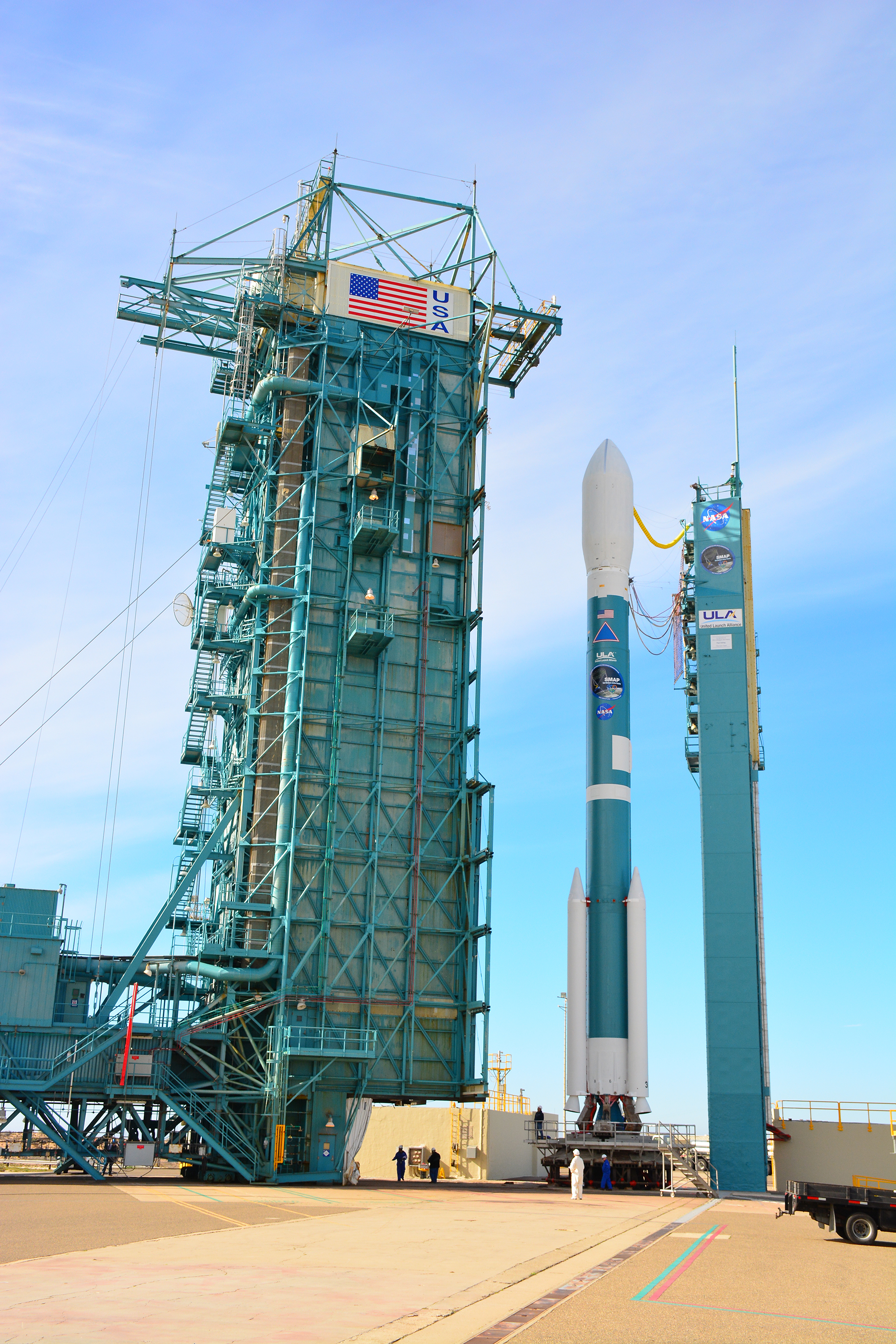
English: The mobile service tower rolls toward the United Launch Alliance Delta II rocket at Space Launch Complex 2 on Vandenberg Air Force Base in California. Aboard the rocket is NOAA's Soil Moisture Active Passive satellite, or SMAP, designed to produce the highest-resolution maps of soil moisture ever obtained from space. Launch was postponed today due to violation of upper-level wind shear constraints. Launch now is targeted for Jan. 31. |
||||||||||
| Date | |||||||||||
| Source | |||||||||||
| Author |
NASA/Randy Beaudoin
|
||||||||||
This image or video was catalogued by Kennedy Space Center of the United States National Aeronautics and Space Administration (NASA) under Photo ID: KSC-2015-1247. This tag does not indicate the copyright status of the attached work. A normal copyright tag is still required. See Commons:Licensing. Other languages:
|
Licensing[edit]
.jpg&action=edit§ion=2)
| This file is in the public domain in the United States because it was solely created by NASA. NASA copyright policy states that "NASA material is not protected by copyright unless noted". (See Template:PD-USGov, NASA copyright policy page or JPL Image Use Policy.) | ||
 |
Warnings:
|
File history
Click on a date/time to view the file as it appeared at that time.
| Date/Time | Thumbnail | Dimensions | User | Comment | |
|---|---|---|---|---|---|
| current | 14:22, 12 July 2015 | | 2,000 × 3,000 (4.67 MB) | Huntster (talk | contribs) | {{Information |Description={{en|1=The mobile service tower rolls toward the United Launch Alliance Delta II rocket at Space Launch Complex 2 on Vandenberg Air Force Base in California. Aboard the rocket is NOAA's Soil Moisture Active Passive satellite,... |
You cannot overwrite this file.
File usage on Commons
The following page uses this file:
.jpg&oldid=753667047)