File:Central African Republic sub-prefectures.png
Jump to navigation
Jump to search

Size of this preview: 800 × 486 pixels. Other resolutions: 320 × 194 pixels | 640 × 389 pixels | 1,025 × 623 pixels.
Original file (1,025 × 623 pixels, file size: 19 KB, MIME type: image/png)
Captions
Captions
Add a one-line explanation of what this file represents

|
This map has been uploaded by Electionworld from en.wikipedia.org to enable the |
Summary[edit]
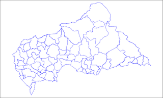
Map of the sub-prefectures of the Central African Republic. Created by Rarelibra 17:58, 31 March 2006 (UTC) for public domain use. Created using MapInfo Professional v7.5 and various mapping resources.
Licensing[edit]
| I, the copyright holder of this work, release this work into the public domain. This applies worldwide. In some countries this may not be legally possible; if so: I grant anyone the right to use this work for any purpose, without any conditions, unless such conditions are required by law. |
File history
Click on a date/time to view the file as it appeared at that time.
| Date/Time | Thumbnail | Dimensions | User | Comment | |
|---|---|---|---|---|---|
| current | 09:36, 3 June 2022 | | 1,025 × 623 (19 KB) | Borysk5 (talk | contribs) | Blue color |
| 17:39, 2 June 2022 |  | 1,025 × 624 (20 KB) | Borysk5 (talk | contribs) | Updated map | |
| 19:19, 27 November 2006 |  | 1,025 × 624 (18 KB) | Electionworld (talk | contribs) | {{ew|en|Rarelibra}} == Summary == Map of the sub-prefectures of the Central African Republic. Created by Rarelibra 17:58, 31 March 2006 (UTC) for public domain use. Created using MapInfo Professional v7.5 and various mapping resources. |
You cannot overwrite this file.
File usage on Commons
The following page uses this file:
File usage on other wikis
The following other wikis use this file:
- Usage on ca.wikipedia.org
- Usage on cs.wikipedia.org
- Usage on en.wikipedia.org
- Bangui
- Mobaye
- Bria, Central African Republic
- Obo
- Sibut
- Mbaïki
- Bambari
- Kaga-Bandoro
- Bangassou
- Bouar
- Berbérati
- N'Délé
- Kabo
- Alindao
- Batangafo
- Baoro
- Bimbo, Central African Republic
- Birao
- Boali
- Bossangoa
- Bozoum
- Boda, Lobaye
- Bouca
- Damara, Central African Republic
- Carnot, Central African Republic
- Nola, Central African Republic
- Rafaï
- Mongoumba
- Ouadda
- Ippy
- Kouango
- Kembé
- Paoua
- Gamboula
- Sub-prefectures of the Central African Republic
- User talk:Rarelibra/Maps2
- Bakouma
- Bocaranga
- Ouanda Djallé
- Grimari
- Baboua, Central African Republic
- Bamingui
- Yalinga
- Zemio
- Djemah
- Template:Sub-prefectures of the Central African Republic
- Mingala
- Dekoa
View more global usage of this file.