File:Brazil in 1534.svg
Jump to navigation
Jump to search

Size of this PNG preview of this SVG file: 606 × 599 pixels. Other resolutions: 243 × 240 pixels | 486 × 480 pixels | 777 × 768 pixels | 1,036 × 1,024 pixels | 2,072 × 2,048 pixels | 2,008 × 1,985 pixels.
Original file (SVG file, nominally 2,008 × 1,985 pixels, file size: 1,016 KB)
Captions
Captions
Add a one-line explanation of what this file represents
Summary[edit]
| Description |
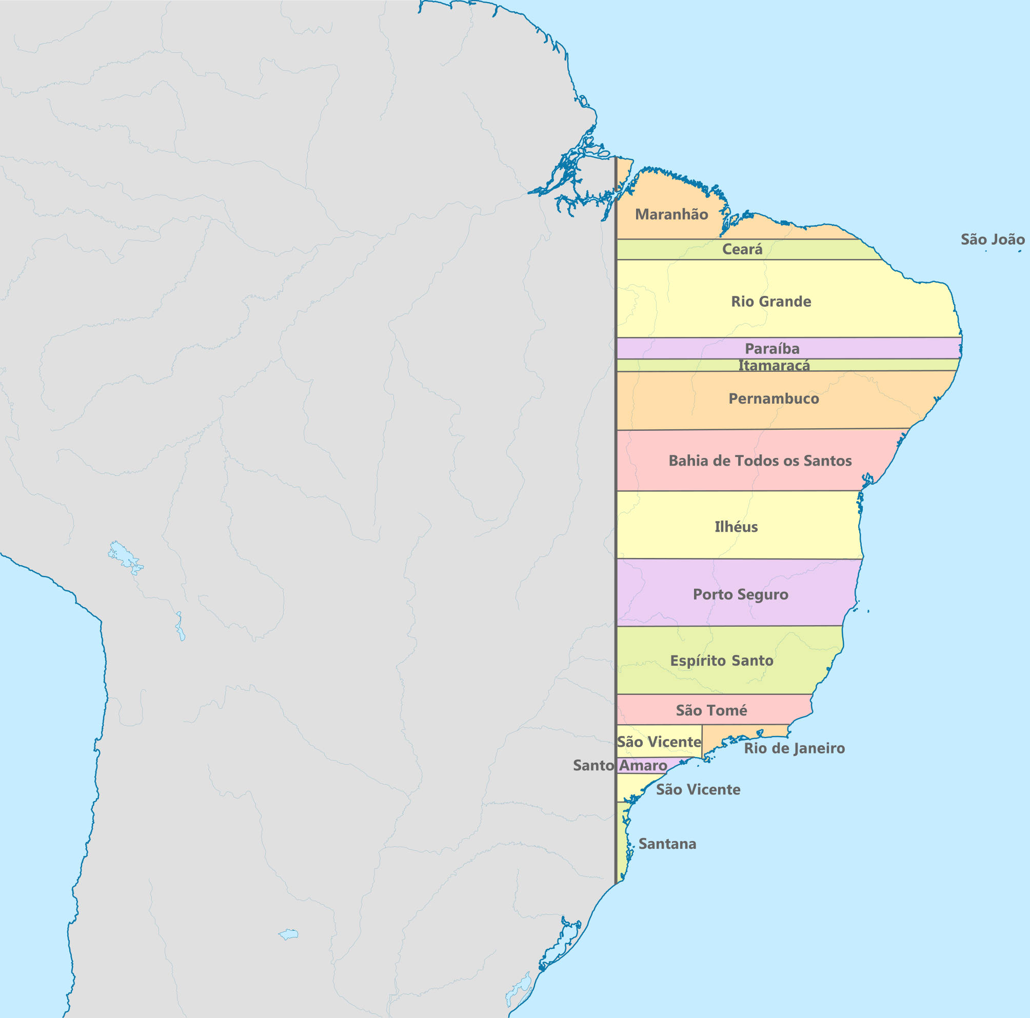
Español: Map of Brazil in 1534 |
| Date | |
| Source |
Own work based on: Brazil, administrative divisions (states) - en - colored.svg |
| Author | Milenioscuro |
_-_en_-_colored.svg)
Licensing[edit]
I, the copyright holder of this work, hereby publish it under the following license:
This file is licensed under the Creative Commons Attribution-Share Alike 4.0 International license.
- You are free:
- to share – to copy, distribute and transmit the work
- to remix – to adapt the work
- Under the following conditions:
- attribution – You must give appropriate credit, provide a link to the license, and indicate if changes were made. You may do so in any reasonable manner, but not in any way that suggests the licensor endorses you or your use.
- share alike – If you remix, transform, or build upon the material, you must distribute your contributions under the same or compatible license as the original.
File history
Click on a date/time to view the file as it appeared at that time.
| Date/Time | Thumbnail | Dimensions | User | Comment | |
|---|---|---|---|---|---|
| current | 13:55, 25 June 2018 | | 2,008 × 1,985 (1,016 KB) | DAR7 (talk | contribs) | corrigindo mapa de acordo com o livro Capitães do Brasil, de autoria de Eduardo Bueno, página 86, que diz que a capitania de Santa Catarina começa na Ilha do Mel, mas não na Ilha de São Francisco, como quem se enganou na hora de fazer a cartografia. |
| 13:08, 25 June 2018 |  | 2,008 × 1,985 (985 KB) | DAR7 (talk | contribs) | Reverted to version as of 23:19, 19 November 2017 (UTC) | |
| 13:06, 25 June 2018 |  | 2,008 × 1,985 (988 KB) | DAR7 (talk | contribs) | corrigindo mapa de acordo com o livro Capitães do Brasil, de autoria de Eduardo Bueno, página 86, que diz que a capitania de Santa Catarina começa na Ilha do Mel, mas não na Ilha de São Francisco, como quem se enganou na hora de fazer a cartografia. | |
| 23:19, 19 November 2017 |  | 2,008 × 1,985 (985 KB) | Milenioscuro (talk | contribs) | mejoras | |
| 20:47, 2 December 2015 |  | 2,008 × 1,984 (652 KB) | Milenioscuro (talk | contribs) | User created page with UploadWizard |
You cannot overwrite this file.
File usage on Commons
The following 7 pages use this file:
.svg&redirect=no)
File usage on other wikis
The following other wikis use this file:
- Usage on ast.wikipedia.org
- Usage on ba.wikipedia.org
- Usage on be.wikipedia.org
- Usage on bg.wikipedia.org
- Usage on ca.wikipedia.org
- Usage on cs.wikipedia.org
- Usage on de.wikipedia.org
- Usage on el.wikipedia.org
- Usage on en.wikipedia.org
- Colonial Brazil
- Viceroyalty of Peru
- Captaincies of Brazil
- Captaincy of São Vicente
- Treaty of Madrid (13 January 1750)
- Borders of Brazil
- Captaincy of Pernambuco
- Captaincy of Bahia
- User:Falcaorib
- History of Paraná
- History of Rio Grande do Norte
- Captaincy of Espírito Santo
- Captaincy of Maranhão
- Captaincy of Rio Grande
- Captaincy of Ceará
- Captaincy of Itamaracá
- Usage on eo.wikipedia.org
- Usage on es.wikipedia.org
- Fernando VI de España
- Historia del Brasil
- Tratado de Madrid (1750)
- Capitanías del Brasil
- Capitanía de Porto Seguro
- Capitanía de Ilhéus
- Capitanía de Itamaracá
- Historia territorial del Brasil
- Capitanía de Santana
- Anexo:Cronología de la organización territorial de Brasil
- Historia de Bahía
- Capitanía de Santo Amaro
- Capitanía de Paranaguá
- Usage on fa.wikipedia.org
- Usage on fi.wikipedia.org
- Usage on fr.wikipedia.org
View more global usage of this file.