File:Borussia Regia et Ducalis (map of Prussia with one of the regions titled as Land Litauen) by Leonhard Euler, 1753.png
Jump to navigation
Jump to search

Size of this preview: 800 × 572 pixels. Other resolutions: 320 × 229 pixels | 640 × 457 pixels | 1,024 × 732 pixels | 1,280 × 915 pixels | 2,560 × 1,829 pixels | 5,260 × 3,759 pixels.
Original file (5,260 × 3,759 pixels, file size: 42.98 MB, MIME type: image/png)
Captions
Captions
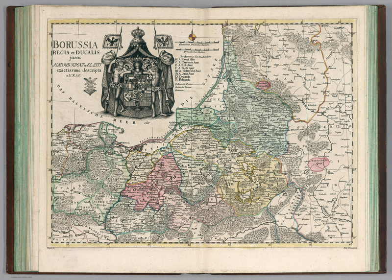
Map Borussia Regia et Ducalis (with one of the regions of Prussia titled as Land Litauen – Lithuanian Land) by Leonhard Euler, 1753.
Summary[edit]
_by_Leonhard_Euler,_1753.png&action=edit§ion=1)
| Description |
English: Map Borussia Regia et Ducalis (with one of the regions of Prussia titled as Land Litauen – Lithuanian Land) by Leonhard Euler, 1753.
Lietuvių: Leonhard Euler 1753 m. žemėlapis „Borussia Regia et Ducalis“, kuriame vienas iš Prūsijos regionų įvardijamas kaip „Land Litauen“ (lietuvių žemė). |
| Date | |
| Source | DavidRumsey.com |
| Author | Leonhard Euler (1707-1783) |
| Other versions |
,_1753.jpg) ,_1753.jpg) |
Licensing[edit]
_by_Leonhard_Euler,_1753.png&action=edit§ion=2)
|
This work is in the public domain in its country of origin and other countries and areas where the copyright term is the author's life plus 70 years or fewer. This work is in the public domain in the United States because it was published (or registered with the U.S. Copyright Office) before January 1, 1929. | |
| This file has been identified as being free of known restrictions under copyright law, including all related and neighboring rights. | |
File history
Click on a date/time to view the file as it appeared at that time.
| Date/Time | Thumbnail | Dimensions | User | Comment | |
|---|---|---|---|---|---|
| current | 20:25, 7 August 2023 | | 5,260 × 3,759 (42.98 MB) | Pofka (talk | contribs) | Higher resolution |
| 20:15, 7 August 2023 |  | 1,623 × 767 (2.71 MB) | Pofka (talk | contribs) | Uploaded a work by Leonhard Euler (1707-1783) from [https://www.davidrumsey.com/luna/servlet/detail/RUMSEY~8~1~290937~90062552:Borussia-Regia-et-Ducalis- DavidRumsey.com] with UploadWizard |
You cannot overwrite this file.
File usage on Commons
The following 3 pages use this file:
_by_Leonhard_Euler,_1753.png&redirect=no)
File usage on other wikis
The following other wikis use this file:
- Usage on en.wikipedia.org
- Usage on tr.wikipedia.org
_by_Leonhard_Euler,_1753.png&oldid=847179543)