File:Bahia RM FeiradeSantana AreadeExpansao.svg
Jump to navigation
Jump to search

Size of this PNG preview of this SVG file: 572 × 600 pixels. Other resolutions: 229 × 240 pixels | 458 × 480 pixels | 732 × 768 pixels | 977 × 1,024 pixels | 1,953 × 2,048 pixels | 659 × 691 pixels.
Original file (SVG file, nominally 659 × 691 pixels, file size: 448 KB)
Captions
Captions
Add a one-line explanation of what this file represents
| Description |
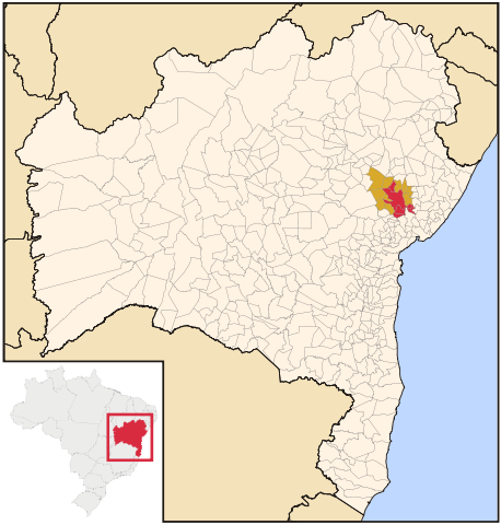
Português: Mapa de localização da Região Metropolitana de Feira de Santana (Bahia), em vermelho, e os municípios, em laranja, da Área de Expansão Metropolitana de Feira de Santana.
English: Map locator of the Metropolitan Region of Feira de Santana (BA) and your Espansion Area. |
| Date | (UTC) |
| Source | |
| Author |
|
I, the copyright holder of this work, hereby publish it under the following licenses:
This file is licensed under the Creative Commons Attribution 2.5 Generic license.
- You are free:
- to share – to copy, distribute and transmit the work
- to remix – to adapt the work
- Under the following conditions:
- attribution – You must give appropriate credit, provide a link to the license, and indicate if changes were made. You may do so in any reasonable manner, but not in any way that suggests the licensor endorses you or your use.
| This file is licensed under the Creative Commons Attribution-Share Alike 3.0 Unported license. | ||
| ||
| This licensing tag was added to this file as part of the GFDL licensing update. |

|
Permission is granted to copy, distribute and/or modify this document under the terms of the GNU Free Documentation License, Version 1.2 or any later version published by the Free Software Foundation; with no Invariant Sections, no Front-Cover Texts, and no Back-Cover Texts. A copy of the license is included in the section entitled GNU Free Documentation License. |
You may select the license of your choice.
Original upload log[edit]
This image is a derivative work of the following images:
- File:Bahia_RM_FeiradeSantana.svg licensed with Cc-by-2.5, Cc-by-sa-3.0-migrated, GFDL
- 2011-06-30T04:22:35Z Luan 659x691 (458001 Bytes) {{Information |Description=Map locator of the Metropolitan Region of Feira de Santana, BA. |Source=*[[:File:Bahia_MesoMicroMunicip.svg|]] {{Inkscape}} |Date=2011-06-30 04:20 (UTC) |Author=*[[:File:Bahia_MesoMicroMunicip.svg|]
Uploaded with derivativeFX
File history
Click on a date/time to view the file as it appeared at that time.
| Date/Time | Thumbnail | Dimensions | User | Comment | |
|---|---|---|---|---|---|
| current | 00:14, 6 July 2011 | | 659 × 691 (448 KB) | Luan (talk | contribs) | {{Information |Description={{pt|Mapa de localização da Região Metropolitana de Feira de Santana (Bahia), em vermelho, e os municípios, em laranja, da Área de Expansão Metropolitana de Feira de Santana.}} {{en|Map locator of the Metropolitan Region o |
You cannot overwrite this file.
File usage on Commons
There are no pages that use this file.
File usage on other wikis
The following other wikis use this file:
- Usage on pt.wikipedia.org